Hürth is a town in the Rhein-Erft-Kreis, North Rhine-Westphalia, Germany. Hürth shares borders with the city of Cologne and is about 6 km to the southwest of Cologne city centre, at the northeastern slope of the natural preserve Kottenforst-Ville. The town consists of thirteen districts, once independent villages, and is distributed over a relatively large area. The municipal area is interspersed with lakes and stretches of forest.
Bornheim is a town in the Rhein-Sieg district, in North Rhine-Westphalia, Germany. It is situated on the West bank of the Rhine, approx. 10 km north-west of Bonn, 20 km south of Cologne.

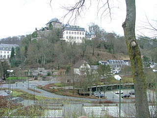
Bad Münstereifel is a historical spa town in the district of Euskirchen, Germany, with about 17,000 inhabitants, situated in the far southwest of the German state of North Rhine-Westphalia. The little town is one of only a few historical towns in the southwest of North Rhine-Westphalia, and because of this is often overcrowded by tourists throughout spring and summer.

Meckenheim is a town in the Rhein-Sieg district, in North Rhine-Westphalia, Germany.
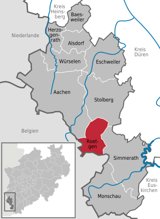
Roetgen is a municipality in the district of Aachen, in North Rhine-Westphalia, Germany.
Nideggen is a town in the district of Düren in the state of North Rhine-Westphalia, Germany. It is located on the river Rur, in the Eifel hills, approx. 15 km south of Düren.
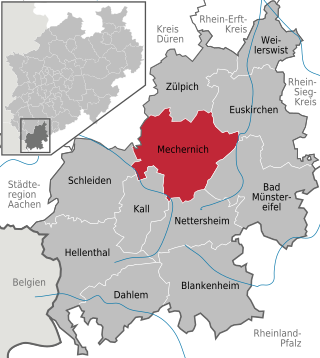
Mechernich is a town in the district of Euskirchen in the south of the state of North Rhine-Westphalia, Germany. It is located in the "Naturpark Nordeifel" in the Eifel hills, approx. 15 km south-west of Euskirchen and 55 km from Cologne. Mechernich is a former mining town and had, in 2009, its 700-years celebration of foundation. Its local football club is called TUS Mechernich.
Blankenheim is a municipality in the district of Euskirchen in the state of North Rhine-Westphalia, Germany.
Dahlem is a municipality in the district of Euskirchen. It has the lowest population density and population of all municipalities of in the state of North Rhine-Westphalia, Germany. It is located in the Eifel hills, approx. 35 km south-west of Euskirchen. The small medieval town Kronenburg is part of the municipality.

Hellenthal is a municipality in the district of Euskirchen in the state of North Rhine-Westphalia, Germany. It is located in the Eifel hills, near the border with Belgium, approx. 30 km south-west of Euskirchen and 40 km south-east of Aachen.

Nettersheim is a municipality in the district of Euskirchen in the state of North Rhine-Westphalia, Germany. It is located in the Eifel hills, approx. 20 km south-west of Euskirchen. The rivers Erft and Urft have their source in the municipality.
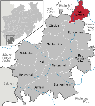
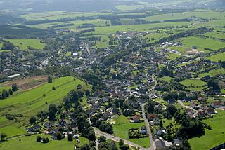
Weilerswist is a municipality in the district of Euskirchen in the state of North Rhine-Westphalia, Germany. It is located in the Eifel hills, approximately 10 kilometers north of Euskirchen, and 20 kilometers south-west of Cologne.

Büren is a municipality in the district of Paderborn, in North Rhine-Westphalia, Germany.

Rheinbach is a town in the Rhein-Sieg-Kreis district (Landkreis), in North Rhine-Westphalia, Germany. It belongs to the administrative district (Regierungsbezirk) of Cologne.

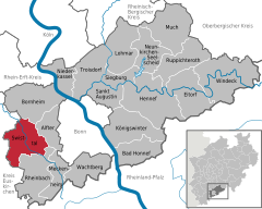
Alfter is a municipality in the Rhein-Sieg district, in North Rhine-Westphalia, Germany. It is situated approximately 6 km west of Bonn.

Wachtberg is a municipality in the Rhein-Sieg district, of North Rhine-Westphalia, Germany. It is situated approximately 15 km south of Bonn. In 2021 the Wachtberg municipality had approximately 20,352 inhabitants.
Ostbevern is a municipality in the district of Warendorf, in North Rhine-Westphalia, Germany.

The Swist is a stream, 43.6 kilometres (27.1 mi) long, in the German Rhineland. It rises on the northern edge of the Eifel at 330 metres above sea level and empties from the right and southeast into the Rhine tributary, the Erft, between Weilerswist and Bliesheim. Occasionally the Swist is also called the Swistbach, and locals often just call it der Bach.

Ludendorf is a village in the municipality Swisttal in the North Rhine-Westphalian Rhein-Sieg district. It is situated approximately 18 km southwest of Bonn. On January 1, 2007 the village had a population of 578. The city hall of the municipality Swisttal is located between Ludendorf and the neighboring village Swisttal-Essig.
Essig is a village in the municipality of Swisttal in Rhein-Sieg district in the German state of North Rhine-Westphalia. It is situated approximately 18 km southwest of Bonn. In 2007 it had a population of 428. The village hall of the municipality of Swisttal is located between Essig and its neighbouring village, Ludendorf.