Siegburg

Last updated • 3 min readFrom Wikipedia, The Free Encyclopedia

Siegburg
Luftbild Siegburg.jpg
Aerial view
DEU Siegburg COA.svg
Location of Siegburg within Rhein-Sieg-Kreis district
Siegburg in SU.svgMuch
Germany adm location map.svg
Red pog.svg
Siegburg
North Rhine-Westphalia location map 01.svg
Red pog.svg
Siegburg
Coordinates: 50°48′5″N7°12′16″E / 50.80139°N 7.20444°E / 50.80139; 7.20444
Country Germany
State North Rhine-Westphalia
Admin. region Köln
District Rhein-Sieg-Kreis
Subdivisions8
Government
   Mayor (202025) Stefan Rosemann [1] (SPD)
  Governing parties SPD / Greens / FDP
Area
  Total23.47 km2 (9.06 sq mi)
Elevation
60 m (200 ft)
Population
 (2021-12-31) [2]
  Total41,660
  Density1,800/km2 (4,600/sq mi)
Time zone UTC+01:00 (CET)
  Summer (DST) UTC+02:00 (CEST)
Postal codes
53721
Dialling codes 02241
Vehicle registration SU
Website https://www.siegburg.de/

Siegburg (i.e. fort on the Sieg river; Ripuarian: Sieburch) is a city in the district of Rhein-Sieg-Kreis in North Rhine-Westphalia, Germany. It is located on the banks of the rivers Sieg and Agger, 10 kilometres (6.2 mi) from the former seat of West German government Bonn and 26 kilometres (16 mi) from Cologne. The population of the city was 39,192 in the 2013 census.

Contents

Geography

Siegburg is located approximately 8 kilometres (5.0 mi) east of the river Rhine, at the confluence where the Agger joins the Sieg, in the southeast corner of the Cologne Lowland. Neighbouring towns include Troisdorf, Lohmar, Sankt Augustin and Hennef. The nearby cities of Cologne and Bonn are easily accessible through good transport links. The highest point of the urban area is 220 metres (720 ft) above sea level (NHN) in the Braschoß area and the lowest point is just under 54 metres (177 ft) above sea level at the mouth of the Agger.

History

St. Servatius and the Zum Winter House Picture Siegburg Servatius church.jpg
St. Servatius and the Zum Winter House

Archbishop-Elector Anno II of Cologne founded a Benedictine monastery in 1064, known as Michaelsberg Abbey, on top of the hill also called the Michaelsberg. A settlement that arose from that was first mentioned as a city in 1182. Siegburg reached the height of its prosperity in the 15th and 16th century. It is famous for its pottery, especially for the Siegburg pitchers (Siegburger Krüge).

Siegburg has been the county seat of the Rhein-Sieg-Kreis since 1816.

Siegburg's synagogue was destroyed on Kristallnacht, signaling the demise of its Jewish community.

Politics

City council with 50 seats as elected in 2020
Left: 2 seats
SPD: 14 seats
Greens: 10 seats
SBU: 2 seats
Volksabstimmung: 1 seat
FDP: 2 seats
CDU: 19 seats Germany Siegburg Stadtrat 2020.svg
City council with 50 seats as elected in 2020
  Left : 2 seats
  SPD : 14 seats
  Greens : 10 seats
  SBU: 2 seats
  Volksabstimmung: 1 seat
  FDP : 2 seats
  CDU : 19 seats

Municipal elections are held every five years, in which the mayor and city council of Siegburg, as well as the district administrator (German : Landrat) and district council (German : Kreistag) of the Rhein-Sieg-Kreis are chosen. [4] The last election took place on 13 September 2020. [3]

City council

The city council (German : Stadtrat) of Siegburg consists of 50 councillors, half of which are chosen directly in 25 constituencies. The remaining 25 seats are distributed via party lists, resulting in a proportional representation.

On 30 October 2020 the Social Democrats, Greens, and Liberals agreed to form a coalition government. [5]

Mayor

The mayor of Siegburg is Stefan Rosemann, who was elected with 57.54% of the vote. [6] [7] He stated that he would withdraw from party politics and completely focus on the mayoral office. [5] He was sworn into office on 5 November 2020. [8]

Transport

Siegburg/Bonn station is a railway station on the Cologne-Frankfurt high-speed railway and the Sieg Railway. The name of the station derives from it having been rebuilt for the high-speed line in order to serve Bonn. It is connected to Bonn by the Siegburg line of the Bonn Stadtbahn every 10 or 15 minutes. The station is located in the network area of the Verkehrsverbund Rhein-Sieg (Rhine-Sieg Transport Association, VRS) public transit authority.

Twin towns – sister cities

Siegburg is twinned with: [9]

Notable people

Related Research Articles

The Rhein-Erft-Kreis is a district in the west of North Rhine-Westphalia, Germany. Neighboring districts are Neuss, district-free Cologne, Rhein-Sieg, Euskirchen, Düren.

<span class="mw-page-title-main">Rhein-Sieg-Kreis</span> District in North Rhine-Westphalia, Germany

The Rhein-Sieg-Kreis is a Kreis (district) in the south of North Rhine-Westphalia, Germany. Neighboring districts are Rheinisch-Bergischer Kreis, Oberbergischer Kreis, Altenkirchen, Neuwied, Ahrweiler, Euskirchen, Rhein-Erft-Kreis, the urban district of Cologne. The federal city of Bonn is nearly completely surrounded by the district.

The Rheinisch-Bergische Kreis is a Kreis (district) in the Cologne Bonn Region of North Rhine-Westphalia, Germany. Neighboring districts are Kreis Mettman, Oberbergischer Kreis and Rhein-Sieg, and the district-free cities Cologne, Leverkusen, Solingen and Remscheid.

<span class="mw-page-title-main">Ruppichteroth</span> Town in North Rhine-Westphalia, Germany

Ruppichteroth is a municipality in the Rhein-Sieg district, in the southern part of North Rhine-Westphalia, Germany. It is located approximately 30 kilometers east of Bonn.

<span class="mw-page-title-main">Salzkotten</span> Town in North Rhine-Westphalia, Germany

Salzkotten is a town in the district of Paderborn, in North Rhine-Westphalia, Germany. The name Salzkotten is based in the former salt production, which gave Salzkotten its raison d'être. Salt was found in the salty springs around the town.
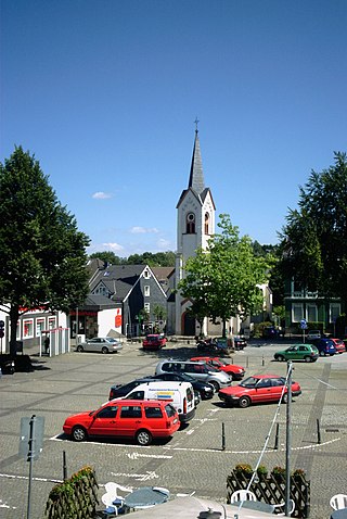
<span class="mw-page-title-main">Wipperfürth</span> Town in North Rhine-Westphalia, Germany

Wipperfürth is a municipality in the Oberbergischer Kreis of North Rhine-Westphalia, Germany, about 40 km north-east of Cologne, and the oldest town in the Bergischen Land.
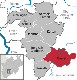
<span class="mw-page-title-main">Overath</span> Town in North Rhine-Westphalia, Germany

Overath is a town in the Rheinisch-Bergischer district of North Rhine-Westphalia, Germany.

<span class="mw-page-title-main">Kaarst</span> Town in North Rhine-Westphalia, Germany

Kaarst is a town in Germany. It lies in the district of Rhein-Kreis Neuss in North Rhine-Westphalia. It is 5 km west of Neuss and 12 km east of Mönchengladbach.

<span class="mw-page-title-main">Frechen</span> Town in North Rhine-Westphalia, Germany

Frechen is a town in the Rhein-Erft District, North Rhine-Westphalia, Germany. Frechen was first mentioned in 877. It is situated at the western Cologne city border.
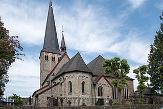
<span class="mw-page-title-main">Neunkirchen-Seelscheid</span> Municipality in North Rhine-Westphalia, Germany

Neunkirchen-Seelscheid is a municipality in the Rhein-Sieg district in the southern part of North Rhine-Westphalia, Germany. Beside the two principal places Neunkirchen and Seelscheid there are numerous smaller localities among the municipality.

<span class="mw-page-title-main">Meckenheim</span> Town in North Rhine-Westphalia, Germany

Meckenheim is a town in the Rhein-Sieg district, in North Rhine-Westphalia, Germany. It is situated approximately 15 km south-west of Bonn.

<span class="mw-page-title-main">Elsdorf</span> Town in North Rhine-Westphalia, Germany

Elsdorf is a town in the Rhein-Erft-Kreis, in North Rhine-Westphalia, Germany. It is situated approximately 5 km south-west of Bergheim and 27 km west of Cologne.
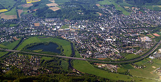
<span class="mw-page-title-main">Hennef (Sieg)</span> Town in North Rhine-Westphalia, Germany

Hennef (Sieg) (German pronunciation:[ˈhɛnɛf] ) is a town in the Rhein-Sieg district of North Rhine-Westphalia, Germany. It is situated on the river Sieg, approx. 7 kilometres (4 miles) south-east of Siegburg and 15 km (9 mi) east of Bonn. Hennef is the fourth-biggest town in the Rhein-Sieg-Kreis (i.e. district). It is the site of the 15th-century castle, Schloss Allner, next to the Allner See. Within Hennef is the town of Stadt Blankenberg, with the castle of Blankenberg.

<span class="mw-page-title-main">Lohmar</span> Town in North Rhine-Westphalia, Germany

Lohmar is a town in the Rhein-Sieg district, in North Rhine-Westphalia, Germany.

<span class="mw-page-title-main">Niederkassel</span> Town in North Rhine-Westphalia, Germany

Niederkassel is a town in the Rhein-Sieg district, in North Rhine-Westphalia, Germany, with a population of around 37,000 people. It is situated on the right bank of the Rhine, approx. 10 km (6 mi) north-east of Bonn and 15 km (9 mi) south-east of Cologne. Niederkassel is subdivided into seven quarters : Mondorf, Rheidt, Niederkassel, Uckendorf, Stockem, Lülsdorf and Ranzel. People can walk next to the river Rhine in Lülsdorf, Niederkassel and Rheidt.

<span class="mw-page-title-main">Rheinbach</span> Town in North Rhine-Westphalia, Germany

Rheinbach is a town in the Rhein-Sieg-Kreis district (Landkreis), in North Rhine-Westphalia, Germany. It belongs to the administrative district (Regierungsbezirk) of Cologne.
<span class="mw-page-title-main">Sankt Augustin</span> Town in North Rhine-Westphalia, Germany

Sankt Augustin is a town in the Rhein-Sieg district in North Rhine-Westphalia, Germany. It is named after the patron saint of the Divine Word Missionaries, Saint Augustine of Hippo (354-430). The Missionaries established a monastery near the current town centre in 1913. The municipality of Sankt Augustin was established in 1969, and on September 6, 1977 Sankt Augustin acquired town privileges. Sankt Augustin is situated about eight km northeast of Bonn and three km southwest of Siegburg.

<span class="mw-page-title-main">Alfter</span> Municipality in North Rhine-Westphalia, Germany

Alfter is a municipality in the Rhein-Sieg district, in North Rhine-Westphalia, Germany. It is situated approximately 6 km west of Bonn.

<span class="mw-page-title-main">Much, North Rhine-Westphalia</span> Municipality in North Rhine-Westphalia, Germany

Much is a municipality in the Rhein-Sieg district, in North Rhine-Westphalia, Germany. It is situated approximately 30 kilometres (19 mi) north-east of Bonn, and 20 kilometres (12 mi) south-west of Gummersbach.

<span class="mw-page-title-main">Siegburg/Bonn station</span> Railway station in Germany

Siegburg/Bonn station, in the town of Siegburg, North Rhine-Westphalia, Germany, is on the Cologne–Frankfurt high-speed rail line and the Sieg Railway. It was rebuilt for the high-speed line and is connected to Bonn by the Siegburg line of the Bonn Stadtbahn. It is in the network area of the Verkehrsverbund Rhein-Sieg.

References

  1. Wahlergebnisse in NRW Kommunalwahlen 2020, Land Nordrhein-Westfalen, accessed 29 June 2021.
  2. "Bevölkerung der Gemeinden Nordrhein-Westfalens am 31. Dezember 2021" (in German). Landesbetrieb Information und Technik NRW . Retrieved 20 June 2022.
  3. 1 2 "Ratswahl - Kommunalwahlen / Integrationsratswahl 2020 in der Kreisstadt Siegburg - Gesamtergebnis". wahlen.kdvz-frechen.de (in German). Retrieved 12 November 2020.
  4. "Kommunalwahl". Kreisstadt Siegburg (in German). Retrieved 12 November 2020.
  5. 1 2 Kieras, Paul (31 October 2020). "Stadtrat: SPD, Grüne und FDP schließen Bündnis in Siegburg". General-Anzeiger Bonn (in German). Retrieved 12 November 2020.
  6. "Bürgermeisterstichwahl - Kommunalwahlen / Integrationsratswahl 2020 in der Kreisstadt Siegburg - Gesamtergebnis". wahlen.kdvz-frechen.de (in German). Retrieved 12 November 2020.
  7. "Kommunalwahl 2020: Das sind die Stichwahlergebnisse aus dem Rhein-Sieg-Kreis". General-Anzeiger Bonn (in German). 27 September 2020. Retrieved 12 November 2020.
  8. Quadt, Nadine (7 November 2020). "Fragestunde am Anfang: Der Siegburger Rat hat sich konstituiert". General-Anzeiger Bonn (in German). Retrieved 12 November 2020.
  9. "Städtepartnerschaften". siegburg.de (in German). Siegburg. Retrieved 25 March 2021.