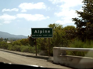
Alpine is a census-designated place (CDP) in the Cuyamaca Mountains of San Diego County, California. Alpine had a population of 14,696 at the 2020 census, up from 14,236 at the 2010 census. The town is largely surrounded by the Cleveland National Forest and borders two reservations of the Kumeyaay Nation, Viejas and Sycuan, and the rural unincorporated areas around the city of El Cajon.

Bostonia is a neighborhood in San Diego County, California, comprising part of the northeastern portion of the city of El Cajon, as well as adjacent unincorporated areas of San Diego County. The portion of Bostonia that lies outside the El Cajon city limits is classified as a census-designated place (CDP) for statistical purposes by the United States Census Bureau. The population of the CDP was 15,379 at the 2010 census, up from 15,169 at the 2000 census.

Casa de Oro-Mount Helix is a census-designated place (CDP) in the East County region of San Diego County, California.
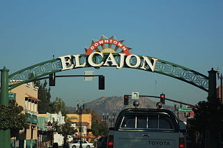
El Cajon is a city in San Diego County, California, United States, 17 mi (27 km) east of downtown San Diego. The city takes its name from Rancho El Cajón, which was named for the box-like shape of the valley that surrounds the city, and the origin of the city's common nickname "the Box".

Granite Hills is a census-designated place in San Diego County, California. The name is also applied to a neighborhood within the city limits of El Cajon in the eastern part of that city. The population of the CDP, which does not include the people living within the city of El Cajon, was 3,035 at the 2010 census, down from 3,246 at the 2000 census.
Harbison Canyon is a census-designated place (CDP) in San Diego County, California. Harbison Canyon had a population of 4,048 as of the 2020 census, up from 3,841 as of the 2010 census.
La Mesa is a city in San Diego County, located nine miles east of Downtown San Diego in Southern California. The population was 61,121 at the 2020 census, up from 57,065 at the 2010 census. Its civic motto is "the Jewel of the Hills."

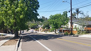
Spring Valley is a census-designated place (CDP) in the East County region of San Diego County, California. The population was 28,205 at the time of the 2010 census.
The College Area is a residential community in the Mid-City region of San Diego, California, United States. The College Area is dominated by San Diego State University, after which the area is named. Several neighborhoods in the College Area were developed in the 1930s, with others becoming established in the post-war period. The College Area is bordered on the west by Kensington and Talmadge and on the east by the city of La Mesa. El Cajon Boulevard is a busy shopping district; additional retail, entertainment and dining establishments are located in a new housing and commercial complex known as South Campus Plaza on College Avenue at Aztec Center. The College Area includes the neighborhoods of the Catoctin Area, Dennstedt Point, East Falls View Drive, Saranac-Mohawk, and an Orthodox Jewish neighborhood in the area near Congregation Beth Jacob Orthodox Synagogue on College Avenue. The region includes Alvarado Hospital, a 306-bed acute care facility, and the College-Rolando branch of the San Diego Public Library.

North Park is a neighborhood in San Diego, California, United States, as well as a larger "community" as defined by the City of San Diego for planning purposes. The neighborhood is bounded:
California's 51st congressional district is a congressional district in the U.S. state of California. The district is currently represented by Democrat Sara Jacobs. The district currently includes central and eastern portions of San Diego, as well as eastern suburbs such as El Cajon, La Mesa, Spring Valley, and Lemon Grove.

Gillespie Field is a county-owned public towered airport 11.5 miles northeast of downtown San Diego, in El Cajon, San Diego County, California, United States.
Grossmont College is a public community college in El Cajon, California. Its name originated with the silent film actor and producer William J. Gross, who was enticed by Ed Fletcher to invest in the purchase of land, part of which was called Grossmont. The campus sits in the Fletcher Hills community of El Cajon and is bordered by the cities of San Diego and Santee. Grossmont College along with Cuyamaca College make up what is the Grossmont-Cuyamaca Community College District. Grossmont is part of the California Community College System.

Torrey Pines is a community neighborhood of 2,600 acres (1,100 ha) in the northern coastal area of San Diego, California, residential with large areas of office space along I-5.

El Cerrito is a neighborhood of the Mid-City region of San Diego, California. El Cerrito is a residential neighborhood, consisting mostly of suburban homes, with some commercial activity along the streets that define its borders.

Rolando is a neighborhood of the Mid-City region of San Diego, California. Rolando is mostly residential with the exception of El Cajon Boulevard, which features the Campus Plaza shopping center. Rolando is divided by University Avenue into two sections: Rolando Village to the north, and Rolando Park to the south.
The Fletcher Hills are a low mountain range in the Peninsular Ranges, in southwestern San Diego County, California.

Birdland is a neighborhood in San Diego, California. It is located between California State Route 163, Interstate 805 and Mission Valley. Most of the streets in the area are named after different bird species, hence the name of the community.

Rancho El Cajón was a 48,800-acre (197 km2) Mexican land grant in present day San Diego County, California given in 1845 by Governor Pio Pico to María Antonia Estudillo de Pedrorena. The name means "the box" in Spanish, and refers to the valley between hills. The grant encompassed present day El Cajon, Bostonia, Santee, Lakeside, Flinn Springs, and the eastern part of La Mesa. The grant contained the 28-acre (0.11 km2) Rancho Cañada de los Coches grant.

East County is a region of San Diego County, California, east of San Diego.