Related Research Articles

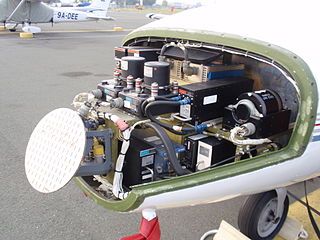
Avionics are the electronic systems used on aircraft. Avionic systems include communications, navigation, the display and management of multiple systems, and the hundreds of systems that are fitted to aircraft to perform individual functions. These can be as simple as a searchlight for a police helicopter or as complicated as the tactical system for an airborne early warning platform.

The Federal Aviation Administration (FAA) is a U.S. federal government agency within the U.S. Department of Transportation which regulates civil aviation in the United States and surrounding international waters. Its powers include air traffic control, certification of personnel and aircraft, setting standards for airports, and protection of U.S. assets during the launch or re-entry of commercial space vehicles, powers over neighboring international waters were delegated to the FAA by authority of the International Civil Aviation Organization.

In aviation, instrument flight rules (IFR) is one of two sets of regulations governing all aspects of civil aviation aircraft operations; the other is visual flight rules (VFR).

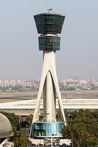
Air traffic control (ATC) is a service provided by ground-based air traffic controllers (people) who direct aircraft on the ground and through a given section of controlled airspace, and can provide advisory services to aircraft in non-controlled airspace. The primary purpose of ATC worldwide is to prevent collisions, organise and expedite the flow of traffic in the air, and provide information and other support for pilots.

In aviation, the instrument landing system (ILS) is a precision radio navigation system that provides short-range guidance to aircraft to allow them to approach a runway at night or in bad weather. In its original form, it allows an aircraft to approach until it is 200 feet (61 m) over the ground, within a 1⁄2 mile (800 m) of the runway. At that point the runway should be visible to the pilot; if it is not, they perform a missed approach. Bringing the aircraft this close to the runway dramatically increases the range of weather conditions in which a safe landing can be made. Other versions of the system, or "categories", have further reduced the minimum altitudes, runway visual ranges (RVRs), and transmitter and monitoring configurations designed depending on the normal expected weather patterns and airport safety requirements.
The basic principles of air navigation are identical to general navigation, which includes the process of planning, recording, and controlling the movement of a craft from one place to another.

A non-directional beacon (NDB) or non-directional radio beacon is a radio beacon which does not include inherent directional information. Radio beacons are radio transmitters at a known location, used as an aviation or marine navigational aid. NDB are in contrast to directional radio beacons and other navigational aids, such as low-frequency radio range, VHF omnidirectional range (VOR) and tactical air navigation system (TACAN).

Very High Frequency Omnidirectional Range Station (VOR) is a type of short-range radio navigation system for aircraft, enabling aircraft with a receiving unit to determine its position and stay on course by receiving radio signals transmitted by a network of fixed ground radio beacons. It uses frequencies in the very high frequency (VHF) band from 108.00 to 117.95 MHz. Developed in the United States beginning in 1937 and deployed by 1946, VOR became the standard air navigational system in the world, used by both commercial and general aviation, until supplanted by satellite navigation systems such as GPS in the early 21st century. As such, VOR stations are being gradually decommissioned. In 2000 there were about 3,000 VOR stations operating around the world, including 1,033 in the US, but by 2013 the number in the US had been reduced to 967. The United States is decommissioning approximately half of its VOR stations and other legacy navigation aids as part of a move to performance-based navigation, while still retaining a "Minimum Operational Network" of VOR stations as a backup to GPS. In 2015, the UK planned to reduce the number of stations from 44 to 19 by 2020.

In aviation, distance measuring equipment (DME) is a radio navigation technology that measures the slant range (distance) between an aircraft and a ground station by timing the propagation delay of radio signals in the frequency band between 960 and 1215 megahertz (MHz). Line-of-visibility between the aircraft and ground station is required. An interrogator (airborne) initiates an exchange by transmitting a pulse pair, on an assigned 'channel', to the transponder ground station. The channel assignment specifies the carrier frequency and the spacing between the pulses. After a known delay, the transponder replies by transmitting a pulse pair on a frequency that is offset from the interrogation frequency by 63 MHz and having specified separation.

The Civil Aviation Authority (CAA) is the statutory corporation which oversees and regulates all aspects of civil aviation in the United Kingdom. Its areas of responsibility include:

A flight recorder is an electronic recording device placed in an aircraft for the purpose of facilitating the investigation of aviation accidents and incidents. The device may often be referred to colloquially as a "black box", an outdated name which has become a misnomer—they are now required to be painted bright orange, to aid in their recovery after accidents.

Aircrew, also called flight crew, are personnel who operate an aircraft while in flight. The composition of a flight's crew depends on the type of aircraft, plus the flight's duration and purpose.

In the United States, airways or air routes are defined by the Federal Aviation Administration (FAA) in two ways:
Airband or aircraft band is the name for a group of frequencies in the VHF radio spectrum allocated to radio communication in civil aviation, sometimes also referred to as VHF, or phonetically as "Victor". Different sections of the band are used for radionavigational aids and air traffic control.

Area navigation is a method of instrument flight rules (IFR) navigation that allows an aircraft to choose any course within a network of navigation beacons, rather than navigate directly to and from the beacons. This can conserve flight distance, reduce congestion, and allow flights into airports without beacons. Area navigation used to be called "random navigation", hence the acronym RNAV.
In aviation, a standard terminal arrival (STAR) is a published flight procedure followed by aircraft on an instrument flight rules (IFR) flight plan just before reaching a destination airport.
An aeronautical chart is a map designed to assist in the navigation of aircraft, much as nautical charts do for watercraft, or a roadmap does for drivers. Using these charts and other tools, pilots are able to determine their position, safe altitude, best route to a destination, navigation aids along the way, alternative landing areas in case of an in-flight emergency, and other useful information such as radio frequencies and airspace boundaries. There are charts for all land masses on Earth, and long-distance charts for trans-oceanic travel.
The Next Generation Air Transportation System (NextGen) is an ongoing United States Federal Aviation Administration (FAA) project to modernize the National Airspace System (NAS). The FAA began work on NextGen improvements in 2007 and plans to finish the final implementation segment by 2030. The goals of the modernization include using new technologies and procedures to increase the safety, efficiency, capacity, access, flexibility, predictability, and resilience of the NAS while reducing the environmental impact of aviation.
Next Generation (NextGen) Data Communications, an element of the Next Generation Air Transportation System, will significantly reduce controller-to-pilot communications and controller workload, whilst improving safety. NextGen comprises complex integrated and interlinked programs, portfolios, systems, policies, and procedures. NextGen has modernized air traffic infrastructure in communications, navigation, surveillance, automation, and information management.

Airway Transportation Systems Specialists', also known as (ATSSs; FV-2101) are Systems Electronics Technicians assigned to the Technical Operations (TechOps) section of the Federal Aviation Administration's Air Traffic Organization (ATO). Airway Transportation Systems Specialists possess theoretical and practical knowledge in electronic theory and characteristics, functions, operations, and capabilities of a variety of National Airspace System (NAS) systems. Airway Transportation Systems Specialists ensure the safety and efficiency of the NAS by performing preventive maintenance, corrective maintenance, and system modifications of air traffic control systems at ATCTs, TRACONs, and ARTCCs throughout the United States of America and its territories. ATSS generally possesses years of experience in a variety of U.S. National Airspace System (NAS) systems. Airway Transportation Systems Specialists are responsible for the maintenance, operation, fabrication, installation, and management of the technical infrastructure of the National Airspace System. Airway Transportation Systems Specialists work at different Systems Support Centers (SSCs) in the United States. Airway Transportation Systems Specialists install, maintain, repair, operate, and monitor hardware and software to ensure they work as designed. ATSS certifies equipment and services to ensure safe and efficient flight operations throughout NAS. The FAA workforce currently includes 5,200 ATSS nationwide.
References
- ↑ "Flight Inspection Operations Group". Federal Aviation Administration . Retrieved 13 January 2015.
- ↑ Scott Thompson (May 2008). "Flight Inspection History". Federal Aviation Administration . Retrieved 13 January 2015.