
Des Moines is the capital and most populous city in the U.S. state of Iowa. It is the county seat of Polk County with parts extending into Warren County. It was incorporated on September 22, 1851, as Fort Des Moines, which was shortened to "Des Moines" in 1857. It is located on, and named after, the Des Moines River, which likely was adapted from the early French name, Rivière des Moines, meaning "River of the Monks". The city's population was 214,133 as of the 2020 census. The six-county metropolitan area is ranked 81st in terms of population in the United States, with 709,466 residents according to the 2020 census by the United States Census Bureau, and is the largest metropolitan area fully located within the state.

The Mississippi River is the primary river of the largest drainage basin in the United States. From its traditional source of Lake Itasca in northern Minnesota, it flows generally south for 2,340 miles (3,766 km) to the Mississippi River Delta in the Gulf of Mexico. With its many tributaries, the Mississippi's watershed drains all or parts of 32 U.S. states and two Canadian provinces between the Rocky and Appalachian mountains. The river either borders or passes through the states of Minnesota, Wisconsin, Iowa, Illinois, Missouri, Kentucky, Tennessee, Arkansas, Mississippi, and Louisiana. The main stem is entirely within the United States; the total drainage basin is 1,151,000 sq mi (2,980,000 km2), of which only about one percent is in Canada. The Mississippi ranks as the world's tenth-largest river by discharge flow, and the largest in North America.

Carlisle is a city in Warren and Polk counties in the U.S. state of Iowa. The population was 4,160 at the 2020 census. The city is part of the Des Moines–West Des Moines Metropolitan Statistical Area.

The Des Moines River is a tributary of the Mississippi River in the upper Midwestern United States that is approximately 525 miles (845 km) long from its farther headwaters. The largest river flowing across the state of Iowa, it rises in southern Minnesota and flows across Iowa from northwest to southeast, passing from the glaciated plains into the unglaciated hills, transitioning near the capital city of Des Moines in the center of the state. The river continues to flow in a southeastern direction away from Des Moines, flowing directly into the Mississippi River. The Des Moines River forms a short portion of Iowa's border with Missouri between Lee County, Iowa and Clark County, Missouri.
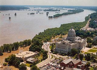
The Great Flood of 1993 was a flood that occurred in the Midwestern United States, along the Mississippi and Missouri rivers and their tributaries, from April to October 1993.

The Raccoon River is a 30.8-mile-long (49.6 km) tributary of the Des Moines River in central Iowa in the United States. As measured using the longest of its three forks, its length increases to 226 miles (364 km). Via the Des Moines River, it is part of the watershed of the Mississippi River. The river runs through an intensely cultivated area of croplands and livestock farming, receiving Tile drainage from slow-draining rich natural bottomland.
Floods in the United States are generally caused by excessive rainfall, excessive snowmelt, and dam failure. Below is a list of flood events that were of significant impact to the country during the 20th century, from 1900 through 1999, inclusive.
Floods in the United States before 1900 is a list of flood events that were of significant impact to the country, before 1900. Floods are generally caused by excessive rainfall, excessive snowmelt, and dam failure.
Floods in the United States (2000–present) is a list of flood events which were of significant impact to the country during the 21st century, since 2000. Floods are generally caused by excessive rainfall, excessive snowmelt, storm surge from hurricanes, and dam failure.

The June 2008 Midwestern United States floods were flooding events which affected portions of the Midwestern United States. After months of heavy precipitation, a number of rivers overflowed their banks for several weeks at a time and broke through levees at numerous locations. Flooding continued into July. States affected by the flooding included Illinois, Indiana, Iowa, Michigan, Minnesota, Missouri and Wisconsin. The American Red Cross assisted the victims of flooding and tornadoes across seven states and the National Guard was mobilized to assist in disaster relief and evacuation.

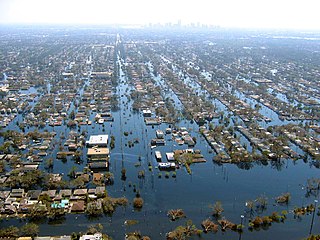
The Iowa flood of 2008 was a hydrological event involving most of the rivers in eastern Iowa which began June 8 and continued until July 1. Flooding continued on the Upper Mississippi River in the southeastern area of the state for many more days. The phrase "Iowa's Katrina" was often heard.

The environment of Iowa has been heavily affected by agricultural production since it became a U.S. state in 1846. However, there remain natural areas in Iowa that reflect a wide varieties of environmental niches.

Iowaville was a small town on the lowland near the northeast bank of the Des Moines River, near the line between Davis and Van Buren counties, and between present-day Eldon and Selma, Iowa, United States. It was established about 1838 near the site of earlier trading posts. Iowaville is now farm land with almost nothing to show the town location, but it is an important Iowa archaeological site.

The Great Flood of 1913 occurred between March 23 and March 26, after major rivers in the central and eastern United States flooded from runoff and several days of heavy rain. Related deaths and damage in the United States were widespread and extensive. While the exact number is not certain, flood-related deaths in Ohio, Indiana, and eleven other states are estimated at approximately 650. The official death toll range for Ohio falls between 422 and 470. Flood-related death estimates in Indiana range from 100 to 200. More than a quarter million people were left homeless. The death toll from the flood of 1913 places it second to the Johnstown Flood of 1889 as one of the deadliest floods in the United States. The flood remains Ohio's largest weather disaster. In the Midwestern United States, damage estimates exceeded a third of a billion dollars. Damage from the Great Dayton Flood at Dayton, Ohio, exceeded $73 million. Indiana's damages were estimated at $25 million. Further south, along the Mississippi River, damages exceeded $200 million. Devastation from the flood of 1913 and later floods along the Mississippi River eventually changed the country's management of its waterways and increased federal support for comprehensive flood prevention and funding for flood control projects. The Ohio Conservancy Act, which was signed by the governor of Ohio in 1914, became a model for other states to follow. The act allowed for the establishment of conservancy districts with the authority to implement flood control projects.
Walnut Creek is a stream in Polk and Dallas counties, in the U.S. state of Iowa. It is a tributary of the Raccoon River.

The Des Moines Water Works (DMWW) is a publicly owned, municipal water utility with its headquarters in Water Works Park. It was founded 1871 southwest of downtown Des Moines, Iowa, along the Raccoon River and provides water to half a million residents of the greater Des Moines metropolitan area. As of 2017, it has three treatment facilities.

Climate change in Iowa encompasses the effects of climate change, attributed to man-made increases in atmospheric carbon dioxide, in the U.S. state of Iowa.

The Midwestern United States experienced major floods in the spring of 2019, primarily along the Missouri River and its tributaries in Nebraska, Missouri, South Dakota, Iowa, and Kansas. The Mississippi River also saw flooding, although starting later and ending earlier. The 2019 January-to-May period was the wettest on record for the U.S., with multiple severe weather outbreaks through May in the Midwest, High Plains, and South exacerbating the flooding and causing additional damage. Throughout late May and early June, rain in Iowa, Illinois, and Missouri caused every site on the Mississippi River to record a top-five crest. At least three people in Iowa and Nebraska died.
