
U.S. Route 319 is a spur of US 19. It runs for 303 miles (488 km) from US 98 at the foot of the John Gorrie Memorial Bridge across from downtown Apalachicola, Florida to US 1/SR 4 in Wadley, Georgia, through the Panhandle of Florida and the southern portion of Georgia.

State Road 520 (SR 520) is a 34.5-mile (55.5 km) east–west state highway in central Florida, United States, connecting with SR 50 in the Orlando area with SR A1A in Cocoa Beach.

State Road 30A (SR 30A) is a Florida Department of Transportation designation shared by four alternate routings of SR 30 in the Florida panhandle. Two segments have SR 30A signage; the other two do not as they are segments of U.S. Route 98 (US 98). Three of the four SR 30A segments are next to the shore of the Gulf of Mexico for most of their length.

Military Trail is a 46.2-mile (74.35 km) long six-lane north–south arterial road in Broward and Palm Beach counties in South Florida. A portion of the road is designated State Road 809 (SR 809), but most of the road within Palm Beach County is locally maintained and signed as County Road 809 (CR 809), while the Broward County section exists without either designation.

State Road 20 is a 358.154-mile-long (576.393 km) east-to-west route across northern Florida and the Florida Panhandle in the United States.
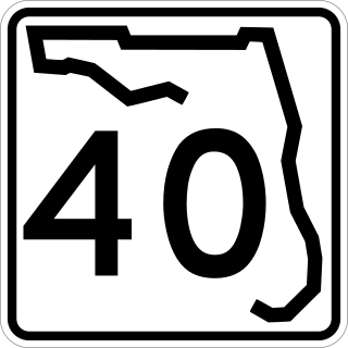
State Road 40 is a 91.8-mile-long (147.7 km) east–west highway across northern and east-central Florida, running from U.S. Highway 41 (US 41) in Rainbow Lakes Estates eastward through Ocala over the Ocklawaha River and through the heart of the Ocala National Forest to SR A1A in Ormond Beach. Names of the road include Silver Springs Boulevard in Ocala, Fort Brooks Road from Silver Springs through Astor, Butler Road in Astor, and Granada Boulevard in Ormond Beach. Former sections in Ormond Beach are named "Old Tomoka Road" and "Old Tomoka Avenue."
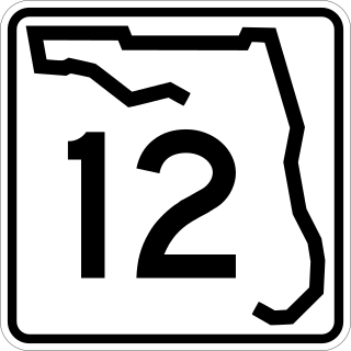
State Road 12 (SR 12) is an east–west route in the Florida Panhandle, running from SR 20 in Bristol to U.S. Route 27 (US 27) in Havana.

State Road 806 (SR 806), locally known as Atlantic Avenue, is the primary east–west highway of Delray Beach in Palm Beach County, Florida. Not to be confused with parallel Atlantic Boulevard (SR 814) 15 miles (24.14 km) to the south, Atlantic Avenue extends from U.S. Route 441 (US 441) and SR 7 eastward to SR A1A just north of Highland Beach. East of Military Trail, SR 806 is in the city of Delray Beach; to the west of Military Trail, the road stretches through unincorporated Palm Beach County in the CDPs of High Point, Kings Point, and the Villages of Oriole.

State Trunk Highway 60, often called Highway 60, STH-60 or WIS 60, is a state highway in the U.S. state of Wisconsin. It runs east–west in southern Wisconsin from Prairie du Chien on the Mississippi River at the Iowa state line to the village of Grafton near Lake Michigan.

State Road 296 is a major thoroughfare in the Pensacola, Florida metropolitan area. It is an east–west route running roughly through midtown Pensacola and West Pensacola. Locally, it is known as Michigan Avenue, Beverly Parkway, Brent Lane, Bayou Boulevard, and Perry Avenue. The western terminus of SR 296 is at U.S. Route 90. Westward of this intersection, County Road 296 connects to State Road 173. The eastern terminus of State Road 296 is again at US 90, this time in eastern Pensacola, where it is known as Cervantes Street.

New York State Route 81 (NY 81) is an east–west state highway in the Capital District of New York in the United States. The western terminus of the route is at an intersection with NY 145 and Potter Hollow Road in the hamlet of Cooksburg within the town of Rensselaerville. Its eastern terminus is at a junction with U.S. Route 9W (US 9W) in the town of Coxsackie. East of US 9W, the right-of-way of NY 81 continues southeast to the village of Coxsackie as NY 385. NY 81 intersects NY 32 north of the hamlet of Cairo.

State Road 426 is a major road in Orange and Seminole counties, entirely north of Orlando. Its length is closely similar to SR 438. East of here, the road continues as County Road 426 as a direct route to Mims and Scottsmoor, the census-designated places of Brevard County, terminating at SR 46.

U.S. Highway 29 (US 29) in the state of Florida is the westernmost north–south United States Numbered Highway in the state. It runs 43.6 miles (70.2 km) from downtown Pensacola north to the Alabama state line entirely within Escambia County. US 29 runs as a four-lane highway through much of the Florida Panhandle, becoming six lanes through and near several towns. The highway's hidden state road designation is entirely State Road 95 (SR 95).

U.S. Route 441 (US 441) in Florida is a north–south United States Highway. It runs 433 miles (697 km) from Miami in South Florida northwest to the Georgia state line, with the overall route continuing to Tennessee in the Rocky Top area.

State Road 121 is a major state highway that runs north and south in northern Florida. The road is part of a long multi-state route that also goes through Georgia and South Carolina.

Pennsylvania Route 106 (PA 106) is a 20.69-mile-long (33.30 km) state highway located in both Susquehanna and Lackawanna counties in Pennsylvania. Route 106 begins at a fork from U.S. Route 11 (US 11) in the community of Kingsley. The route heads southeasterly for most of its length, interchanging with Interstate 81 (I-81) in Lenox Township. PA 106 continues into the city of Carbondale, where the designation terminates at US 6 Business, the former alignment of US 6 through Carbondale.

State Road 71 is a highway in western Florida that runs 95.4 miles (153.5 km) from the Gulf Coast and the Gulf of Mexico, through the panhandle of Florida to the Alabama border.

State Road 368 (SR 368) is a short state road an east–west "bypass route", locally known as 23rd Street, in and around the vicinity of Panama City, Florida. The road is entirely four-lanes wide with center left-turn lanes where available, and is divided only at its eastern terminus. No roads overlap SR 368 or vice versa.
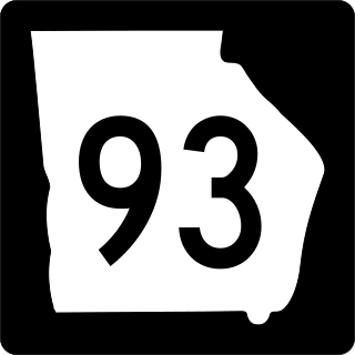
State Route 93 (SR 93) is a state highway in southwest part of the U.S. state of Georgia. The highway runs 60.9 miles (98.0 km) from Thomasville north to Pelham, northeast to Hinsonton, north to Lester, and west to Baconton.

State Route 30 is an east-west state highway in the central and eastern portions of the U.S. state of Tennessee. It runs generally west to east, connecting McMinnville in Warren County with Parksville along the Ocoee River in Polk County. It crosses several major geographic features in Tennessee, including the Cumberland Plateau, the Sequatchie Valley, the Tennessee River, and parts of the Cherokee National Forest.

