
U.S. Route 27 or U.S. Highway 27 (US 27) is a north–south United States Numbered Highway in the Southern and Midwestern U.S. The southern terminus is at US 1 in Miami, Florida. The northern terminus is at Interstate 69 (I-69) in Fort Wayne, Indiana. From Miami, it goes up the center of Florida, then west to Tallahassee, Florida, and north through such cities and towns as Columbus, Georgia; Rome, Georgia; Chattanooga, Tennessee; Lexington, Kentucky; Cincinnati, Ohio; Oxford, Ohio; Richmond, Indiana; and Fort Wayne, Indiana. It once extended north through Lansing, Michigan, to Cheboygan, Mackinaw City, and, for about three years, even as far as St. Ignace. US 27 was first signed in 1926, replacing what had been the eastern route of the Dixie Highway in many states.

U.S. Route 90 or U.S. Highway 90 (US 90) is an east–west major United States highway in the Southern United States. Despite the "0" in its route number, US 90 never was a full coast-to-coast route. It generally travels near Interstate 10 (I-10) and passes through the southern states of Texas, Louisiana, Mississippi, Alabama, and Florida. US 90 also includes part of the DeSoto Trail between Tallahassee and Lake City, Florida.

U.S. Route 23 or U.S. Highway 23 (US 23) is a major north–south United States Numbered Highway between Jacksonville, Florida, and Mackinaw City, Michigan. It is an original 1926 route which originally reached only as far south as Portsmouth, Ohio, and has since been extended. It was formerly part of the major highway known as the Dixie Highway. The highway's southern terminus is in Jacksonville, Florida, at US 1/US 17. The northern terminus is at Interstate 75 (I-75) in Mackinaw City, Michigan.

U.S. Route 301 (US 301) is a spur of U.S. Route 1 running through the South Atlantic states. It runs 1,099 miles (1,769 km) from Biddles Corner, Delaware, at Delaware Route 1 to Sarasota, Florida, at U.S. Route 41. It passes through the states of Delaware, Maryland, Virginia, North Carolina, South Carolina, Georgia, and Florida. It goes through the cities of Middletown, Delaware; Annapolis, Maryland; Richmond and Petersburg, Virginia; Rocky Mount, Wilson, and Fayetteville, North Carolina; Florence, South Carolina; Statesboro and Jesup, Georgia; and Jacksonville, Ocala, Zephyrhills, and Sarasota, Florida.

U.S. Route 319 is a spur of US 19. It runs for 303 miles (488 km) from US 98 at the foot of the John Gorrie Memorial Bridge across from downtown Apalachicola, Florida to US 1/SR 4 in Wadley, Georgia, through the Panhandle of Florida and the southern portion of Georgia.

Interstate 95 (I-95) is the main Interstate Highway of Florida's Atlantic Coast. It begins at a partial interchange with US Highway 1 (US 1) just south of downtown Miami and heads north through Jacksonville, and to the Georgia state line at the St. Marys River near Becker. The route also passes through the cities of Fort Lauderdale, West Palm Beach, Port St. Lucie, Titusville, and Daytona Beach.
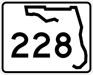
State Road 228 (SR 228) is a 32.532-mile-long (52.355 km) state highway in the northeastern part of the U.S. state of Florida. It exists in two distinct sections, separated by both Baker County Road 228 and Duval CR 228, which are former segments of SR 228.

The Martin Luther King Jr. Parkway is a 7.1-mile (11.4 km) long expressway running along the eastern and northern edges of Downtown Jacksonville, Florida. It carries U.S. Route 1 Alternate from near its southern terminus to an interchange with US 1/US 17. US 1 follows the expressway to its northern terminus, an intersection with US 23. Despite its name, it is not a parkway in the conventional sense, as it has no limits on truck use and is not located near parks or other beautified areas.

U.S. Highway 17 (US 17) is a 124.20-mile-long (199.88 km) United States Numbered Highway in the U.S. state of Georgia. It travels south–north near the Atlantic Ocean, serving the Brunswick and Savannah metropolitan areas on its path from Florida at the St. Marys River to South Carolina at the Savannah River. Except for part of the highway in Savannah, which is concurrent with Interstate 16 and SR 404 Spur to the Talmadge Memorial Bridge to Hutchinson Island, US 17 is concurrent with SR 25. SR 25 uses an older western alignment of US 17 into South Carolina.

State Route 25 (SR 25) is a state highway in the eastern part of the U.S. state of Georgia. It travels south-to-north near the Atlantic Ocean, serving the Brunswick and Savannah metropolitan areas on its path from the Florida state line at the St. Marys River to the South Carolina state line at the Little Back River, a channel of the Savannah River. Except for the northern part of the highway, from Savannah to Port Wentworth, it is concurrent with U.S. Route 17 (US 17) for its entire length.
U.S. Highway 1 (US 1) in Florida runs 545 miles (877 km) along the state's east coast from Key West to its crossing of the St. Marys River into Georgia north of Boulogne and south of Folkston. US 1 was designated through Florida when the U.S. Numbered Highway System was established in 1926. With the exception of Monroe County, the highway runs through the easternmost tier of counties in the state, connecting numerous towns and cities along its route, including nine county seats. The road is maintained by the Florida Department of Transportation (FDOT).

State Route 23 (SR 23) is a 240.0-mile-long (386.2 km) state highway that travels south-to-north through portions of Charlton, Brantley, Wayne, Long, Tattnall, Candler, Emanuel, Jenkins, and Burke counties in the southeastern and east-central parts of the U.S. state of Georgia. The highway connects the Florida state line, south-southwest of Saint George with the southern part of the Augusta metropolitan area, via Folkston, Nahunta, Jesup, Ludowici, Glennville, Reidsville, Metter, Twin City, and Millen.
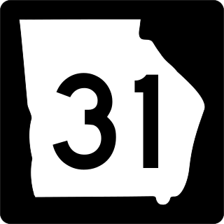
State Route 31 (SR 31) is a 166.9-mile-long (268.6 km) state highway that travels south-to-north through portions of Lowndes, Lanier, Clinch, Atkinson, Coffee, Telfair, Wheeler, Dodge, Laurens, and Johnson counties in the south-central part of the U.S. state of Georgia. The highway connects the Florida state line, south of Clyattville with Wrightsville, via Valdosta, Douglas, and Dublin.
U.S. Highway 27 (US 27) in Florida is a north–south United States Numbered Highway. It runs 496.352 miles (798.801 km) from the Miami metropolitan area northwest to the Tallahassee metropolitan area. Throughout the state, US 27 has been designated the Claude Pepper Memorial Highway by the Florida Legislature. It was named after long-time Florida statesperson Claude Pepper, who served in both the U.S. Senate and House of Representatives. The stretch running from Miami to South Bay was originally designated the Thomas E. Will Memorial Highway by the Florida Legislature in 1937 when that portion was known as State Road 26 (SR 26). Thomas E. Will, the founder of Okeelanta, had worked for almost 20 years to get the state to build a road from Miami to the area south of Lake Okeechobee. For most of its length in the state, US 27 is a divided highway.
U.S. Route 90 (US 90) in the state of Florida is the northernmost east–west United States Numbered Highway in the state. US 90 not only passes through the county seats of all the 16 counties it runs through on its course in Florida and is also the road upon which many of the county courthouses are located, but it was the first paved road in Florida. It is never more than six miles (9.7 km) from Interstate 10 (I-10) throughout the state. It runs as a two-lane highway through most of the sparsely populated inland areas of the Florida Panhandle, widening to four lanes through and near several towns. The speed limit is 55 mph (89 km/h) for all rural points west of Monticello, and it is 60 mph (97 km/h) on all rural points from where it enters Madison County as far as Glen St. Mary.
U.S. Route 301 in Florida runs from the Sarasota-Bradenton-Venice, Florida Metropolitan Statistical Area northeast to the Greater Jacksonville Metropolitan Area. The road is a spur of U.S. Route 1, which it intersects in Callahan.
Several special routes of U.S. Route 1 (US 1) exist, from Florida to Maine. In order from south to north, separated by type, these special routes are as follows.
A total of at least seven special routes of U.S. Route 301 exist and at least eleven have been deleted.
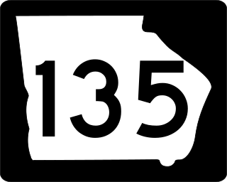
State Route 135 (SR 135) is a 130-mile-long (210 km) state highway in the south-central part of the U.S. state of Georgia. It connects the Florida state line with Higgston, via Lakeland, Willacoochee, Douglas, and Hazlehurst. It travels concurrently with U.S. Route 221 for extensive distances, a short piece in Lakeland and a longer one from Douglas to Uvalda.

Georgia State Route 121 (SR 121) is a 238-mile-long (383 km) state highway between Charlton County and Augusta. It is part of a three-state multistate route beginning in Florida and ending in South Carolina.


