
Interstate 110 (I-110) is a 6.341-mile (10.205 km) auxiliary route of the Interstate Highway System in Pensacola, Florida, extending north from U.S. Route 98 (US 98) to I-10. I-110 carries the hidden Florida Department of Transportation designation of State Road 8A. The easternmost auxiliary route of I-10, it is also known as the Reubin O'Donovan Askew Parkway in honor of the former governor of Florida who originated in Pensacola.
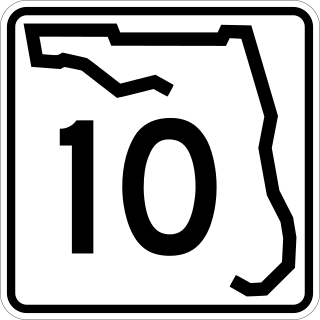
State Road 10, also known as Atlantic Boulevard, is a major east–west state highway in the U.S. state of Florida. Mostly unsigned in favor of U.S. Highway 90, it runs from the Alabama state line to Atlantic Beach. The only sections that are not signed as US 90 are north of Pensacola, where US 90 uses SR 10A and SR 10 is signed as U.S. Highway 90 Alternate, and east of south Jacksonville, where US 90 uses unsigned SR 212.
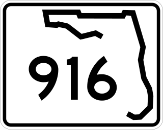
State Road 916, locally known as Northwest 138th Street, West 84th Street, North 135th Street, Opa-locka Boulevard, and Natural Bridge Road is a 10.253 miles (16.501 km) long east–west highway crossing northern Miami-Dade County, Florida. Its western terminus is at an interchange with Interstate 75 (I-75), the Palmetto Expressway, and the Gratigny Parkway on the boundary between Hialeah and Miami Lakes, traveling east to Biscayne Boulevard.

State Road 969, locally known as Milam Dairy Road and West 72nd Avenue, is a 5.2-mile-long (8.4 km) north–south street west of Miami International Airport in western Miami-Dade County, Florida. The southern terminus is currently an intersection with SR 968 in the city of Miami, and its northern terminus is an intersection with SR 934, just south of Medley.

Collier Boulevard is a nearly 27-mile-long (43 km) north–south divided highway that extends from the south end of Marco Island through central Collier County to CR 846 north of Golden Gate. State-maintained segments of Collier Boulevard are designated as State Road 951, which previously existed over the entire route from CR 92 on Marco Island to CR 846. County-maintained segments are County Road 951, which were relinquished from state control in the 1980s.

Glades Road is an 11.115-mile (17.888 km) long east–west arterial boulevard in southern Palm Beach County, Florida. The majority of the road is signed as State Road 808, but the westernmost 3.5 miles (5.63 km) is designated as County Road 808. SR 808 begins at an intersection with US 441–SR 7 in what was formerly Mission Bay (but is now unincorporated Boca Raton; its eastern terminus is an intersection with Federal Highway in Boca Raton. The county-maintained segment proceeds west from US 441 / SR 7 and bends south to end at the western terminus of Palmetto Park Road.
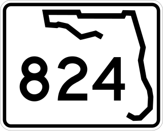
State Road 824, locally known as Pembroke Road, is a 6.547-mile-long (10.536 km) east–west highway and major commuter route in southern Broward County, Florida. Its western terminus is an intersection with South University Drive, on the boundary between Miramar and Pembroke Pines and adjacent to North Perry Airport; its eastern terminus is an intersection with South Federal Highway on the boundary between Hollywood and Hallandale Beach at the northeastern end of the Hollywood Dog Track.

Commercial Boulevard is a 15.2-mile-long (24.5 km) highway serving northern Broward County, Florida, mostly designated as State Road 870 (SR 870). The road extends from its western terminus in Sunrise at SR 869, the Sawgrass Expressway, and serves as a major commercial route through Oakland Park, and Fort Lauderdale, intersecting Florida's Turnpike, U.S. Route 441 (US 441), Interstate 95 (I-95) and US 1 before reaching its eastern terminus at SR A1A in Lauderdale-by-the-Sea, Florida.

Sunrise Boulevard is a 15.6 miles (25.1 km) long east–west highway serving central Broward County mostly designated State Road 838. The road begins at an interchange with the Sawgrass Expressway in Sunrise and continues east to North Ocean Boulevard in Fort Lauderdale, next to Hugh Taylor Birch State Park. For 0.91 miles (1.46 km) in downtown Fort Lauderdale, SR 838 overlaps U.S. Route 1.

Griffin Road is a boulevard extending 18.2 miles (29.3 km) in Broward County, mostly designated State Road 818 (SR 818). It begins at Orange Drive in Southwest Ranches and continues east to Federal Highway (US 1) in Dania Beach. The westernmost 7.5 miles (12.1 km) of Griffin Road are designated as County Road 818 (CR 818).

State Road 742 is a 6.886-mile-long (11.082 km) east–west state highway serving Pensacola, Florida. It is both a commuter road and a bypass route that also provides access for motorists to Pensacola International Airport. Locally known as Burgess Road and Creighton Boulevard, SR 742 stays within a mile south of Interstate 10 from the state road's western terminus at U.S. Route 29 near Ensley to SR 742's eastern terminus at US 90 in Pensacola.

State Road 615, locally known as 25th Street, is a 6.2-mile-long (10.0 km) north–south commuter road serving St. Lucie County, Florida. Its northern terminus is an intersection with U.S. Route 1 northeast of the St. Lucie County Airport in St. Lucie Village. SR 615 continues south along 25th Street, intersecting with Okeechobee Road and Virginia Avenue before the state road designation ends at its intersection with Edwards Road. County Road 615 (CR 615) begins here and extends 10.1 miles (16.3 km) south to Port St. Lucie. At Midway Road, the road changes names from 25th Street to St. James Drive. After winding its way through northern Port St. Lucie, St. James Drive ends at an intersection with Airoso Boulevard, with the CR 615 designation continuing south along Airoso Boulevard. After intersections with Prima Vista Boulevard and Crosstown Parkway, CR 615 and Airoso Blvd. finally reaches its southern terminus with Port St. Lucie Blvd., where Port St. Lucie's City Hall is located.
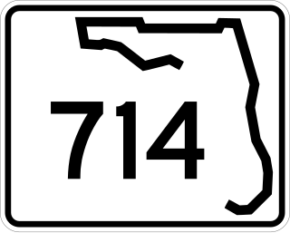
State Road 714 (SR 714) is a 12.4-mile-long (20.0 km) east–west highway serving northern Martin County, Florida, running from just west of Interstate 95 (I-95) near Palm City to an intersection with Southeast Ocean Boulevard in Stuart. The route is known locally as Martin Highway, Martin Downs Boulevard, and Southeast Monterey Road.

State Road 296 is a major thoroughfare in the Pensacola, Florida metropolitan area. It is an east–west route running roughly through midtown Pensacola and West Pensacola. Locally, it is known as Michigan Avenue, Beverly Parkway, Brent Lane, Bayou Boulevard, and Perry Avenue. The western terminus of SR 296 is at U.S. Route 90. Westward of this intersection, County Road 296 connects to State Road 173. The eastern terminus of State Road 296 is again at US 90, this time in eastern Pensacola, where it is known as Cervantes Street.

State Road 134 (SR 134) is an 11-mile-long (18 km), east–west signed state highway located entirely in Jacksonville, Duval County, Florida, in the U.S. state of Florida. It extends from SR 228 to U.S. Route 17 (US 17). It is known as 103rd Street west of Wesconnett Boulevard and Timuquana Road east of the intersection. The road is between four and six lanes wide.

U.S. Highway 29 (US 29) in the state of Florida is the westernmost north–south United States Numbered Highway in the state. It runs 43.7 miles (70.3 km) from downtown Pensacola north to the Alabama state line entirely within Escambia County. US 29 runs as a four-lane highway through much of the Florida Panhandle, becoming six lanes through and near several towns. The highway's hidden state road designation is entirely State Road 95 (SR 95).

U.S. Route 98 is a major east-west thoroughfare through the U.S. state of Florida. Spanning 670.959 miles (1,079.804 km), it connects Pensacola and the Alabama/Florida state line to the west with Palm Beach and the Atlantic coast in the east. It is the longest US road in Florida, as well as the longest US road in any state east of the Mississippi River.

State Road 289, known locally as North 9th Avenue, is a north–south major thoroughfare in Pensacola, Florida.
State Road 294 (SR 294) is a very short state highway that connects State Road 295 and U.S. Highway 98 (US 98) on Chiefs Way in West Pensacola, Florida.


