References
- ↑ U.S. Geological Survey Geographic Names Information System: Floydtown (historical)
- ↑ Krakow, Kenneth K. (1975). Georgia Place-Names: Their History and Origins (PDF). Macon, GA: Winship Press. p. 80. ISBN 0-915430-00-2.
Municipalities and communities of Miller County, Georgia, United States | ||
|---|---|---|
| City | 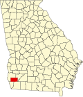 | |
| CDP | ||
| Other unincorporated communities | ||
| Ghost town | ||
| Footnotes | ‡This populated place also has portions in an adjacent county or counties | |
31°08′02″N84°46′02″W / 31.13389°N 84.76722°W
| | This Miller County, Georgia state location article is a stub. You can help Wikipedia by expanding it. |