Boykin, Georgia | |
|---|---|
 Boykin limit on US27 / GA1 | |
 Boykin  Boykin | |
| Coordinates: 31°6′18″N84°41′13″W / 31.10500°N 84.68694°W | |
| Country | |
| State | |
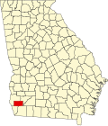
| County | Miller |
| Area | |
• Total | 2.425 sq mi (6.28 km2) |
| • Land | 2.421 sq mi (6.27 km2) |
| • Water | 0.004 sq mi (0.010 km2) |
| Elevation | 131 ft (40 m) |
| Population | |
• Total | 151 |
| • Density | 62.37/sq mi (24.08/km2) |
| Time zone | UTC-5 (Eastern (EST)) |
| • Summer (DST) | UTC-4 (EDT) |
| ZIP code | 39837 (Colquitt) |
| Area code | 229 |
| FIPS code | 13-09852 [1] |
| GNIS feature ID | 2587025 [2] |
Boykin is an unincorporated community and census-designated place (CDP) in Miller County, Georgia, United States. [2] The 2020 census listed a population of 151. [4]