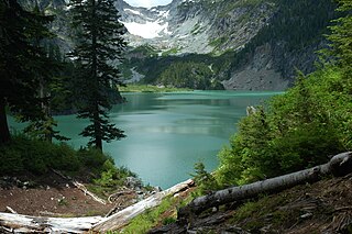
The Henry M. Jackson Wilderness is a 103,297-acre (41,803 ha) designated wilderness area in the state of Washington, United States. The area lies adjacent to the southwest corner of the Glacier Peak Wilderness, northwest of Stevens Pass on U.S. Highway 2 and northeast of the town of Skykomish, Washington. Wild Sky Wilderness is located immediately southwest of the Henry M. Jackson Wilderness. While the wilderness straddles the Cascade Mountain Range, most of it is in the westside ecotype. The wilderness lies in parts of Snoqualmie, Mount Baker, and Wenatchee national forests.

The Alpine Lakes Wilderness is a large wilderness area spanning the Central Cascades of Washington state in the United States. The wilderness is located in parts of Wenatchee National Forest and Snoqualmie National Forest, and is approximately bounded by Interstate 90 and Snoqualmie Pass to the south and U.S. Route 2 and Stevens Pass to the north. The Alpine Lakes is the largest wilderness area near the population centers of Puget Sound, counted at 414,161 acres (167,605 ha) following the 2014 expansion.

Glacier Peak Wilderness is a 566,057-acre (229,075 ha), 35-mile-long (56 km), 20-mile-wide (32 km) wilderness area located within portions of Chelan, Snohomish, and Skagit counties in the North Cascades of Washington. The area lies within parts of Wenatchee National Forest and Mount Baker National Forest and is characterized by heavily forested stream courses, steep-sided valleys, and dramatic glacier-crowned peaks. The dominant geologic feature of the area is 10,541-foot (3,213 m) Glacier Peak. It is the most remote major volcanic peak in the Cascade Range and has more active glaciers than any other place in the lower forty-eight states. Glacier Peak is a volcanic cone of basalt, pumice, and ash which erupted during periods of heavy glaciation.

The Purcell Wilderness Conservancy is a provincial park in British Columbia, Canada. It was established in 1974, and encompasses six large drainages in the Purcell Mountains in the southeast of the province. It contains high peaks, alpine meadows and ridges, deep creek and river valleys, and hot springs at Dewar Creek.

The William O. Douglas Wilderness is a designated wilderness in Central Washington. It includes 169,081 acres (68,425 ha) located between the U.S. Route 12 and State Route 410 and is jointly administered by the Okanogan-Wenatchee National Forest and the Gifford Pinchot National Forest. It shares a boundary with the Mt. Rainier National Park on the west; Norse Peak Wilderness lies to the north, Goat Rocks Wilderness to the south. Approximately 25 miles (40 km) of the Pacific Crest Trail travel along the Cascade Range crest within its boundaries. It contains scattered peaks, sharp ridges, steep slopes and hundreds of small lakes and potholes. Much of the wilderness is drained by tributaries of the Naches River.
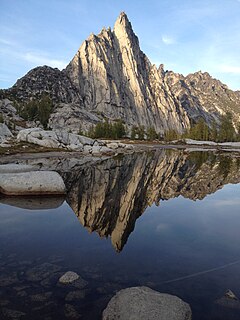
The Enchantments is a region within the Alpine Lakes Wilderness area of Washington state’s Cascade Mountain Range. At an elevation of 4,500 feet, it is home to over 700 alpine lakes and ponds surrounded by the vast peaks of Cashmere Crags, which rate among the best rock-climbing sites in the western United States. The highest peak, Dragontail Peak, stretches 8,840 feet high. The Enchantments is located 15 miles southwest of the popular Bavarian-themed town Leavenworth, Washington in the United States and is regarded as one of the most spectacular regions in the Cascade Range.
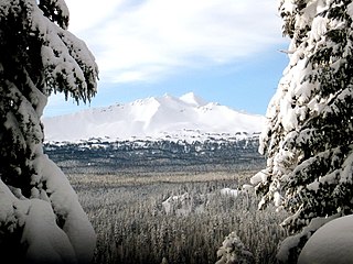
The Diamond Peak Wilderness is a wilderness area straddling the Cascade crest and includes the Diamond Peak volcano. It is located within two National Forests - the Willamette National Forest on the west and the Deschutes National Forest on the east.

The Lone Peak Wilderness is a 30,088-acre (121.76 km2) wilderness area located within the Uinta and the Wasatch-Cache National Forest in the U.S. state of Utah.

The Sawtooth Range is a mountain range of the Rocky Mountains in central Idaho, United States, reaching a maximum elevation of 10,751 feet (3,277 m) at the summit of Thompson Peak. It encompasses an area of 678 square miles (1,756 km2) spanning parts of Custer, Boise, Blaine, and Elmore counties, and is bordered to the east by the Sawtooth Valley. Much of the mountain range is within the Sawtooth Wilderness, part of the Sawtooth National Recreation Area and Sawtooth National Forest.

Jennie Lakes Wilderness is a protected area in the Sierra Nevada, in Tulare County, California. It is located 60 miles (97 km) east of Fresno and managed by the US Forest Service.

Eagle Cap Wilderness is a wilderness area located in the Wallowa Mountains of northeastern Oregon, within the Wallowa–Whitman National Forest. The wilderness was established in 1940. In 1964, it was included in the National Wilderness Preservation System. A boundary revision in 1972 added 73,000 acres (30,000 ha) and the Wilderness Act of 1964 added 66,100 acres (26,700 ha) resulting in a current total of 361,446 acres, making Eagle Cap by far Oregon's largest wilderness area.
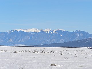
Latir Peak Wilderness is a 20,506-acre (8,298 ha) wilderness area located within the Carson National Forest in northern New Mexico, United States. Designated in 1980, the wilderness is composed of dense forest, meadows, and alpine tundra on Latir Mesa in the northern portion. It includes a portion of the Sangre de Cristo Mountains and contains four of the state's twenty highest peaks - Venado Peak at 12,734 feet (3,881 m), Latir Peak at 12,708 feet (3,873 m), Latir Mesa at 12,692 feet (3,869 m), and Virsylvia Peak at 12,594 feet (3,839 m). Most of the area is drained by the Lake Fork of Cabresto Creek, which originates at Heart Lake and is impounded just outside the wilderness in Cabresto Lake, the main trailhead for visitors entering the wilderness.
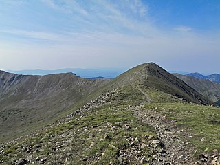
The 19,661-acre (7,957 ha) Wheeler Peak Wilderness lies in the Carson National Forest of New Mexico. It contains the highest point in the state, 13,161-foot (4,011 m) Wheeler Peak as well as Williams Lake.

The Kaiser Wilderness is a federally designated wilderness protected area located 70 miles (110 km) northeast of Fresno in the state of California, USA. It was added to the National Wilderness Preservation System by the United States Congress on October 19, 1976. The wilderness is 22,700 acres (92 km2) in size, is one of five wilderness areas within the Sierra National Forest and is managed by the US Forest Service.

Dragontail Peak, also known as Dragon Tail, is a mountain in the Stuart Range, in Chelan County, Washington. While climbing an adjacent peak, Lex Maxwell, Bob McCall, and Bill Prater remarked that the needles on the crest, southwest of the summit, resembled a "dragon tail". The name was officially accepted in 1955. On the mountain's northeast flank lies Colchuck Lake which drains into Mountaineer Creek, and Colchuck Glacier lies below the western slopes of the peak. On its south side the mountain drops steeply to Ingalls Creek, which flows about 5,800 feet (1,800 m) below the summit.

Alpine Peak, at 9,861 feet (3,006 m) above sea level is a peak in the Sawtooth Range of Idaho. The peak is located in the Sawtooth Wilderness of Sawtooth National Recreation Area in Custer County. The peak is located 1 mi (1.6 km) northeast of Mount Regan, its line parent. Alpine Peak is south of Alpine Lake and east of Sawtooth Lake.

Chikamin Peak is a 7,000+ ft mountain summit located in the cascade Range, in Kittitas County of Washington state. It is situated within the Alpine Lakes Wilderness, on land managed by Okanogan-Wenatchee National Forest. The mountain's name "Chikamin" derives from Chinook Jargon meaning "money" or "metal", and was submitted by Edmond S. Meany, president of The Mountaineers. This name was officially adopted in 1916 by the U.S. Board on Geographic Names. Chikamin Peak is the highest point of Chikamin Ridge, 6 mi (9.7 km) northeast of Snoqualmie Pass. Other notable peaks on Chikamin Ridge include Four Brothers and Three Queens. Precipitation runoff from this mountain drains into tributaries of the Yakima River. The Pacific Crest Trail traverses the southwest slope of Chikamin Ridge, and from the trail a scramble up a gully leads to the summit and several alpine lakes including Chikamin Lake and Spectacle Lake.

Paradise Park Natural Area is a natural area in Rocky Mountain National Park, Colorado, several miles east of Grand Lake. It protects the upper Paradise Creek basin, encompassing several alpine lakes, alpine meadows, and virgin spruce-fir forest. Paradise Creek contains pure strains of Colorado River cutthroat trout. The area is also adjacent to the Hell Canyon Natural Area in the Indian Peaks wilderness.
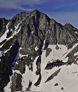
Dip Top Peak is a 7,291-foot-elevation mountain summit located in the Alpine Lakes Wilderness in eastern King County of Washington state. It is part of the Cascade Range and is set on land managed by Mount Baker-Snoqualmie National Forest. The peak is situated 1.25 mi (2.01 km) north of Mount Daniel, and less than one mile south of Jade Lake. Precipitation runoff from the mountain drains into East Fork Foss River, which is a tributary of the Skykomish River. The summit saddle has two rock horns, of which the higher southwest peak is the true summit. The first ascent was made August 1950 by Bill and Gene Prater. In the early 1970s, brothers Gene and Bill Prater created the modern aluminum snowshoe known today, and sold them via Bill's "Sherpa Snowshoes" company, which proved very popular.


