
The Berwyn range is an isolated and sparsely populated area of moorland in the northeast of Wales, roughly bounded by Llangollen in the northeast, Corwen in the northwest, Bala in the southwest, and Oswestry in the southeast.

Carnedd Llewelyn, also spelled Carnedd Llywelyn, is a mountain massif in the Carneddau range in Snowdonia, north-west Wales. It is the highest point of the Carneddau and the second highest peak by relative height in Wales, 49th in the British Isles and lies on the border between Gwynedd and Conwy.

Elidir Fawr is a mountain in Snowdonia, north Wales, the northernmost peak in the Glyderau. Its name means 'Big Elidir', named after a legendary warrior king of the 6th century also known as Eliffer Gosgorddfawr.

Foel-fras (944 m) is a mountain in the Carneddau range, about 10 km east of Bethesda in North Wales. It lies on the border between the counties of Gwynedd and Conwy. With a summit elevation of 944 m it is officially the eleventh-highest summit in Wales. Foel-fras is located at the northern end of the main ridge of the Carneddau, between Drum to the north and Foel Grach to the south, with the subsidiary summit of Garnedd Uchaf (925 m) between it and Foel Grach. Due south and 400 m below lies the reservoir of Llyn Dulyn, while the smaller reservoir of Llyn Anafon lies to the north.

The Snowdon Massif, Snowdon Range or Yr Wyddfa massif is one of the three mountain groups in Snowdonia, north Wales, to include mountains over 3,000 feet (914 m) high. It occupies the area between Beddgelert, Pen-y-Pass and Llanberis. It is surrounded by the Glyderau to the north-east, Moel Siabod to the east, the Moelwynion to the south, Moel Hebog, the Nantlle Ridge and Mynydd Mawr to the west, and by flatter land leading down to Caernarfon and the Menai Strait to the north-west.

Moel Eilio is a mountain in Snowdonia, North Wales, that is situated approximately 3 miles north-west of Snowdon itself. It has two subsidiary tops, Foel Gron and Foel Goch (Eilio). The average annual temperature of the mountain is around 6 °C (43 °F). During the winter season, some significant accumulations of snowfall is known to take place on Moel Eilio, due to its relatively flat, grassy slopes.

Fan Brycheiniog is the highest peak at a height of 802.5 metres (2,633 ft) in the Black Mountain region of the Brecon Beacons National Park in southern Wales. There is a trig point at the peak and on the edge of the escarpment, and nearby, a stone shelter with an inner seat. It lies just inside the historic county of Brecknockshire which gives the mountain its Welsh name. A subsidiary top, less than a kilometre from the summit along the ridge to the northwest, is the highest point of the neighbouring county of Carmarthenshire. Fan Brycheiniog is also within the Fforest Fawr Geopark designated in 2005 in recognition of the area's geological heritage. The views of the moorland and open country to the north are spectacular when the weather is clear, and reveals the isolation of the range, especially when compared with the more popular Pen y Fan range to the east.

Carnedd Gwenllian is a minor summit of the Carneddau range in Snowdonia, Wales, and included in the Welsh 3000s. From the summit, distant views to the north can extend as far as Ireland and the Isle of Man, and to the South as far as the Berwyn Ranges.

Drum is a summit in the Carneddau mountains in northern Wales, 2 km north-east of Foel-fras. It is 771 m (2,526 ft) high. It is also known as Carnedd Penyborth-Goch.

Tomle is a top of Cadair Berwyn in north east Wales. It is the highest of the summits found on the most easterly of Cadair Berwyn's long south ridges.

Foel Meirch is a top of Carnedd Dafydd in the Carneddau range in Snowdonia, North Wales. It offers commanding views of Carnedd Llewelyn and Yr Elen, and the Ysgolion Duon Cliffs.

Foel Hafod-fynydd is a subsidiary summit of Aran Fawddwy in southern Snowdonia, North Wales, Wales, United Kingdom. It tops the east ridge of Erw y Ddafad-ddu. Creiglyn Dyfi nestles in the bowl between Foel Hafod-fynydd and Aran Fawddwy.

Erw y Ddafad-ddu is a subsidiary summit of Aran Fawddwy in southern Snowdonia, North Wales, Wales, United Kingdom. It is the third highest peak in the Aran mountain range.

Cefn Cyfarwydd is a ridge in Conwy county borough, north Wales. It is located above the village of Trefriw on the western side of the Conwy valley, and dramatically separates Cwm Cowlyd and the rugged mountains of the Carneddau from the greener, lusher Conwy valley.

Carnedd y Filiast is a mountain in Snowdonia, Wales, forming part of the Glyderau. It, along with its top Y Fronllwyd, forms the most northerly summit in the Glyderau. The average annual temperature on Carnedd y Filiast is estimated to be around 4 Celsius.

Moel Llyfnant is a mountain in the southern portion of the Snowdonia National Park in Gwynedd, Wales. It is a peak in the Arenig mountain range. It lies to the west of Arenig Fawr. It has one notable top, the twin peaked Gallt y Daren, being at the end of its west ridge.
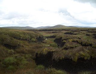
Llechwedd Du is a subsidiary summit of Esgeiriau Gwynion in north Wales. It forms a long peat bog plateau that start at the end of Esgeiriau Gwynion's south ridge, and ends with the higher summit of Moel y Cerrig Duon.

The Afon Aber is a small river in Gwynedd that enters Liverpool Bay on the coast of North Wales at Abergwyngregyn, 53.242°N 4.027°W. It rises in the Carneddau mountains on the northern watersheds of Drum, Foel Fras and Garnedd Uchaf and the eastern watersheds of Drosgl and Moel Wnion. It is principally noted for the spectacular waterfall of one its principal tributaries, the Aber Falls, where it leaves the hills and descends in a single drop to the valley floor. The river, joined by the other main tributary, the Afon Anafon, then flows through a densely wooded valley which is now a nature reserve before entering the sea just north of Abergwyngregyn.
