
Snowdonia, or Eryri, is a mountainous region and national park in North Wales. It contains all 15 mountains in Wales over 3000 feet high, including the country's highest, Snowdon, which is 1,085 metres (3,560 ft) tall. These peaks are all part of the Snowdon, Glyderau, and Carneddau ranges in the north of the region. The shorter Moelwynion and Moel Hebog ranges lie immediately to the south.

Snowdon, or Yr Wyddfa, is a mountain in the Snowdonia region of North Wales. It has an elevation of 1,085 metres (3,560 ft) above sea level, which makes it both the highest mountain in Wales and the highest in the British Isles south of the Scottish Highlands. Snowdon is designated a national nature reserve for its rare flora and fauna, and is located within Snowdonia National Park.
The National Three Peaks Challenge is an event in which participants attempt to climb the highest mountains of England, Scotland and Wales within 24 hours. It is frequently used to raise money for charitable organisations. Walkers climb each peak in turn, and are driven from the foot of one mountain to the next. The three peaks are:

Cnicht is a mountain in Snowdonia which forms part of the Moelwynion mountain range.

Elidir Fawr is a mountain in Snowdonia, north Wales, the northernmost peak in the Glyderau. Its name means 'Big Elidir', named after a legendary warrior king of the 6th century also known as Eliffer Gosgorddfawr.
Moel Siabod is a mountain in Snowdonia, Wales, which sits isolated above the village of Dolwyddelan. At 872 metres (2,861 ft), it is the highest peak in the Moelwynion mountain range. The UK National Mountain Centre, Plas-y-Brenin, is located at the foot of Moel Siabod. From the top of the mountain, it is reputedly possible to see 13 of the 14 highest peaks in Wales on a clear day without turning one's head.

Moel Hebog is a mountain in Snowdonia, north Wales which dominates the view west from the village of Beddgelert. It gives name to a whole range of peaks in the north-western corner of Snowdonia, which include the Nantlle Ridge and Mynydd Mawr.

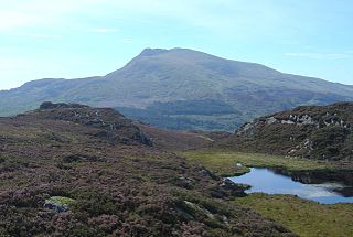
Arenig Fawr is a mountain in Snowdonia, North Wales, close to Llyn Celyn reservoir, alongside the A4212 between Trawsfynydd and Bala.
The Snowdon Massif, Snowdon Range or Yr Wyddfa massif is one of the three mountain groups in Snowdonia, north Wales, to include mountains over 3,000 feet (914 m) high. It occupies the area between Beddgelert, Pen-y-Pass and Llanberis. It is surrounded by the Glyderau to the north-east, Moel Siabod to the east, the Moelwynion to the south, Moel Hebog, the Nantlle Ridge and Mynydd Mawr to the west, and by flatter land leading down to Caernarfon and the Menai Strait to the north-west.

Pen Llithrig y Wrach is a mountain peak in Snowdonia, North Wales. It is one of the four Marilyns that make up the Carneddau range. To the east is Creigiau Gleision, another Marilyn, while to the west are Pen yr Helgi Du and Carnedd Llewelyn. Craig Eigiau and Llyn Eigiau can be seen to the north, while Gallt yr Ogof, Glyder Fach and Tryfan can be viewed to the south.

Moel Eilio is a mountain in Snowdonia, North Wales, that is situated approximately 3 miles north-west of Snowdon itself. It has two subsidiary tops, Foel Gron and Foel Goch (Eilio). The average annual temperature of the mountain is around 6 °C (43 °F). During the winter season, some significant accumulations of snowfall is known to take place on Moel Eilio, due to its relatively flat, grassy slopes.
Foel Gron is a peak on the Moel Eilio ridge of hills/mountains in Snowdonia, North Wales. This ridge is used as a hiker's route from Llanberis to the summit of Snowdon.

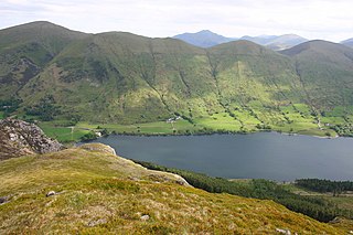
Mynydd Mawr is a mountain in Snowdonia, North Wales, approximately 7 km (4.3 mi) west of Snowdon itself, overlooking Llyn Cwellyn and being the northern outlier of the Moel Hebog group. A popular ascent starts from Rhyd Ddu. On its western flank are the remains of ancient settlements and field systems. The profile of Mynydd Mawr from the north is often thought to resemble an elephant lying down, and consequently the mountain is often colloquially also called "Yr Eliffant", or "Elephant Mountain" by non-Welsh speakers.

Dyffryn Mymbyr is a valley in Snowdonia, in north-west Wales, approximately 5 miles (8.0 km) in length, and leading up from Capel Curig to the Pen-y-Gwryd hotel.

Tal y Fan is an outlying peak of the Carneddau mountains in North Wales. It is one of the four Marilyns that make up the Carneddau, the others being Carnedd Llywelyn, Pen Llithrig y Wrach and Creigiau Gleision.

Aran Benllyn is a subsidiary summit of Aran Fawddwy in southern Snowdonia, North Wales, Wales, United Kingdom. It is the second highest peak in the Aran mountain range.

Trum y Ddysgl is a mountain in Snowdonia, north Wales and is the second highest summit on the Nantlle Ridge. It is also one half of the two Marilyns that make up the ridge, the other being Craig Cwm Silyn.

Moel Lefn is a summit in Snowdonia. It is a subsidiary peak of Moel Hebog and a sister peak of Moel yr Ogof. Its summit marks the end of the Hebog ridge.

Carnedd y Filiast is a mountain near Cerrigydrudion on the border of the Snowdonia National Park, North Wales and is 669 metres (2,195 ft) high.

The Summit railway station is the southern, upper terminus of the Snowdon Mountain Railway, located within yards of the summit of Snowdon. In 2009 a new station building was opened, which was named Hafod Eryri.
