Folly Mills Creek is a tributary of Christians Creek in Augusta County, Virginia. [1] [2] Located approximately 5 miles SSW of Staunton, Virginia, it features Folly Mills Falls.

Folly Mills Creek is a tributary of Christians Creek in Augusta County, Virginia. [1] [2] Located approximately 5 miles SSW of Staunton, Virginia, it features Folly Mills Falls.

Garrett County is the westernmost county of the U.S. state of Maryland completely within the Appalachian Mountains. As of the 2020 census, the population was 28,806, making it the third-least populous county in Maryland. Its county seat is Oakland. The county was named for John Work Garrett (1820–1884), president of the Baltimore and Ohio Railroad. Created from Allegany County in 1872, it was the last county to be formed in the state. The county is part of the Western Maryland region of the state. Garrett County is bordered by four West Virginia counties and to the north the Maryland–Pennsylvania boundary known as the Mason–Dixon line. The eastern border with Allegany County was defined by the Bauer Report, submitted to Governor Lloyd Lowndes, Jr. on November 9, 1898. The Potomac River and State of West Virginia lie to the south and west.

Pittsylvania County is a county located in the Commonwealth of Virginia. At the 2020 census, the population was 60,501. The county seat is Chatham.

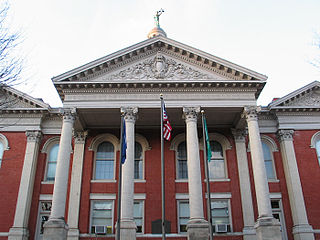
Augusta County is a county in the Shenandoah Valley on the western edge of the Commonwealth of Virginia in the United States. The second-largest county of Virginia by total area, it completely surrounds the independent cities of Staunton and Waynesboro. Its county seat is Staunton, but most of the administrative services have offices in neighboring Verona.

Craigsville is a town in Augusta County, Virginia, United States. The population was 923 at the 2010 census. It is part of the Staunton–Waynesboro Micropolitan Statistical Area.

Greenville is a census-designated place (CDP) in Augusta County, Virginia, United States. The population was 887 at the 2020 census. It is part of the Staunton–Waynesboro Micropolitan Statistical Area.
Verona is a census-designated place (CDP) in Augusta County, Virginia, United States. The population was 4,239 at the 2010 census. It is part of the Staunton–Waynesboro Micropolitan Statistical Area.

Monterey is a town and the county seat of Highland County, Virginia, United States. The population was 165 at the 2020 census.

Ripley is a city in and the county seat of Jackson County, West Virginia, United States. The population was 3,074 at the 2020 census.

Franklin is a town in and the county seat of Pendleton County, West Virginia, United States. The population was 486 at the 2020 census. Franklin was established in 1794 and named for Francis Evick, an early settler.

Mill Creek is a town in Randolph County, West Virginia, United States, along the Tygart Valley River. The population was 563 at the 2020 census.
Altaville is a former unincorporated community in Calaveras County, California, now located in the northwest portion of the city of Angels Camp. It sits at an elevation of 1,542 feet above sea level and is located at 38°05′02″N120°33′43″W, at the intersections of SR 49 and SR 4. The community is in ZIP code 95221 and area code 209.
Riverheads High School is a public school located in Augusta County, Virginia. Riverheads is the home of the Gladiators. Riverheads High School was built in 1962 to accommodate 600 students. Located at Routes 11 and 701, ten miles south of Staunton, it is one of five high schools serving Augusta County. A six-classroom wing was added in 1976 to provide for increased enrollment and additional course offerings. An eight million dollar program, completed in 1997, provided renovation with improved and expanded instructional, athletic, and support facilities. Riverheads is nestled in an historic area. In the vicinity are the Hessian House, McCormick’s Grist Mill, and Old Providence Church. Nearby three major highways converge: I-81, U.S. 11, and Route 340. Students are transported by buses covering an area which extend eighteen miles at certain points. Forming the school community are areas such as Moffatts Creek, McKinley, Newport, Vesuvius, Mint Spring, Middlebrook, Greenville, Spottswood, Lofton, White Hill, Jollivue, and the southern sections of both the Stuarts Draft area and the Beverley Manor District. Membership in recent times has varied from a high of 729 in 1978-79 to 420 in 1991-92. Many parents are employed in agriculture, industry-labor trade, and services. A majority are high school graduates and about one-fourth have education beyond high school. The student body is stable; about 90 percent of the senior class have been at Riverheads all their high school experience. Academically, the students compare well with other students in the nation on achievement tests, scoring above the norms for the South in SAT scores. Over half of the senior class typically continue their education beyond high school. The school is accredited by the State Board of Education and by the Southern Association of Colleges and Schools. In 2015, Riverheads High School was recognized as a Blue Ribbon School by U.S. Secretary of Education Arne Duncan. Only seven schools in Virginia were awarded this prestigious title in 2015. While the community is a growing industrial area, agriculture remains important to the school community. Varied cultural and recreational opportunities, good medical services, including those for the disabled and mentally or emotionally disturbed, community employment and guidance services, varied transportation and communication services, many churches and service clubs to meet the religious and civic needs, and a number of educational facilities for advanced or specialized training are all available nearby.
Mill Creek is a 5.3-mile-long (8.5 km) tributary stream of the North Fork South Branch Potomac River in Pendleton County, West Virginia. Mill Creek rises on the western flanks of North Fork Mountain and from there, flows north through Germany Valley. Its confluence with the North Fork lies at Hinkle Gap between Germany and Harman Knobs.

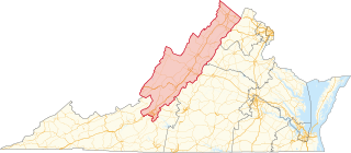
Virginia's sixth congressional district is a United States congressional district in the Commonwealth of Virginia. It covers much of the west-central portion of the state, including Roanoke and most of the Shenandoah Valley. The current representative is Ben Cline (R), who has held the seat since the 2019 retirement of incumbent Republican Bob Goodlatte.

Folly Mills Creek Fen Natural Area Preserve is a Natural Area Preserve located in Augusta County, Virginia. The preserve was dedicated in 1998, and was the first privately owned Natural Area Preserve to be dedicated in the state.
Sharon is an unincorporated community and coal town in southeastern Kanawha County, West Virginia, United States, located along the West Virginia Turnpike.
Leesville is an unincorporated community in Campbell County, in the U. S. state of Virginia.

Folly is a historic plantation house located near Staunton, Augusta County, Virginia. The house was built about 1818, and is a one-story, brick structure with a long, low service wing and deck-on-hip roof in the Jeffersonian style. It has an original rear ell fronted by a Tuscan order colonnade. The front facade features a tetrastyle pedimented portico with stuccoed Tuscan columns and a simple lunette in the pediment. A similar portico is on the north side and a third portico was replaced by a wing added in 1856. The house closely resembles Edgemont near Covesville, Virginia. Also on the property are contributing original brick serpentine walls, a spring house, smokehouse and icehouse.

Valley Railroad Stone Bridge is a historic stone arch bridge spanning Folly Mills Creek near Jolivue, Augusta County, Virginia. It was built in 1874 by the Valley Railroad, and is a four-span structure with an overall length of 130 feet (40 m) and a width of 15 feet (4.6 m). It is constructed of granite and faced in ashlar and features semi-circular arches set on gently splayed piers. It was acquired by the Virginia Department of Transportation in 1965. It is considered a scenic landmark along Interstate 81.

The Augusta Correctional Center was a state prison for men located near Craigsville in Augusta County, Virginia, United States.
38°05′02″N79°02′27″W / 38.08389°N 79.04089°W