Fonda | |
|---|---|
 Fonda | |
| Coordinates: 48°40′11″N100°1′7″W / 48.66972°N 100.01861°W | |
| Country | United States |
| State | North Dakota |
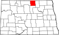
| County | Rolette |
| Founded | 1905 |
| Founded by | Jay Edwards |
| Named after | Fonda, Iowa |
Fonda is an unincorporated community in Rolette County, in the U.S. state of North Dakota. [1]