Sesto ed Uniti is a comune (municipality) in the Province of Cremona in the Italian region Lombardy, located about 70 kilometres (43 mi) southeast of Milan and about 11 kilometres (7 mi) northwest of Cremona.
Agazzano is a comune (municipality) in the Province of Piacenza in the Italian region Emilia-Romagna, located about 150 kilometres (93 mi) northwest of Bologna and about 20 kilometres (12 mi) southwest of Piacenza. As of 31 December 2004, it had a population of 2,021 and an area of 35.9 square kilometres (13.9 sq mi).

Coli is a comune (municipality) in the Province of Piacenza in the Italian region Emilia-Romagna, located about 160 kilometres (99 mi) west of Bologna and about 40 kilometres (25 mi) southwest of Piacenza. As of 31 December 2004, it had a population of 1,030 and an area of 72.2 square kilometres (27.9 sq mi).

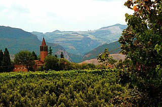
Corte Brugnatella is a comune (municipality) in the Province of Piacenza in the Italian region Emilia-Romagna, located about 160 kilometres (99 mi) west of Bologna and about 45 kilometres (28 mi) southwest of Piacenza.
Farini is a comune (municipality) in the Province of Piacenza in the Italian region Emilia-Romagna, located about 140 kilometres (87 mi) west of Bologna and about 40 kilometres (25 mi) southwest of Piacenza. As of 31 December 2004, it had a population of 1,744 and an area of 112.0 square kilometres (43.2 sq mi).
Gazzola is a comune (municipality) in the Province of Piacenza in the Italian region Emilia-Romagna, located about 150 kilometres (93 mi) northwest of Bologna and about 15 kilometres (9 mi) southwest of Piacenza. As of 31 December 2004, it had a population of 1,856 and an area of 44.1 square kilometres (17.0 sq mi).
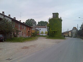
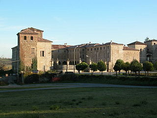
San Pietro in Cerro is a comune (municipality) in the Province of Piacenza in the Italian region Emilia-Romagna, located about 120 kilometres (75 mi) northwest of Bologna and about 20 kilometres (12 mi) east of Piacenza. As of 31 December 2004, it had a population of 962 and an area of 27.5 square kilometres (10.6 sq mi).
Zerba is a comune (municipality) in the Province of Piacenza in the Italian region Emilia-Romagna, located about 170 kilometres (110 mi) west of Bologna and about 50 kilometres (31 mi) southwest of Piacenza. As of 31 December 2004, it had a population of 123 and an area of 25.0 square kilometres (9.7 sq mi).
Frassinoro is a comune (municipality) in the Province of Modena in the Italian region Emilia-Romagna, located about 70 kilometres (43 mi) southwest of Bologna and about 50 kilometres (31 mi) southwest of Modena.

Montefiorino is a comune (municipality) in the Province of Modena in the Italian region Emilia-Romagna, located about 60 kilometres (37 mi) southwest of Bologna and about 40 kilometres (25 mi) southwest of Modena.

Novi di Modena is a comune (municipality) in the Province of Modena in the Italian region Emilia-Romagna, located about 60 kilometres (37 mi) northwest of Bologna and about 25 kilometres (16 mi) north of Modena in the Pianura Padana.

Polinago is a comune (municipality) in the Province of Modena in the Italian region Emilia-Romagna, located about 50 kilometres (31 mi) southwest of Bologna and about 40 kilometres (25 mi) southwest of Modena.
Anzola dell'Emilia is a comune (municipality) in the Metropolitan City of Bologna in the Italian region Emilia-Romagna, located about 13 kilometres (8 mi) northwest of Bologna.
Castel Guelfo di Bologna is a comune (municipality) in the Metropolitan City of Bologna in the Italian region Emilia-Romagna, located about 30 kilometres (19 mi) southeast of Bologna.
Zola Predosa is a comune (municipality) in the Metropolitan City of Bologna in the Italian region Emilia-Romagna, located about 11 kilometres (7 mi) west of Bologna.
Gatteo is a comune (municipality) in the Province of Forlì-Cesena in the Italian region Emilia-Romagna, located about 90 kilometres (56 mi) southeast of Bologna and about 30 kilometres (19 mi) southeast of Forlì. As of 31 December 2004, it had a population of 7,252 and an area of 14.1 square kilometres (5.4 sq mi).
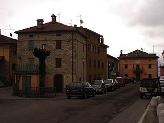
Montiano is a comune (municipality) in the Province of Forlì-Cesena in the Italian region Emilia-Romagna, located about 90 kilometres (56 mi) southeast of Bologna and about 25 kilometres (16 mi) southeast of Forlì. As of 31 December 2004, it had a population of 1,573 and an area of 9.3 square kilometres (3.6 sq mi).

Misano Adriatico is a comune (municipality) in the Province of Rimini in the Italian region Emilia-Romagna, located about 120 kilometres (75 mi) southeast of Bologna and about 14 kilometres (9 mi) southeast of Rimini.