| Foraker River | |
| Country | United States |
|---|---|
| State | Alaska |
| District | Denali Borough |
| Source | Denali National Park and Preserve |
| - location | Foraker Glacier, Alaska Range |
| - elevation | 3,251 ft (991 m) [1] |
| - coordinates | 63°07′43″N151°34′24″W / 63.12861°N 151.57333°W [2] |
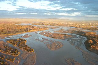
| Mouth | Minchumina Lake [3] |
| - location | near village of Lake Minchumina |
| - elevation | 646 ft (197 m) [2] |
| - coordinates | 63°53′27″N152°05′45″W / 63.89083°N 152.09583°W Coordinates: 63°53′27″N152°05′45″W / 63.89083°N 152.09583°W [2] |
| Length | 60 mi (97 km) [3] |
 Location of the mouth of the Foraker River in Alaska | |
The Foraker River (Lower Tanana : Kwalana or Kotalhno) is a 60-mile (97 km) stream in central Alaska in the United States. [3] It drains an area on the north slope of the Alaska Range on the south edge of the Tanana Valley southwest of Fairbanks. [4] The Herron River is a major tributary. [4]
Lower Tanana is an endangered language spoken in Interior Alaska in the lower Tanana River villages of Minto and Nenana. Of about 380 Tanana people in the two villages, about 30 still speak the language. As of 2010, "Speakers who grew up with Lower Tanana as their first language can be found only in the 250-person village of Minto." It is one of the large family of Athabaskan languages, also known as Dené.

Alaska is a U.S. state in the northwest extremity of North America, just across the Bering Strait from Asia. The Canadian province of British Columbia and territory of Yukon border the state to the east and southeast. Its most extreme western part is Attu Island, and it has a maritime border with Russia to the west across the Bering Strait. To the north are the Chukchi and Beaufort seas—southern parts of the Arctic Ocean. The Pacific Ocean lies to the south and southwest. It is the largest U.S. state by area and the seventh largest subnational division in the world. In addition, it is the 3rd least populous and the most sparsely populated of the 50 United States; nevertheless, it is by far the most populous territory located mostly north of the 60th parallel in North America: its population—estimated at 738,432 by the United States Census Bureau in 2015— is more than quadruple the combined populations of Northern Canada and Greenland. Approximately half of Alaska's residents live within the Anchorage metropolitan area. Alaska's economy is dominated by the fishing, natural gas, and oil industries, resources which it has in abundance. Military bases and tourism are also a significant part of the economy.

The Alaska Range is a relatively narrow, 650-km-long (400 mi) mountain range in the southcentral region of the U.S. state of Alaska, from Lake Clark at its southwest end to the White River in Canada's Yukon Territory in the southeast. The highest mountain in North America, Denali, is in the Alaska Range. It is part of the American Cordillera.
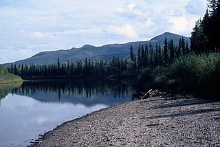
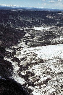
The Foraker River issues from Foraker Glacier in Denali National Park and Preserve, northwest of Mount Foraker. [4] It flows through the tundra to the north of the Alaska range in a generally northwest direction to Minchumina Lake near the village of Lake Minchumina. [4]
Foraker Glacier is a glacier in Denali National Park and Preserve in the U.S. state of Alaska. The glacier begins in the Alaska Range on the north side of Mount Foraker, moving northwest for 15 miles (24 km). It is the source of the Foraker River.

Denali National Park and Preserve is an American national park and preserve located in Interior Alaska, centered on Denali, the highest mountain in North America. The park and contiguous preserve encompass 6,045,153 acres which is larger than the state of New Hampshire. On December 2, 1980, 2,146,580-acre Denali Wilderness was established within the park. Denali's landscape is a mix of forest at the lowest elevations, including deciduous taiga, with tundra at middle elevations, and glaciers, snow, and bare rock at the highest elevations. The longest glacier is the Kahiltna Glacier. Wintertime activities include dog sledding, cross-country skiing, and snowmobiling. The park received 594,660 recreational visitors in 2018.

Mount Foraker is a 17,400-foot (5,304 m) mountain in the central Alaska Range, in Denali National Park, 14 mi (23 km) southwest of Denali. It is the second highest peak in the Alaska Range, and the third highest peak in the United States. It rises almost directly above the standard base camp for Denali, on a fork of the Kahiltna Glacier also near Mount Hunter in the Alaska Range.
The river was named for its glacial source in 1925 by S.R. Capps of the U.S. Geological Survey. Other names or variants include Seyh Khoolanh No' and Gotothna River. [2]