The French Overseas Department of Martinique is a Caribbean island belonging to the Lesser Antilles group in the Caribbean Sea, southeast of Cuba and north of Trinidad and Tobago. It is part of the French West Indies. It lies near the Tropic of Cancer between 14° 26' and 14°53' latitude north and 63° 9' and 63° 34' longitude west. At most some 50 miles long and 22 miles wide, Martinique covers an area of 425 square miles. Its coastline is so indented that no part of the island is more than seven miles from the sea.

Mount Pelée or Mont Pelée, meaning "bald mountain" or "peeled mountain" in French, is an active volcano at the northern end of Martinique, an island and French overseas department in the Lesser Antilles Volcanic Arc of the Caribbean. Its volcanic cone is composed of stratified layers of hardened ash and solidified lava. Its most recent eruption was in 1932.

Antillean Creole is a French-based creole that is primarily spoken in the Lesser Antilles. Its grammar and vocabulary include elements of French, Carib, English, and African languages.

The Carbet Mountains are a massif of volcanic origin on the Caribbean island of Martinique.

Le Lamentin is a city and town, located in the French overseas department and region of Martinique. With its area of 62.32 km2, it is the town with the largest area in Martinique. Le Lamentin, with close to 40,000 inhabitants, is the second most populated town of Martinique, after Fort-de-France. It is also the first industrial town and the heart of the island's economy.

The Lesser Antillean macaw or Guadeloupe macaw is a hypothetical extinct species of macaw that is thought to have been endemic to the Lesser Antillean island region of Guadeloupe. In spite of the absence of conserved specimens, many details about the Lesser Antillean macaw are known from several contemporary accounts, and the bird is the subject of some illustrations. Austin Hobart Clark described the species on the basis of these accounts in 1905. Due to the lack of physical remains, and the possibility that sightings were of macaws from the South American mainland, doubts have been raised about the existence of this species. A phalanx bone from the island of Marie-Galante confirmed the existence of a similar-sized macaw inhabiting the region prior to the arrival of humans and was correlated with the Lesser Antillean macaw in 2015. Later that year, historical sources distinguishing between the red macaws of Guadeloupe and the scarlet macaw of the mainland were identified, further supporting its validity.

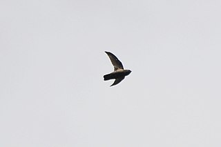
The Lesser Antillean swift is a species a species of bird in subfamily Apodinae of the swift family Apodidae. It is found on Dominica, Guadeloupe, Martinique, Saint Lucia, Saint Vincent, and possibly Nevis.
The Buccament River is a river in the south-west of Saint Vincent. It rises on the western slopes of Grand Bonhomme, flowing west to reach the Caribbean Sea close to the town of Layou.

The Martinique macaw or orange-bellied macaw is a hypothetical extinct species of macaw which may have been endemic to the Lesser Antillean island of Martinique, in the eastern Caribbean Sea. It was scientifically named by Walter Rothschild in 1905, based on a 1630s description of "blue and orange-yellow" macaws by Jacques Bouton. No other evidence of its existence is known, but it may have been identified in contemporary artwork. Some writers have suggested that the birds observed were actually blue-and-yellow macaws. The "red-tailed blue-and-yellow macaw", another species named by Rothschild in 1907 based on a 1658 account, is thought to be identical to the Martinique macaw, if either one ever existed.

Articles related to the French overseas department of Martinique include:

Cauls Pond is a wetland in Anguilla, a British Overseas Territory in the Caribbean Sea. It is one of the territory's Important Bird Areas (IBAs).

West End Pond is a wetland in Anguilla, a British Overseas Territory in the Caribbean Sea. It is one of the territory's Important Bird Areas (IBAs).

The Merrywing Pond System is a golf course wetland system in Anguilla, a British Overseas Territory in the Caribbean Sea. It forms one of the territory's Important Bird Areas (IBAs).

Forest Bay Pond is a small wetland in Anguilla, a British Overseas Territory in the Caribbean Sea. It forms one of the territory's Important Bird Areas (IBAs).

The Northern Forested Ghauts constitute a tract of land on the island of Montserrat, a British Overseas Territory in the Leeward Islands of the Caribbean Sea. It forms one of the territory's Important Bird Areas (IBAs).

Île Frégate is a small, uninhabited island in the Caribbean Sea located off the north coast of Saint Barthélemy, an overseas collectivity of France. Île Frégate is situated within the Nature Reserve of Saint Bartholomew, which was established in 1996 with the objective of conserving coral reefs, sea grass beds and marine life.

Cas Cay is a fifty-acre (200,000-square-metre) undeveloped island, situated a mile south of Red Hook on the eastern side of Saint Thomas in the United States Virgin Islands. It is under the protection of the Department of Natural Resources. Ferries here depart from Compass Point Marina, right east of Nadir.

The Quill/Boven National Park comprises two separated sections of protected land at opposite ends of the island of Sint Eustatius in the Dutch Caribbean, maintained by the St. Eustatius National Parks Foundation (STENAPA). Both parts of the park have been identified by BirdLife International as Important Bird Areas (IBAs) because they support populations of several threatened or restricted-range bird species.

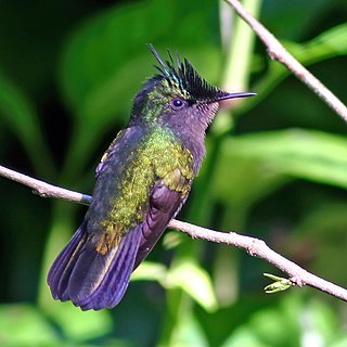
Fresh Pond is a 14 ha water body in Sint Maarten on the island of Saint Martin. It has been identified as an Important Bird Area by BirdLife International because it supports populations of various threatened or restricted-range bird species. Some 2.5 km long by 1 km across, it lies within the capital city of Philipsburg. Because of its low salinity, it supports species which are less common in other parts of the island. The pond is bordered with reeds, mangroves and coconut palms. American coots have been recorded breeding at the site, as well as snowy egrets, pied-billed grebes, common moorhens, great egrets, white-cheeked pintails and ruddy ducks. Other birds for which the IBA was designated include green-throated caribs, Antillean crested hummingbirds, Caribbean elaenias, pearly-eyed thrashers and lesser Antillean bullfinches.

Little Bay is an 8-hectare (20-acre) coastal pond in the country of Sint Maarten on the island of Saint Martin in the Dutch Caribbean. It has a low salinity and lies near the capital, Philipsburg. It has been identified as an Important Bird Area by BirdLife International because it supports threatened or restricted-range bird species. Birds for which the IBA was designated include green-throated caribs, Antillean crested hummingbirds, Caribbean elaenias, pearly-eyed thrashers and lesser Antillean bullfinches. Pied-billed grebes, common moorhens, American coots, white-cheeked pintails and ruddy ducks have been recorded nesting at the site.


