Fort Clarke, Florida

Last updated

Historic marker and Forte Clarke Church Fort Clarke, Florida.jpg
Historic marker and Forte Clarke Church

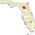
Fort Clarke was an unincorporated community in central Alachua County. The fort established was by the US Army during the Second Seminole War. A historical marker commemorates the fort, which was abandoned by the US Army in 1840. In 1841, 16 citizens voted at Fort Clarke on adopting a proposed constitution for Florida. In May 1845, the community was a precinct at which seven residents voted in the election of the state governor and legislators, and the representative to the US House of Representatives, after Florida was admitted to the union as a state. A post office was established in 1846 and closed in 1858. In 1883, John Bevill, who was described as the model farmer of Alachua County, had over 1,000 acres (400 ha) in cultivation at Fort Clarke. Two churches, the Fort Clarke United Methodist Church and the Greater Fort Clarke Missionary Baptist Church, are currently located in the vicinity of the former site of the fort. The site is now part of the urbanized area west of Gainesville. [1] [2] [3] [4] [5] [6]

Related Research Articles

<span class="mw-page-title-main">Alachua County, Florida</span> County in Florida, United States

Alachua County is a county in the north central portion of the U.S. state of Florida. As of the 2020 census, the population was 278,468. The county seat is Gainesville, the home of the University of Florida since 1906, when the campus opened with 106 students.

<span class="mw-page-title-main">Alachua, Florida</span> City in Florida, United States

Alachua is the second-largest city in Alachua County, Florida and the third-largest in North Central Florida. According to the 2020 census, the city's population was 10,574. The city is part of the Gainesville metropolitan area, which had a population of 339,247 in 2020.

<span class="mw-page-title-main">Gainesville, Florida</span> City in Florida, United States

Gainesville is the county seat of Alachua County, Florida, and the largest city in North Central Florida, with a population of 141,085 in 2020. It is the principal city of the Gainesville metropolitan area, which had a population of 339,247 in 2020.

<span class="mw-page-title-main">Hawthorne, Florida</span> City in Florida, United States

Hawthorne is a city in Alachua County, Florida, United States, incorporated in 1881. Indigenous peoples of the Americas had been living in the area since around 100 CE; Hawthorne grew around their trading trails. Throughout its history, Hawthorne has been known for its agriculture, railroad, and rural lifestyle. Hawthorne's population was 1,478 at the 2020 census, with an area of 7.38 sq mi (19.1 km2).

<span class="mw-page-title-main">Micanopy, Florida</span> Town in the state of Florida, United States

Micanopy is a town in Alachua County, Florida, United States, located south of Gainesville. The population as of the 2010 census was 600. The oldest community in the interior of Florida that has been continually inhabited, it has a downtown that is designated as the Micanopy Historic District and listed on the National Register of Historic Places. It contains a number of antique stores, as well as several restaurants, a library, firehouse, and post office. The town's unofficial slogan is "The Town that Time Forgot."

<span class="mw-page-title-main">Alachua County Public Schools</span> Public school district in Florida, US

Alachua County Public Schools is a public school district serving Alachua County in North Central Florida. It serves approximately 29,845 students in 64 schools and centers.

<span class="mw-page-title-main">Newnansville, Florida</span> United States historic place

Newnansville, Florida was one of the first American settlements in the interior of Florida. It became the second county seat of Alachua County in 1828, and one of the central locations for activity during the Second Seminole War, during which time it was one of the largest cities in the State. In the 1850s, the Florida Railroad bypassed Newnansville, resulting in the county seat being moved to the new town of Gainesville in 1854. Consequently, Newnansville began to decline, and when a second railway bypassed the town in 1884, most of its residents relocated and formed the new City of Alachua. By 1900, Newnansville was deserted.

<span class="mw-page-title-main">Evinston, Florida</span>

Evinston is an unincorporated community in Alachua and Marion counties, Florida, United States.

<span class="mw-page-title-main">Rochelle, Florida</span>

Rochelle is an unincorporated community in Alachua County, Florida, United States. It was found in the 1830s on a former native settlement and mission site. and was built around the Plantation of Madison Starke Perry.

<span class="mw-page-title-main">Bellamy Road</span> Improved 19th century road in Florida, USA

The Bellamy Road was the first major U.S. federal highway in early territorial Florida.

<span class="mw-page-title-main">Hogtown, Florida</span> Former human settlement in Florida, US

Hogtown was a 19th-century settlement in and around what is now Westside Park in Gainesville, Florida, United States where a historical marker notes Hogtown's location at that site and is the eponymous outpost of the adjacent Hogtown Creek. Originally a village of Seminoles who raised hogs, the habitation was dubbed "Hogtown" by nearby white people who traded with the Seminoles. Indian artifacts were found at Glen Springs, which empties into Hogtown Creek.

<span class="mw-page-title-main">Hague, Florida</span>

Hague is an unincorporated community in Alachua County, Florida, United States. It is located on Alachua County Road 237 between U.S. Route 441 and the Deerhaven Subdivision line of the CSX Railroad, between the cities of Alachua and Gainesville.

<span class="mw-page-title-main">Campville, Florida</span> Human settlement in Florida, US

Campville is a community in eastern Alachua County, Florida, north of Hawthorne. The community grew up along the route of the Florida Transit and Peninsular Railroad, with a sawmill, a store, a church, a school and a score of homes in the area when a post office was established in 1881. It was named for three brothers by the name of Camp who ran a large sawmill in the area. The population was about 300 in 1928, when a brick factory, several tree nurseries, and four stores were located in the community. The brick factory was also founded by the Camp brothers and bricks produced there can be seen in Gainesville's old downtown buildings. The bricks are a tan buff color. The post office was closed in 1966.

<span class="mw-page-title-main">Fairbanks, Florida</span> Populated place in Florida, US

Fairbanks is an unincorporated community in Alachua County, Florida, United States. It is located along Florida State Road 24 between Gainesville and Waldo.

Grove Park is an unincorporated community in Alachua County, Florida, United States, on Florida State Road 20 west of Hawthorne.

Paradise was an unincorporated community in Alachua County, Florida, United States. It has been annexed into the city of Gainesville, and is located approximately where Alachua County Road 232 crosses U.S. Route 441.

<span class="mw-page-title-main">Rutledge, Florida</span> Unincorporated community in Alachua County, Florida

Rutledge, Florida is an unincorporated community in central Alachua County, Florida. The community was established for formerly enslaved persons during Reconstruction by the Freedmen's Bureau. The First Morning Star Missionary Baptist Church and the Greater Liberty Hill United Methodist Church, both founded in the 19th century, continue to serve the community. The Greater Liberty Hill church is the site of the Liberty Hill Schoolhouse, which is on the National Register of Historic Places. The Rutledge Community Cemetery, formerly called Union Cemetery of Rutledge, is under the stewardship of the Second Morning Star Missionary Baptist Church. The center of the community was located about five miles west of Gainesville, Florida in the 19th century. As of 2021 it extends from just west of the Gainesville city limits to I-75. A post office was established in 1886, and closed in 1905. In 1888 the community had three stores and a boarding house. It was on the planned route of the Gainesville, Tallahassee and Western Railroad, which was never built.

Gordon is a community in northern Alachua County, Florida.

<span class="mw-page-title-main">Flora, Florida</span> Unincorporated community in Alachua County

Flora was a community just northeast of the city of Gainesville, in Alachua County, in the late 19th century. A former colonel in the Union Army, Louis A. Barnes, who had served as sheriff and tax collector for the county, and registrar for the U.S Land Office, laid out a 2,000-acre (810 ha) subdivision between the Florida Transit and Peninsular Railroad and the Live Oak, Tampa and Charlotte Harbor Railroad north of the Gainesville city limits. In 1883, five-acre (2.0 ha) lots were being sold for fruit and vegetable farming. A post office was opened in 1895 and closed in 1896. The community was annexed into the city of Gainesville, beginning in 1905.

<span class="mw-page-title-main">Historic communities of Alachua County</span> Aspect of history

The historic communities of Alachua County were populated places and/or places with a post office that were established in the 19th century or early 20th century in what is now Alachua County, Florida, but which were abandoned, annexed into an incorporated municipality, or had a much reduced population by the later part of the 20th century.

References

  1. "Fort Clarke Marker, Gainesville, Florida". University of Florida Digital Commons. Retrieved June 20, 2021.
  2. Dibble, Earnest F. (Fall 1999). "Giveaway Forts: Territorial Forts and the Settlement of Florida". The Florida Historical Quarterly. 78 (2): 220. JSTOR   30149384.
  3. "Fort Clark (Alachua County)". Florida Memory: State Library and Archives of Florida. Retrieved June 21, 2021.
  4. Bradbury, Alford G.; Hallock, E. Story (1962). A chronology of Florida post offices. Florida Federation of Stamp Clubs. p. 30.
  5. Webber, Carl (1883). The Eden of the South. New York. p. 91.{{cite book}}: CS1 maint: location missing publisher (link)
  6. "Feature query results for Fort Clarke". USGS GNIS. Retrieved June 20, 2021.

29°39′35″N82°26′22″W / 29.65974722°N 82.43949167°W / 29.65974722; -82.43949167