Related Research Articles

The Mojave River is an intermittent river in the eastern San Bernardino Mountains and the Mojave Desert in San Bernardino County, California, United States. Most of its flow is underground, while its surface channels remain dry most of the time, except for the headwaters and several bedrock gorges in the lower reaches.

The Fort Mohave Indian Reservation is an Indian reservation along the Colorado River, currently encompassing 23,669 acres (95.79 km2) in Arizona, 12,633 acres (51.12 km2) in California, and 5,582 acres (22.59 km2) in Nevada. The reservation is home to approximately 1,100 members of the federally recognized Fort Mojave Indian Tribe of Arizona, California, and Nevada, a federally recognized tribe of Mohave people.

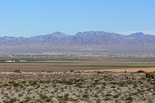
The Mohave Valley is a valley located mostly on the east shore of the south-flowing Colorado River in northwest Arizona. The valley extends into California's San Bernardino County; the northern side of the valley extends into extreme southeast Clark County, Nevada. The main part of the valley lies in southwest Mohave County, Arizona and is at the intersection of the southeast Mojave and northwest Sonoran deserts.
The United States Camel Corps was a mid-19th-century experiment by the United States Army in using camels as pack animals in the Southwestern United States. Although the camels proved to be hardy and well suited to travel through the region, the Army declined to adopt them for military use. The Civil War interfered with the experiment, which was eventually abandoned; the animals were sold at auction.

The Hualapai is a federally recognized Native American tribe in Arizona with about 2300 enrolled members. Approximately 1353 enrolled members reside on the Hualapai Reservation, which spans over three counties in Northern Arizona.

The Piute Range is located in the Mojave Desert, primarily in northeast San Bernardino County, California, United States, with a north portion in Nevada. Most of the range is the eastern border of the Mojave National Preserve, a National Park Service natural area and park.

Lanfair Valley is located in the Mojave Desert in southeastern California near the Nevada state line. It is bounded on the north by the New York Mountains and Castle Mountains, on the east by the Piute Range, and on the south by the Woods Mountains and Vontrigger Hills. Joshua Trees can be found in most of the valley. Elevation is 4,045 feet.

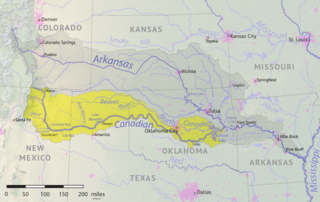
The Beaver River is an intermittent river, 280 miles (450 km) long, in western Oklahoma and northern Texas in the United States. It is a tributary of the North Canadian River, draining an area of 11,690 square miles (30,300 km2) in a watershed that extends to northeastern New Mexico and includes most of the Oklahoma Panhandle.

The Mojave Road, also known as Old Government Road, is a historic route and present day dirt road across what is now the Mojave National Preserve in the Mojave Desert in the United States. This rough road stretched 147 miles (237 km) from Beale's Crossing, to Fork of the Road location along the north bank of the Mojave River where the old Mojave Road split off from the route of the Old Spanish Trail/Mormon Road.

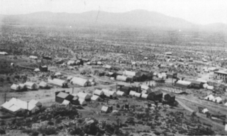
Ivanpah was a short-lived silver mining town located in San Bernardino County, California, United States. It was founded in 1869 and existed until at least the mid-1880s.
The District of Southern California was a nineteenth century district of Department of the Pacific, a command of the United States Army.

Fort Mohave was originally named Camp Colorado when it was established on April 19, 1859 by Lieutenant Colonel William Hoffman during the Mohave War. It was located on the east bank of the Colorado River, at Beale's Crossing, near the head of the Mohave Valley in Mohave County, Arizona by the recommendation of Lieutenant Edward Fitzgerald Beale. After the end of the Indian Wars, the fort was transferred to the Bureau of Indian Affairs in 1890. In 1935 it was transferred to the Fort Mojave Indian Reservation; the fort is administered by the state of Arizona.

The Department of California was an administrative department of the United States Army. The Department was created in 1858, replacing the original Department of the Pacific, and it was ended by the reorganizations of the Henry L. Stimson Plan implemented in February 1913. As with the preceding organization, headquarters were in San Francisco. Its creation was authorized by General Orders, No. 10, of the War Department, Adjutant-General's Office, September 13, 1858.

In 1857, an expedition led by Edward Fitzgerald Beale was tasked with establishing a trade route along the 35th parallel from Fort Smith, Arkansas to Los Angeles, California.
Hualapai Valley is a valley in Mohave County, Arizona.
Bitter Spring is a spring within the Fort Irwin National Training Center in San Bernardino County, California. It lies at an elevation of 1355 feet and is located in a valley between the Soda Mountains to the east, the Tiefort Mountains to the northwest, Alvord Mountain to the southwest and Cronese Mountains to the south and southeast.

The Mohave Trail was a Native American trade route between Mohave Indian villages on the Colorado River and settlements in coastal Southern California.
Beale's Crossing was a river crossing on the Colorado River, near the head of the Mohave Valley, between New Mexico Territory and California along the 35th Parallel route of Beale's Wagon Road. It was at what became the site of Fort Mohave in what is now Fort Mohave, Arizona, west of Beaver Lake, Nevada. It was named for Edward Fitzgerald Beale, who lead the expedition that built what came to be called Beale's Wagon Road from Albuquerque, New Mexico to Beale's Crossing in California, then by way of the Mohave Trail/Old Spanish Trail, and another old route west from the Mojave River to Fort Tejon, California.
Piute Spring is a spring in a canyon in the Piute Range of San Bernardino County, California. It lies an elevation 3,025 feet / 922 meters at the head of Piute Creek. Piute Creek runs from Piute Spring down a canyon through the Piute Range east then northeast downstream to where its waters sink into the sands of a wash near the ruins of Fort Piute. From there that wash turns east widening into an alluvial fan of braided washes that terminate in Piute Wash in the middle of Piute Valley.

The Mojave Road Los Angeles was designated a California Historic Landmark on March 19, 1985. It runs from Drum Barracks in Los Angeles County to the Colorado River in San Bernardino County, California
References
- 1 2 Historic California Posts, Camps, Stations and Airfields: Fort Piute (Fort Beale, Fort Piute Hill) from militarymuseum.org accessed May 13, 2016
- ↑ U.S. Geological Survey Geographic Names Information System: Fort Piute (historical)
Coordinates: 35°06′54″N114°59′07″W / 35.11500°N 114.98528°W