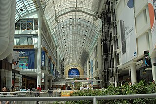
A shopping center or shopping centre, also called a shopping complex, shopping arcade, shopping plaza or galleria, is a group of shops built together, sometimes under one roof.

Taliparamba is a Municipality in Taliparamba taluk of Kannur district, Kerala, India. The municipal town spreads over an area of 18.96 square kilometres (7.32 sq mi) and is inhabited by 44,247 number of people.

Iritty is a Municipality and a Taluk of Kannur district in Kerala State, India. The town is the main market place for the farmer communities in the surrounding regions. Iritty is known as The Coorg Valley in God's Own Country. Iritty is one of the fastest upcoming towns in Kerala with the distance of 20 km (12 mi) from Kannur International Airport and one among five taluks in Kannur district. Iritty is one of the major towns lies between Coorg and Kannur international airport -Mattanur.

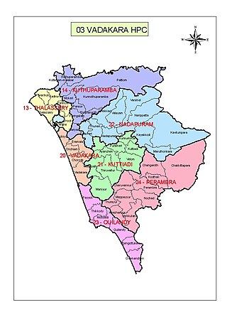
Vatakara, also spelled Vadakara, IPA: [ʋɐɖɐgɐɾɐ], French: Bargaret, is a Municipality in the state of Kerala, India. Vatakara is located between Kannur and Kozhikode. The municipality of Vatakara covers an area of 23.33 km2 (9.01 sq mi) and is bordered by Mahé to the north and Payyoli to the south. It is the headquarters of Vatakara taluk, which consists of 22 panchayats. During the reign of the Kolathiris and Zamorins, Vatakara was known as Kadathanadu. During the British Raj, it was part of the North Malabar region of Malabar District in the state of Madras. The historic Lokanarkavu temple, made famous by the Vadakkan Pattukal, is situated in Vatakara. A new tardigrade species collected from Vadakara coast has been named after Kerala State; Stygarctus keralensis.

Payyanur, IPA: [pɐjːɐn̺ːuːɾ], is a municipal town and a taluk, a sub-district administrative unit, in the Kannur district of Kerala, India. On 10 March 2018, Kerala Chief Minister Pinarayi Vijayan inaugurated Payyanur as the fifth taluk in the district. Payyanur taluk comprises 22 villages including 16 de-linked from the Taliparamba taluk and six from the Kannur taluk. The town is situated on the banks of the Perumba River.

Valapattanam is a census town in the Kannur district, located in the Indian state of Kerala. It is also the smallest panchayat in Kerala. Its area is 2.04 sqr Km. It is about 7 km north of Kannur. Valapattanam is known for its communal harmony. On one side Kalarivathukkal Temple is located and on the other bank there is "Kakkulangara Mosque".

Palakkad, formerly known as Palghat, historically known as Palakkattussery is a city and municipality in the Indian state of Kerala. It is the administrative headquarters of the Palakkad District. Palakkad is most densely populated municipality and fourth densely populated city in Kerala. It was established before Indian independence under British rule and was known by the name Palghat. Palakkad is famous for the ancient Palakkad Fort, which is situated at the heart of the city and was captured and rebuilt by Hyder Ali in 1766. The city is situated about 347 kilometres (216 mi) northeast of the state capital Thiruvananthapuram.

Kankurgachi is a neighbourhood of northeast Kolkata, in Kolkata district, West Bengal, India. With a cosmopolitan crowd and several commercial buildings and restaurants, Kankurgachi is considered one of the upmarket and elite places in Kolkata. Kankurgachi has become a very important part of Kolkata for its excellent connectivity and infrastructure. Kolkata Airport, Bidhannagar Road railway station, Salt Lake and New Town are close to Kankurgachi.

Al Souk Al Kabir, also referred to as Souk Al Kabir or Meena Bazaar, is a community in Dubai, United Arab Emirates (UAE). Al Souk Al Kabir is located in the area of Bur Dubai and is one of the oldest residential areas in the city with a predominantly South Asian population, restaurants and shops. The locality, referred to as Meena Bazaar by the local Pakistani and Indian community, also encompasses the historic Al Bastakiya district of Dubai.

George Town is a neighbourhood in Chennai, Tamil Nadu, India. It is near the Fort Saint George, Chennai. It is also known as Muthialpet and Parry's corner. It is an historical area of Chennai city from where its expansion began in the 1640s. It extends from the Bay of Bengal in the east to Park town on the west. The Fort St. George is on the south, to Royapuram in the north. The Fort St. George houses the Tamil Nadu Legislative Assembly and the Secretariat. The High court of Tamil Nadu at Chennai, Dr. Ambedkar Law College, Stanley Medical College and Hospital are located here.

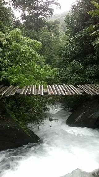
Chemperi is a town on the bank of the Chemperi River, in the Western Ghat, in the Kannur district of South India. Chemperi is often referred as the education city of Kannur with the establishment of Vimal Jyothi Engineering College, Chemperi. It is characterized by its production and export of rubber and spices, its beautiful hillocks, and its serene streams. Village and Panchayath of Chemperi is Eruvessi. Both Panchayath and Village offices of Eruvessi are located in Chemperi. Also Lourde Matha Forane Church, Chemperi is another attraction.Paithalmala and Palakkayam thatt is also a few kilometres away from here.
Redditch is a town and local government district in north-east Worcestershire, England. The town is divided into separate districts. All street-name signs in Redditch have the street name in white lettering on a blue background and the district name in black lettering on a white background at the bottom of the sign. In the New Town areas the roads are usually named in alphabetical order and house numbering in the cul-de-sac closes is consecutive, starting with number 1 as the first house on the left as you enter, and the highest house number will be on the opposite side of the road as you leave.

Alakode is an emerging town in Kannur district in the Indian state of Kerala. It is located 46 km (29 mi) North of District headquarters Kannur. Alakode is located on Taliparamba-Manakadavu-Coorg Road. Alakode was one of the major centers of Malabar Migration.
There are places of worship considered important in the Kannur district. Kannur District is one of the 14 districts in the state of Kerala, India. The town of Kannur is the district headquarters, and gives the district its name.

The city centre is the prominent central business district of Sector 4, Bokaro Steel City, Jharkhand, India. It is a CBD and one of the most developed and planned CBD in Jharkhand and Eastern India Recent years have seen it grow more than threefold in size. The difference of this market and most other major markets in Indian cities happens to be the planning of the market. There is ample parking space, and the approach roads, as well as those inside the market are wide. The place houses almost all major Indian banks, has various shops in the city for clothing, electronics, and the best food joints.

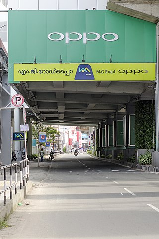
Mahatma Gandhi Road, popularly known as M. G. Road, is the main artery as well as the commercial high street of the city of Kochi, in the state of Kerala, India. The road lies north-south with its boundaries at the Venduruthy bridge, Thevara in the south, and the Madhava Pharmacy Junction in the north, where it intersects the Banerji Road. The road was earlier part of the NH 47A and was later handed over to Kochi Municipal Corporation. The highway was earlier known as Seventy Feet road. The total distance of the road is 4.5 kilometres (2.8 mi).

China Bazaar Road, officially Netaji Subash Chandra Bose Road, is one of the main thoroughfares of the commercial centre of George Town in Chennai, India. The road connects Rajaji Salai in the east with Wall Tax Road in the west. Passing through thickly populated residential areas of the historical neighbourhood, the road has several streets, lanes, and by lanes joining it housing several commercial establishments of the city.
Kannur, India has a number of tourist attractions including beaches, hills, temples and other monuments.
Kozhikode is one of the main commercial cities of Kerala. The economy is mainly business oriented. The city currently is the major trade hub of North Kerala with good connectivity through road, rail and air. It also has large timber yards along the banks of the Kallayi River. Kozhikode District, with 8% of the state population, makes 12% contribution to the state's income. Nedungadi Bank, the first and oldest bank in the modern state of Kerala, was established by Appu Nedungadi at Kozhikode in the year 1899.


