
The Snoqualmie River is a 45-mile (72 km) long river in King County and Snohomish County in the U.S. state of Washington. The river's three main tributaries are the North, Middle, and South Forks, which drain the west side of the Cascade Mountains near the town of North Bend and join near the town of Snoqualmie just above the Snoqualmie Falls. After the falls the river flows north through rich farmland and the towns of Fall City, Carnation, and Duvall before meeting the Skykomish River to form the Snohomish River near Monroe. The Snohomish River empties into Puget Sound at Everett. Other tributaries of the Snoqualmie River include the Taylor River and the Pratt River, both of which enter the Middle Fork, the Tolt River, which joins at Carnation, and the Raging River at Fall City.

The White River is a white, glacial river in the U.S. state of Washington. It flows about 75 miles (121 km) from its source, the Emmons Glacier on Mount Rainier, to join the Puyallup River at Sumner. It defines part of the boundary between King and Pierce counties.

The Hood River, formerly known as Dog River, is a tributary of the Columbia River in northwestern Oregon in the United States. Approximately 25 miles (40 km) long from its mouth to its farthest headwaters on the East Fork, the river descends from wilderness areas in the Cascade Range on Mount Hood and flows through the agricultural Hood River Valley to join the Columbia River in the Columbia River Gorge.

The Nooksack River is a river in the northwest part of the U.S. state of Washington. It drains an area of the Cascade Range around Mount Baker, near the Canada–US border. The lower river flows through a fertile agricultural area before emptying into Bellingham Bay and, via the Strait of Juan de Fuca and the Strait of Georgia, the Pacific Ocean. The river begins in three main forks, the North Fork, Middle Fork, and South Fork. The North Fork is sometimes considered the main river. Including the North Fork, the Nooksack is approximately 75 miles (121 km) long. All three forks originate in the Mount Baker Wilderness.

The Feather River is the principal tributary of the Sacramento River, in the Sacramento Valley of Northern California. The river's main stem is about 73 miles (117 km) long. Its length to its most distant headwater tributary is just over 210 miles (340 km). The main stem Feather River begins in Lake Oroville, where its four long tributary forks join together—the South Fork, Middle Fork, North Fork, and West Branch Feather Rivers. These and other tributaries drain part of the northern Sierra Nevada, and the extreme southern Cascades, as well as a small portion of the Sacramento Valley. The total drainage basin is about 6,200 square miles (16,000 km2), with approximately 3,604 square miles (9,330 km2) above Lake Oroville.

The Sauk River is a tributary of the Skagit River, approximately 45 miles (72 km) long, in northwestern Washington in the United States. It drains an area of the high Cascade Range in the watershed of Puget Sound north of Seattle. The river is a popular destination for fly fishing. It is a National Wild and Scenic River.
The Breitenbush River is a tributary of the North Santiam River in western Oregon in the United States. It drains a rugged, forested area of the Cascade Range east of Salem.

The Skykomish River is a 29-mile (47 km) long river in the U.S. state of Washington which drains the west side of the Cascade Mountains in the southeast section of Snohomish County and the northeast corner of King County. The river starts with the confluence of the North Fork Skykomish River and South Fork Skykomish River approximately one mile west of Index, then flowing northwesterly towards Puget Sound. It is joined by the Sultan River and the Wallace River at Sultan. It then meets the Snoqualmie River to form the Snohomish River at Monroe. The Snohomish River continues along the river valley eventually dumping into Port Gardner Bay on Possession Sound.

The Skokomish River is a river in Mason County, Washington, United States. It is the largest river flowing into Hood Canal, a western arm of Puget Sound. From its source at the confluence of the North and South Forks the main stem Skokomish River is approximately 9 miles (14 km) long. The longer South Fork Skokomish River is 40 miles (64 km), making the length of the whole river via its longest tributary about 49 miles (79 km). The North Fork Skokomish River is approximately 34 miles (55 km) long. A significant part of the Skokomish River's watershed is within Olympic National Forest and Olympic National Park.

The Cispus River is about 54 miles (87 km) long and flows into the Cowlitz River at Lake Scanewa in the Cascade Range of Washington. Its tributaries drain most of south-central and southeastern Lewis County, extreme northeast Skamania County, and some of western Yakima County.

The Entiat River is a tributary of the Columbia River, joining the Columbia near Entiat. The United States Geological Survey (USGS) lists two variant names for the Entiat River: En-ti-at-kwa River and Entiatqua River. The river's name is derived from the Columbia-Moses (Salishan) term /nt'yátkw/ [nt'iátkw], meaning "place of grassy water"; another source states that it was called Enteatqua which means "Rapid Water" or "Rushing Water." The name, spelled "Entiat", was selected for the river in 1958 by the Chelan County Public Utility District.
The Naches River is a tributary of the Yakima River in central Washington in the United States. Beginning as the Little Naches River, it is about 75 miles (121 km) long. After the confluence of the Little Naches and Bumping River the name becomes simply the Naches River. The Naches and its tributaries drain a portion of the eastern side of the Cascade Range, east of Mount Rainier and northeast of Mount Adams. In terms of discharge, the Naches River is the largest tributary of the Yakima River.

The Tieton River is a tributary of the Naches River, in Yakima County, Washington in the United States.

The Sol Duc River is a river in the U.S. state of Washington. About 78 miles (126 km) long, it flows west through the northwest part of the Olympic Peninsula, from the Olympic Mountains of Olympic National Park and Olympic National Forest, then through the broad Sol Duc Valley. Near the Pacific Ocean the Sol Duc River joins the Bogachiel River, forming the Quillayute River, which flows about 4 miles (6.4 km) to the Pacific Ocean at La Push. Although the Quillayute River is short, its large tributary rivers—the Sol Duc, Bogachiel, Calawah, and Dickey Rivers—drain the largest watershed of the northern Olympic Peninsula, 629 square miles (1,630 km2). The Sol Duc's watershed is the largest of the Quillayute's tributaries, at 219 square miles (570 km2).

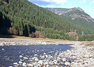
The Sultan River is a river in Snohomish County in the U.S. state of Washington. It is a tributary of the Skykomish River, which it joins at the town of Sultan, Washington. The river is dammed in its upper third by Culmback Dam to form Spada Lake.
The Miller River is a river in King County, Washington. Named for 1890s prospector John Miller, it is a tributary of the Skykomish River, which it joins near the community of Miller River. The Miller River is about 3.5 miles (5.6 km) long from the confluence of its main tributaries, the East Fork and West Fork. Miller River Campground is located just downriver from the confluence.
The Tye River is a river in the U.S. state of Washington. It rises near Stevens Pass in the Cascade Mountains and flows west, joining the Foss River to form the South Fork Skykomish River. Its waters eventually empty into Puget Sound near Everett via the Skykomish River and Snohomish River. U.S. Route 2 follows the river's entire length. A BNSF Railway line follows most of the river except near the pass where the tracks use the Cascade Tunnel. Powerlines run by the Bonneville Power Administration (BPA) follow the Tye River west of Tunnel Creek.

The Beckler River is a tributary of the South Fork Skykomish River in the U.S. state of Washington in the United States.
The Rapid River is a tributary of the Beckler River in the U.S. state of Washington in the United States. It is 13 miles (21 km) long, with a drainage basin of 41 square miles (106 km2).

The Dickey River is a stream on the Olympic Peninsula in the U.S. state of Washington. It has three main forks, the East Fork, West Fork, and Middle Fork Dickey Rivers. The main stem is formed by the confluence of the East and West Forks. The river and its forks rise in the northwestern part of the Olympic Peninsula and flow generally south and west to join the Quillayute River near its mouth on the Pacific Ocean.

