
Filgrave is a hamlet in the Borough of Milton Keynes, Buckinghamshire, England. It is about three miles north of Newport Pagnell.

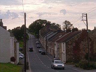
Craghead is a former mining village in County Durham, England. It is located at the bottom of the valley to the south of Stanley, on the main road between Stanley and Durham, and not far from the village of Edmondsley.
Aislaby ) is a small village and civil parish on the north bank of the River Tees within the borough of Stockton-on-Tees and the ceremonial county of County Durham, England. It is located to the west of Eaglescliffe and Yarm. The name, first attested as Asulue(s)bi in 1086, is of Viking origin and means "Aslak's farm." Aislaby was listed in the Domesday Book of 1086.
Killerby is a village in the borough of Darlington and the ceremonial county of County Durham, England. It is situated a few miles to the west of Darlington. At the 2011 Census the population was less than 100. Details are maintained in the parish of Staindrop.

Cornsay is a hamlet and civil parish in County Durham, England. The population of the Civil Parish taken at the 2011 census was 1,128. It is 6 miles (9.7 km) southeast of Consett and 7 miles (11 km) southwest of Durham. It consists of nineteen dwellings, including four farms & is the home of Greenacres nudist club. All formerly belonged to Ushaw College for the training of Catholic priests, hence the organised nomenclature. East and West Farms are now in private hands as homes but the other two are still active, South Farm run by the Suddes family and North Farm by the Tweddle family.

Bowlees is a small village in County Durham, England. It is situated near Newbiggin, on the other side of Teesdale from Holwick.

Ingleton is a village and civil parish in County Durham, England. The population of the parish as taken at the 2011 census was 420. It is situated about eight miles to the west of Darlington, and a short distance from the villages of Langton, Hilton and Killerby. The Church of St John the Evangelist in Ingleton was built in 1843 by Ignatius Bonomi and J.A. Cory., and is a Grade II listed building.

Houghton-le-Side is a small village in the borough of Darlington and the ceremonial county of County Durham, England. It is situated a few miles to the south-west of Newton Aycliffe. The population at the 2011 Census was less than 100. Details are now maintained within the parish of Walworth.
Hummersknott is an area in the western end of Darlington, County Durham England. It is a ward in the unitary authority of Darlington. It consists of mainly post-war houses, and is closely linked to Mowden. The population of the ward taken at the 2011 Census was 3,478.
Monk Hesleden is a village in County Durham, England. The population of the parish at the 2011 Census was 5,722. It is situated a short distance to the south of High Hesleden, to the north-west of Hartlepool.
Morley is a village in County Durham, England. It is situated five miles to the west of Bishop Auckland. Morley is first mentioned in 1295, already with its present spelling; its coal mine was mentioned, as Morleypitte already in c. 1440. The name probably means "open ground by a moor", from Old English mōr "moor, clearing, pasture" + lẽah "open ground, clearing".
Morton Tinmouth is a hamlet of a few farms in County Durham, England. It is situated a few miles to the north-west of Darlington close to the village of Bolam.
Woodside is a village in County Durham, England. It is situated 2 miles (3 km) to the west of Bishop Auckland. In the 2001 census Woodside had a population of 153.
Hamsterley is a village in County Durham, England. It is situated to the north of Consett and borders the hamlet of Low Westwood.
Great Stainton is a village in the borough of Darlington and ceremonial county of County Durham, England. It is situated to the north of Darlington, and to the west of Stockton-on-Tees. Elstob is a hamlet, just north of Great Stainton, which is part of the Parish of Great Stainton. The population as taken at the Census 2011 was less than 100. Details are now maintained in the parish of Little Stainton.

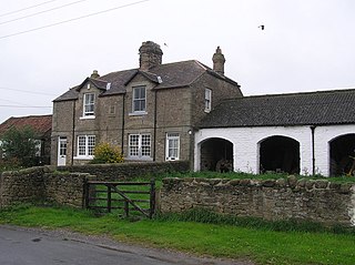
Headlam is a village in the borough of Darlington and the ceremonial county of County Durham, England. It lies to the west of Darlington. The population taken at the 2011 Census was less than 100. Details are included in the parish of Ingleton. The hamlet has 14 stone houses plus 17th-century Headlam Hall, now a country house hotel. The village is set around a village green with a medieval cattle-pound and an old stone packhorse bridge across the beck. Headlam is classed as Lower Teesdale and has views to the south as far as Richmond and to the Cleveland Hills in the east.
Croxdale and Hett is a civil parish in County Durham, England. It is situated approximately four miles south of Durham. The population of the civil parish as taken at the 2011 census was 866.

Fiddleford is a hamlet in the county of Dorset in southern England. Fiddleford is situated between Sturminster Newton and Okeford Fitzpaine in the North Dorset administrative district. It was founded by an English nobleman named Fitela, and the aforementioned ford is over the River Stour.
Ferrensby is a village and civil parish in the Harrogate district of North Yorkshire, England. The population of the civil parish at the 2011 census was 187. It is about 3 miles (4.8 km) north-east of Knaresborough and near the A1(M) motorway. Nearby attractions include a balloon centre and a maze.

Dacre Beck is a small river in Cumbria, England.
