
Tacuarembó is the capital city of the Tacuarembó Department in north-central Uruguay.

Melo is the capital city of the Cerro Largo Department of north-eastern Uruguay. As of the census of 2011, it is the ninth most populated city of the country.

Cerro Largo Department is a department of Uruguay. Its capital is Melo. It is located in the east of the country, bordering Brazil to its northeast with Yaguaron River as the natural border, Treinta y Tres Department to its south, Durazno Department to its west and the departments of Tacuarembó and Rivera to its northwest with Negro River as its natural border with them.

Durazno is a department of Uruguay. Its capital is Durazno. Its name means "peach" in Spanish, referring to the department's peaches and its status as an agricultural breadbasket. It is located in the centre of the country, and is bounded to the north by the Río Negro and the Río Yi to the South. To its north are the departments of Río Negro and Tacuarembó, to it southeast the departments of Treinta y Tres, to its south the departments of Flores and Florida, while on its east is the department of Cerro Largo.
Rivera Department is a department of the northern region of Uruguay. It has an area of 9,370 km2 (3,620 sq mi) and a population of 103,493. Its capital is the city of Rivera. It borders Brazil to the north and east, Cerro Largo Department to the southeast, Tacuarembó Department to the south and west and Salto Department to the northwest.
Treinta y Tres is a department of Uruguay. Its capital is Treinta y Tres. It is located in the east of the country, bordering the departments of Cerro Largo to the north, Durazno and Florida to the west, Lavalleja and Rocha to the south, while to its east is the lake Laguna Merín separating it from the southernmost end of Brazil.

Piriápolis is a city in the Maldonado Department of Uruguay. It is an important summer resort in the country, predating the larger and better known resort town of Punta del Este. Because it is mainly used as a resort, it has a relatively small permanent population for a city of its size.

Bella Unión is a city in the north part of Artigas Department of Uruguay.

Río Branco is a city in the Cerro Largo department of northeastern Uruguay, it borders the Brazilian city of Jaguarão, with which it communicates through the Baron of Mauá International Bridge.
La Paz is a small city in the Canelones Department, southern Uruguay.
Aceguá is the Uruguayan part of a town in the Cerro Largo Department of eastern Uruguay.
Isidoro Noblía is a small town (villa) in the Cerro Largo Department of eastern Uruguay.
Ramón Trigo is a small village in the Cerro Largo Department of eastern Uruguay.
Tupambaé is a village (pueblo) in the Cerro Largo Department of eastern Uruguay.

Cerro Chato is a town in central Uruguay that is divided in three parts belonging to Durazno Department, Florida Department, and Treinta y Tres Department.

Vichadero is a small village in the Rivera Department of northeastern Uruguay.

Castillos is a small city in the Rocha Department of southeastern Uruguay.
Santa Clara de Olimar is a small town in Treinta y Tres Department in eastern Uruguay.
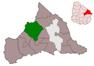
The municipality of Ramón Trigo is one of the municipalities of Cerro Largo Department, Uruguay, established on 3 April 2013. Its seat is the town of Ramón Trigo.
Tres Islas is a locality in Cerro Largo Department in Uruguay. It is the head of the Municipality of Tres Islas.

