Francisco Palacios Miranda was the Governor and Military Commandant of the Baja California Territory from 1844 to 1847. He is known for his cooperation with the Americans during the Mexican American War, accepting neutrality of his Territory in 1846 and making the abject surrender of La Paz to the Americans in 1847. For this he was declared a traitor and forced into exile at the end of the war.

Baja California Territory was a Mexican territory from 1824 to 1931, that encompassed the Baja California Peninsula of present-day northwestern Mexico. It replaced the Baja California Province (1773–1824) of the Spanish colonial Viceroyalty of New Spain, after Mexican independence. Along with Alta California, the two territories were split from the Spanish The Californias region.

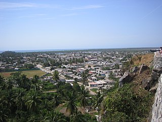
La Paz is the capital city of the Mexican state of Baja California Sur and an important regional commercial center. The city had a 2015 census population of 244,219 inhabitants, making it the most populous city in the state. Its metropolitan population is somewhat larger because of the surrounding towns, such as El Centenario, Chametla and San Pedro. It is in La Paz Municipality, which is the fourth-largest municipality in Mexico in geographical size and reported a population of 290,286 inhabitants on a land area of 20,275 km2 (7,828 sq mi).
On August 17, 1846, Commodore of the Pacific Squadron, Robert F. Stockton proclaimed: "...having by right of conquest taken possession of that territory known by the name of Upper and Lower California do now declare it to be a territory of the United States under the name of the Territory of California." [1] Holding only part of Alta California and no part of the Territory of Baja California, Stockton was overstating the facts in the extreme. To carry out his intent to blockade the West coast of Mexico and to in fact control Baja California, on August 19, Stockton ordered the blockade of San Blas and Mazatlán. While stopping at La Paz, on the southeast corner of Baja California, and San José del Cabo, at the southern tip of the peninsula, Commander Samuel F. Du Pont, commander of the second-class sloop-of-war Cyane secured a promise of neutrality from Colonel Miranda. [2] This allowed the American Navy to seize ships in the ports and get water and provisions there to support their blockade of the other Mexican ports on the west coast of the mainland.

Robert Field Stockton was a United States Navy commodore, notable in the capture of California during the Mexican–American War. He was a naval innovator and an early advocate for a propeller-driven, steam-powered navy. Stockton was from a notable political family and also served as a U.S. Senator from New Jersey.

Alta California, known sometimes unofficially as Nueva California, California Septentrional, California del Norte or California Superior, began in 1804 as a province of New Spain. Along with the Baja California peninsula, it had previously comprised the province of Las Californias, but was split off into a separate province in 1804. Following the Mexican War of Independence, it became a territory of Mexico in April 1822 and was renamed "Alta California" in 1824. The claimed territory included all of the modern US states of California, Nevada and Utah, and parts of Arizona, Wyoming, Colorado and New Mexico.

San Blas is both a municipality and municipal seat located on the Pacific coast of Mexico in Nayarit.
Receiving this report of weakness from Du Pont, returning to San Francisco from the blockade in October, Stockton on February 2, 1847 ordered Commander John B. Montgomery on the first-class sloop-of-war Portsmouth to reestablish the blockade at Mazatlán and to raise the United States flag at San José del Cabo, La Paz, Pichilinque and Loreto. After reimposing a blockade at Mazatlán Montgomery sailed for Baja California. On April 14, Colonel Miranda surrendered La Paz and in effect all of Baja California to the Americans. A committee of residents soon afterward signed articles of capitulation which granted them United States citizen rights and the retention of their own officials and laws, as had been offered by the Americans before in Alta California.

John Berrien Montgomery was an officer in the United States Navy who rose up through the ranks, serving in the War of 1812, Mexican–American War and the American Civil War, performing in various capacities including the commanding of several different vessels.

The second USS Portsmouth was a wooden sloop-of-war in the United States Navy in service during the mid-to-late 19th century. She was designed by Josiah Barker on the lines of a French-built privateer, and built at the Portsmouth Navy Yard, directly across the Piscataqua River from Portsmouth, New Hampshire. She was described as an improvement over the USS Saratoga built in the same shipyard a year earlier. The Portsmouth was launched on 23 October 1843 and commissioned on 10 November 1844, with Commander John Berrien Montgomery in command.
Pichilinque is a port city in the La Paz Municipality, in the state of Baja California Sur, Mexico. It is located in the Bay of La Paz, on the Baja California peninsula nearby the state capital of La Paz.
However, as in Alta California, patriotic bajacalifornios were not ready to quietly surrender. On February 15, a council meeting of resistors at Santa Anita, north of San José del Cabo, declared Miranda a traitor and named Mauricio Castro Cota, of San José del Cabo, as his successor. [3]
Bajacalifornio a person from one of the former territories or modern states of the Baja California Peninsula of Mexico.
Santa Anita is a village in Los Cabos Municipality, Baja California Sur, western Mexico. It is located north of San Jose del Cabo on the right bank of the Arroyo San José along Federal Highway 1. It had a population of 687 inhabitants in the 2010 census, and is situated at an elevation of 76 meters (249 ft.) above sea level.
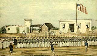
On November 16, 1847 Mexican forces under Manuel Pineda, made a sudden assault on the U.S. Army garrison at La Paz but failed to take the town. However, as they withdrew on the 17th, they burned ex-Governor Miranda's town house. At the end of the Mexican American War, in early August, 1848 the 1st Regiment of New York Volunteers occupying Baja California were ordered to return to Alta California to be discharged. They were accompanied by over 130 refugees from La Paz and 350 from San José. Among the refugees was ex-governor Francisco Palacios Miranda, forced to abandon his lands and property. [2]
Manuel Pineda Munoz (1804–1891), Mexican Army officer that led the Mexican resistance to the forces of the United States in Baja California Sur, during the Mexican–American War. Victor of the Battle of Mulege, he inspired the resistance force of bajacalifornios to attack and then besiege La Paz and attack San José del Cabo. Although he was eventually defeated and later captured at San Antonio de la Sierra, the protracted resistance he led made the American hold on the Baja California peninsula unsecure and prompted American statesman to omit in the final peace treaty, their original demand for the annexation of Baja California and Baja California Sur.

The Battle of La Paz was an engagement of the Pacific Coast Campaign during the Mexican–American War. The belligerents were United States Army troops against Mexican militia, commanded by Mexican Army officers. The battle occurred on November 16 and 17, 1847.
1st Regiment of New York Volunteers, for service in California and during the war with Mexico, was raised in 1846 during the Mexican–American War by Jonathan D. Stevenson. Accepted by the United States Army on August 1846 the 1st Regiment of New York Volunteers was transported around Cape Horn to California, where it served as garrisons in Yerba Buena, Monterey, Santa Barbara, Los Angeles and San Diego. Elements of the Volunteers under Lieutenant Colonel Henry Stanton Burton were involved in operations of the Pacific Coast Campaign in Baja California, captured and garrisoned towns there, fighting in the Battle of La Paz, Siege of La Paz and defeated local forces at the Skirmish of Todos Santos after the peace was negotiated in 1848. The Regiment was then evacuated from Baja California and disbanded in California on August, September and October 1848.


