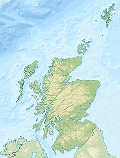
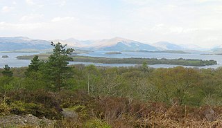
Fraoch Eilean is a small island in Loch Lomond, Scotland. Its name means "heather island" in Scottish Gaelic.
Loch Lomond is a freshwater Scottish loch which crosses the Highland Boundary Fault, often considered the boundary between the lowlands of Central Scotland and the Highlands. Traditionally forming part of the boundary between the counties of Stirlingshire and Dunbartonshire, Loch Lomond is split between the council areas of Stirling, Argyll and Bute and West Dunbartonshire. Its southern shores are about 23 kilometres (14 mi) northwest of the centre of Glasgow, Scotland's largest city. The Loch forms part of the Loch Lomond and The Trossachs National Park which was established in 2002.
Scottish Gaelic or Scots Gaelic, sometimes also referred to simply as Gaelic, is a Celtic language native to the Gaels of Scotland. A member of the Goidelic branch of the Celtic languages, Scottish Gaelic, like Modern Irish and Manx, developed out of Middle Irish. Most of modern Scotland was once Gaelic-speaking, as evidenced especially by Gaelic-language placenames.
It is near Luss on the mainland, and according to legend, was used as its prison, indeed on Charles Ross's 1792 Plan of Dunbartonshire, Loch Lomond and its Environs, Fraoch Eilean is marked as "Luss Prison". [1]
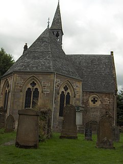
Luss is a village in Argyll & Bute, Scotland, on the west bank of Loch Lomond. The village is within the Loch Lomond and The Trossachs National Park.
Inchmurrin is an island in Loch Lomond in Scotland. It is the largest fresh water island in the British Isles.
Inchconnachan is an island in Loch Lomond in Scotland.
This is a list of islands called Eilean Fraoch or Fraoch Eilean, which provides an index for islands in Scotland with this and similar names. Literally meaning "heather island" in Scottish Gaelic, it is a common Scottish island name. It may also represent the forename "Fraoch" from Gaelic mythology.
Inchmoan is an island in Loch Lomond, Scotland.
Inchcruin is an island in Loch Lomond in Scotland. It is not to be confused with Creinch, which has occasionally been referred to as "Inchcroin".
Inchlonaig is an island in Loch Lomond in Scotland.
Inchtavannach, is one of the larger islands in Loch Lomond.
Inchgalbraith is an islet in Loch Lomond, Scotland, and is the ancestral home of Clan Galbraith.
Ellanderroch is an island in Loch Lomond in Scotland.
Bucinch or Buc-Innis is a small island in Loch Lomond, in west central Scotland.
Eilean I Vow is a small island in Loch Lomond in west central Scotland. Other variants of the name include Ellan I Vow, Eilean a' Vow, Elanvow, Ellan Vhow and Island I Vow. The island is listed in 13th/14th century charters as "Elanvow".
Clairinsh or Clairinch is an island in Loch Lomond, central Scotland.
Eilean nan Deargannan is a small island in Loch Lomond, in west central Scotland. It lies between Rowardennan and Inverbeg.
The Ross Isles are two small islands in Loch Lomond, in west central Scotland.
Fraoch Eilean is a small island situated at the northern end of Loch Awe, a freshwater lake in Argyll and Bute, Scotland. It is notable for being the site of a medieval royal castle, now ruined, which was given into the keeping of Clan Macnaghten by Alexander III in 1267.
The Sound of Islay is a narrow strait between the islands of Islay and Jura off the west coast of Scotland. It is approximately 30 kilometres (19 mi) in extent from north to south and lies between Rubh' a' Mhàil on Islay and Rubh' Aird na Sgitheich on Jura to the north and Macarthur's Head and Rubha na Tràille to the south. The islands in the Sound are Am Fraoch Eilean, Brosdale Island and Glas Eilean, all of which are off the south east coast of Jura. These islands, Jura south of Loch Tarbert and the eastern part of the Sound are one of 40 National Scenic Areas in Scotland.
Aldlochlay is a small hamlet in Argyll and Bute, Scotland, on the shore of Loch Lomond opposite the island of Inchtavannach and just south of Luss. It was formerly part of Dunbartonshire, but is now part of Argyll and Bute. The hamlet has no speed limit sign, due to it being a quiet hamlet.
Wikimedia Commons has media related to Fraoch Eilean . |
Coordinates: 56°23′N5°03′W / 56.383°N 5.050°W
A geographic coordinate system is a coordinate system that enables every location on Earth to be specified by a set of numbers, letters or symbols. The coordinates are often chosen such that one of the numbers represents a vertical position and two or three of the numbers represent a horizontal position; alternatively, a geographic position may be expressed in a combined three-dimensional Cartesian vector. A common choice of coordinates is latitude, longitude and elevation. To specify a location on a plane requires a map projection.