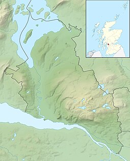
Inchtavannach faces the settlement of Aldochlay. Bandry Bay separates the island from the mainland, just south of Luss. According to Rev. Wilson, the island is "comparatively steep and lofty, mostly covered with natural oak".[7] A northern summit, Tom nan Clag (English: Mound of the Bell), rises steeply to 282 feet (86m), the highest point on the loch.[6] A southern summit reaches 180 feet (55m) in height.
It was once the site of a monastery, giving rise to its translated name of 'Monk's Isle'. A large house has stood on the site of the monastery since 1760. The island is predominantly wooded. It is here that the monks rang the bell to the call of prayer.
Roe Deer are recorded to have lived here. Sir James Colquhoun built a winding path up to the summit in the 17th century.[6]
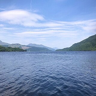
Loch Lomond is a freshwater Scottish loch which crosses the Highland Boundary Fault, often considered the boundary between the lowlands of Central Scotland and the Highlands. Traditionally forming part of the boundary between the counties of Stirlingshire and Dunbartonshire, Loch Lomond is split between the council areas of Stirling, Argyll and Bute and West Dunbartonshire. Its southern shores are about 23 kilometres (14 mi) northwest of the centre of Glasgow, Scotland's largest city. The Loch forms part of the Loch Lomond and The Trossachs National Park which was established in 2002.
Inchmurrin is an island in Loch Lomond in Scotland. It is the largest fresh water island in the British Isles.
Inchconnachan is an island in Loch Lomond in Scotland, in the Trossachs National Park. It is accessible by boat from the village of Luss on the south side of the Loch.
Saint Kessog was an Irish missionary of the mid-sixth century active in the Lennox area and southern Perthshire. Son of the king of Cashel in Ireland, Kessog is said to have worked miracles, even as a child. He left Ireland and became a missionary bishop in Scotland. Using Monks' Island in Loch Lomond as his headquarters, he evangelized the surrounding area until he was martyred, supposedly at Bandry, where a heap of stones was known as St Kessog's Cairn. Kessog was killed in 520 AD.
Inchcailloch is an islet on Loch Lomond in Scotland. It is 85 metres (279 ft) at its highest point. It is also known to some as Inchebroida.
Eilean Shona is a tidal island situated at the entrance of Loch Moidart, on the west coast of Scotland, just north of the Ardnamurchan Peninsula. The island is 525 hectares in area, with the highest point being Beinn a' Bhàillidh at 265 metres (869 ft). There are five other peaks of over 150 metres (490 ft) and views of the sea and off-shore islands including Rhum, Eigg and Skye. It is reached by a short boat ride from the mainland. The modern name may be from the Old Norse for "sea island". The pre-Norse Gaelic name, as recorded by Adomnán was Airthrago or Arthràigh, meaning 'foreshore island', similar to the derivation of Erraid.
Oronsay is an uninhabited island in Loch Sunart, Scotland.
Inchfad is an island in the south east of Loch Lomond in Scotland.
Ceann Ear is the largest island in the Monach or Heisgeir group off North Uist in north west Scotland. It is 203 hectares in size and connected by sandbanks to Ceann Iar via Sibhinis at low tide. It is said that it was at one time possible to walk all the way to Baleshare, and on to North Uist, 5 miles away at low tide. In the 16th century, a large tidal wave was said to have washed this away.
Inchmoan is an island in Loch Lomond, Scotland.
Inchcruin is an island in Loch Lomond in Scotland. It is not to be confused with Creinch, which has occasionally been referred to as "Inchcroin".
Inchlonaig is an island in Loch Lomond in Scotland.
Moncreiffe Island, also known as Friarton Island, is an island in Perth, Scotland. It divides the River Tay into two channels as it flows through Perth, and is crossed by the single-track Tay Viaduct, carrying the Scottish Central Railway.
Inchgalbraith is an islet in Loch Lomond, Scotland, and is the ancestral home of Clan Galbraith.
Bucinch or Buc-Innis is a small island in Loch Lomond, in west central Scotland.
Clairinsh or Clairinch is an island in Loch Lomond, central Scotland.
Fraoch Eilean is a small island in Loch Lomond, Scotland. Its name means "heather island" in Scottish Gaelic.
The Ross Isles are two small islands in Loch Lomond, in west central Scotland.
Pier Road is a street in Luss, Argyll and Bute, Scotland. Located on Loch Lomond's western shore, the road, which is on an east–west alignment, consists of around twenty buildings, many of which are listed cottages dating from the 19th century.
This page is based on this Wikipedia article Text is available under the CC BY-SA 4.0 license; additional terms may apply. Images, videos and audio are available under their respective licenses.