Aldochlay

Last updated

Aldochlay
Luss, Rowanbank Cottage at Aldochlay - geograph.org.uk - 205404.jpg
Rowanbank Cottage at Aldochlay, 2006
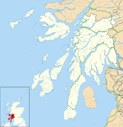
Argyll and Bute UK location map.svg
Red pog.svg
Aldochlay
Location within Argyll and Bute
OS grid reference NS360913
Council area
Lieutenancy area
Country Scotland
Sovereign state United Kingdom
Post town Alexandria
Postcode district G83
Police Scotland
Fire Scottish
Ambulance Scottish
UK Parliament
Scottish Parliament
List of places
UK
Scotland
56°05′13″N4°38′13″W / 56.087°N 4.637°W / 56.087; -4.637 Coordinates: 56°05′13″N4°38′13″W / 56.087°N 4.637°W / 56.087; -4.637

Aldochlay is a small hamlet in Argyll and Bute, Scotland, on the shore of Loch Lomond opposite the island of Inchtavannach and just south of Luss. It was formerly part of Dunbartonshire, but is now part of Argyll and Bute. The hamlet has no speed limit sign, due to it being a quiet hamlet.

It is known to many people for the small statue of a boy on a plinth in the loch.
Related Research Articles

Argyll and Bute Council area of Scotland

Argyll and Bute is one of 32 unitary authority council areas in Scotland and a lieutenancy area. The current Lord-Lieutenant for Argyll and Bute is Jane Margaret MacLeod. The administrative centre for the council area is in Lochgilphead at Kilmory Castle, a 19th-century Gothic Revival building and estate. The current Council leader is Councillor Robin Currie, a councillor for Kintyre and the Islands.

County of Bute Historic county in Scotland

The County of Bute, also known as Buteshire, is a historic county and registration county of Scotland.

Argyll Historic county in Scotland

Argyll, sometimes called Argyllshire, is a historic county and registration county of western Scotland.

Isle of Bute Island in the Firth of Clyde in Scotland

The Isle of Bute, known as Bute, is an island in the Firth of Clyde in Scotland, United Kingdom. It is divided into highland and lowland areas by the Highland Boundary Fault.

Cowal Human settlement in Scotland

Cowal is a peninsula in Argyll and Bute, in the west of Scotland, that extends into the Firth of Clyde.

Loch Long Sea-loch in Argyll and Bute, Scotland, UK

Loch Long is a body of water in Argyll and Bute, Scotland. The Sea Loch extends from the Firth of Clyde at its southwestern end. It measures approximately 20 miles (32 km) in length, with a width of between 1 and 2 miles. The loch also has an arm, Loch Goil, on its western side.

Loch Fyne Sea inlet on west coast of Scotland

Loch Fyne, is a sea loch off the Firth of Clyde and forms part of the coast of the Cowal peninsula. Located on the west coast of Argyll and Bute, Scotland. It extends 65 kilometres (40 mi) inland from the Sound of Bute, making it the longest of the sea lochs in Scotland. It is connected to the Sound of Jura by the Crinan Canal. Although there is no evidence that grapes have grown there, the title is probably honorific, indicating that the river, Abhainn Fìne river Fyne, was a well-respected river.

Ardrishaig Human settlement in Scotland

Ardrishaig is a coastal village on Loch Gilp, at the southern (eastern) entrance to the Crinan Canal in Argyll and Bute in the west of Scotland. It lies immediately to the south of Lochgilphead, with the nearest larger town being Oban.

Tarbert, Kintyre Village in Argyll and Bute, Scotland

Tarbert is a village in the west of Scotland, in the Argyll and Bute council area. It is built around East Loch Tarbert, an inlet of Loch Fyne, and extends over the isthmus which links the peninsula of Kintyre to Knapdale and West Loch Tarbert. Tarbert had a recorded population of 1,338 in the 2001 Census.

Loch Striven

Loch Striven is a sea loch extending off the Firth of Clyde, and forms part of the Cowal peninsula coast, in Argyll and Bute, Scotland.

Whistlefield, Argyll Human settlement in Scotland

Whistlefield is a hamlet on the east shore of Loch Eck on the Cowal peninsula, Argyll and Bute, West of Scotland. It is home to the Category C listed building, the Whistlefield Inn, which was established around 1801–1804. The hamlet is within the Argyll Forest Park, which is itself part of the Loch Lomond and The Trossachs National Park.

Cairndow Human settlement in Scotland

Cairndow; is a coastal hamlet, on the Cowal peninsula in Argyll and Bute, Scottish Highlands. The town lies between the A83 road and the head of Loch Fyne.

Ardgartan Human settlement in Scotland

Ardgartan is a hamlet, on the Cowal peninsula in Argyll and Bute, Scottish Highlands. It is located on the shores of Loch Long, at the bottom of Glen Croe.

Kilchoman is a small settlement and large parish on the Scottish island of Islay, within the unitary council of Argyll and Bute.

Argyll's Bowling Green is an area on the Ardgoil estate in Argyll and Bute, Scotland. It is also known as the Ardgoil peninsula and is the most southerly part of the Arrochar Alps and lies between Loch Goil and Loch Long. It is part of the Argyll Forest Park and is within the Loch Lomond and the Trossachs National Park.

Inverarnan Hamlet in Stirling, Scotland

Inverarnan is a small hamlet in Stirling, Scotland, near the village of Crianlarich and the hamlet of Ardlui, Argyll and Bute. It is the only settlement in the historical county of Perthshire which has a G postcode.

Rashfield Human settlement in Scotland

Rashfield; is a hamlet on the Cowal peninsula, situated between Loch Eck and the head of Holy Loch, in Argyll and Bute, West of Scotland. The hamlet is on the A815 road and the River Eachaig flows pass from Loch Eck to the Holy Loch. Rashfield is within the Argyll Forest Park which is itself within the Loch Lomond and The Trossachs National Park.

Strachur Bay

Strachur Bay is a coastal embayment, on a 114° orientation, on the eastern coast of the longest sea loch in Scotland, Loch Fyne located in Argyll and Bute, on the west coast of Scotland. Strachur Bay provides good anchorage, for small vessels, when the wind is from the northeast and southeast.

References