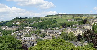
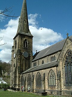
Hebden Bridge is a market town in the Upper Calder Valley in West Yorkshire, England. It is 8 miles (13 km) west of Halifax and 14 miles (21 km) north-east of Rochdale, at the confluence of the River Calder and the Hebden Water. The town is the largest settlement in the civil parish of Hebden Royd.
Ripponden is a village and civil parish on the River Ryburn near Halifax in West Yorkshire, England. Historically it was part of the West Riding of Yorkshire. Its population was 6,412 at the time of the 2001 Census, and 7,421 in 2011.

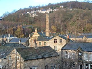
Sowerby Bridge is a market town in the Upper Calder Valley in Calderdale in West Yorkshire, England. The Calderdale Council ward population at the 2011 census was 11,703.

The Metropolitan Borough of Calderdale is a metropolitan borough of West Yorkshire, England. The estimated population in mid-2020 was 211,439. It takes its name from the River Calder, and dale, a word for valley. The name Calderdale usually refers to the borough through which the upper river flows, while the actual landform is known as the Calder Valley. Several small valleys contain tributaries of the River Calder.
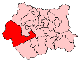
Calder Valley is a parliamentary constituency in the United Kingdom, represented in the House of Commons of the UK Parliament since 2010 by Craig Whittaker, a Conservative.

Halifax is a constituency represented in the House of Commons of the UK Parliament since 2015 by Holly Lynch of the Labour Party.

Warley Town is an area of Halifax in the county of West Yorkshire, England. Warley is a ward of Calderdale. The population of this ward as taken at the 2011 Census was 12,215.
Hebden Royd is a civil parish with a town council in the Metropolitan Borough of Calderdale in West Yorkshire, England. According to the 2001 census it had a population of 9,092, rising to 9,558 at the 2011 census. It includes Hebden Bridge, Mytholmroyd and Cragg Vale. The parish was an urban district before 1974, created in 1937 by the merger of Hebden Bridge and Mytholmroyd urban districts. The area now shares the HX7 postcode area.
Sowerby is a village in the Metropolitan Borough of Calderdale, in West Yorkshire, England. It lies in the Pennines, contiguous with Sowerby Bridge, 3.7 miles (6.0 km) west-southwest of Halifax.
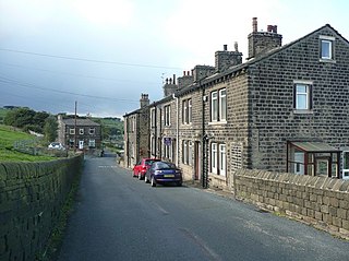
Luddendenfoot or Luddenden Foot is a community in Calderdale, West Yorkshire, England. The population of Luddendenfoot is 2,547, with the wider Calderdale Ward at the 2011 Census as 10,653. It lies along the Upper Calder Valley below the village of Luddenden, between Sowerby Bridge and Mytholmroyd

Sowerby was a county constituency centred on the village of Sowerby in Calderdale, West Yorkshire. It returned one Member of Parliament (MP) to the House of Commons of the Parliament of the United Kingdom.

The Upper Calder Valley lies in West Yorkshire, in northern England, and covers the towns of Todmorden, Hebden Bridge, Mytholmroyd, Luddendenfoot, and Sowerby Bridge, as well as a number of smaller settlements such as Portsmouth, Cornholme, Walsden, and Eastwood. The valley is the upper valley of the River Calder. Major tributaries of the Upper Calder include the Walsden Water, which flows through the large village of Walsden to join the Calder at Todmorden; the Hebden Water, which flows through Hebden Dale to join the Calder at Hebden Bridge; Cragg Brook, which flows through Cragg Vale to join the Calder at Mytholmroyd, and the largest, the River Ryburn, which joins the Calder at Sowerby Bridge.

Wainhouse Tower is a folly in the parish of King Cross, on the south west side of Halifax, Calderdale, West Yorkshire, in England. At 275 feet (84 m), it is the tallest structure in Calderdale and the tallest folly in the world, and was erected in the four years between 1871 and 1875. The main shaft is octagonal in shape and it has a square base and 369 steps leading to the first of two viewing platforms which is open to the public, and a total of 405 to the top viewing platform which is usually closed to the public. The tower is open to the public during bank holidays, and is a Grade II* listed building.

The South Pennines is a region of moorland and hill country in northern England lying towards the southern end of the Pennines. In the west it includes the Rossendale Valley and the West Pennine Moors. It is bounded by the Greater Manchester conurbation in the west and the Bowland Fells and Yorkshire Dales to the north. To the east it is fringed by the towns of West Yorkshire whilst to the south it is bounded by the Peak District. The rural South Pennine Moors constitutes both a Site of Special Scientific Interest and Special Area of Conservation.

Rishworth railway station was a railway station on the Rishworth Branch, built by the Lancashire & Yorkshire Railway, to serve the village of Rishworth in Calderdale, West Yorkshire, England. It opened in 1881 and closed to passenger services in 1929; goods traffic ceased in 1953.

Wadsworth is a civil parish in the Metropolitan Borough of Calderdale in West Yorkshire, England. It has a population of 1,456, increasing to 1,603 at the 2011 Census, and was, until 1974, part of Hepton Rural District.

Erringden is a civil parish in the Metropolitan Borough of Calderdale in West Yorkshire, England. Previously it was a township within the chapelry of Heptonstall.
Portsmouth is a village on the A646 road in the Calderdale district, in the county of West Yorkshire, England. Nearby settlements include the towns of Burnley and Todmorden and the village of Cornholme.

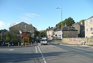
Triangle is a village in the Calderdale borough of West Yorkshire, England. It is located in the valley of the River Ryburn, on the A58 road over the South Pennines, between Sowerby Bridge and Ripponden. Historically a part of the West Riding of Yorkshire, it dates mainly from the 19th century period of industrialisation but was here for some time prior. The name of the village derives from the patch of ground formed when the old road parted with the newer (A58) toll road to Rochdale. Previous to this time the village was named Pond.
Trinity Academy Grammar, formerly known as Trinity Academy Sowerby Bridge, is a coeducational secondary school in Sowerby Bridge, Calderdale, West Yorkshire, England. The school specialises in maths and computing, and is attended by over 1000 students.

