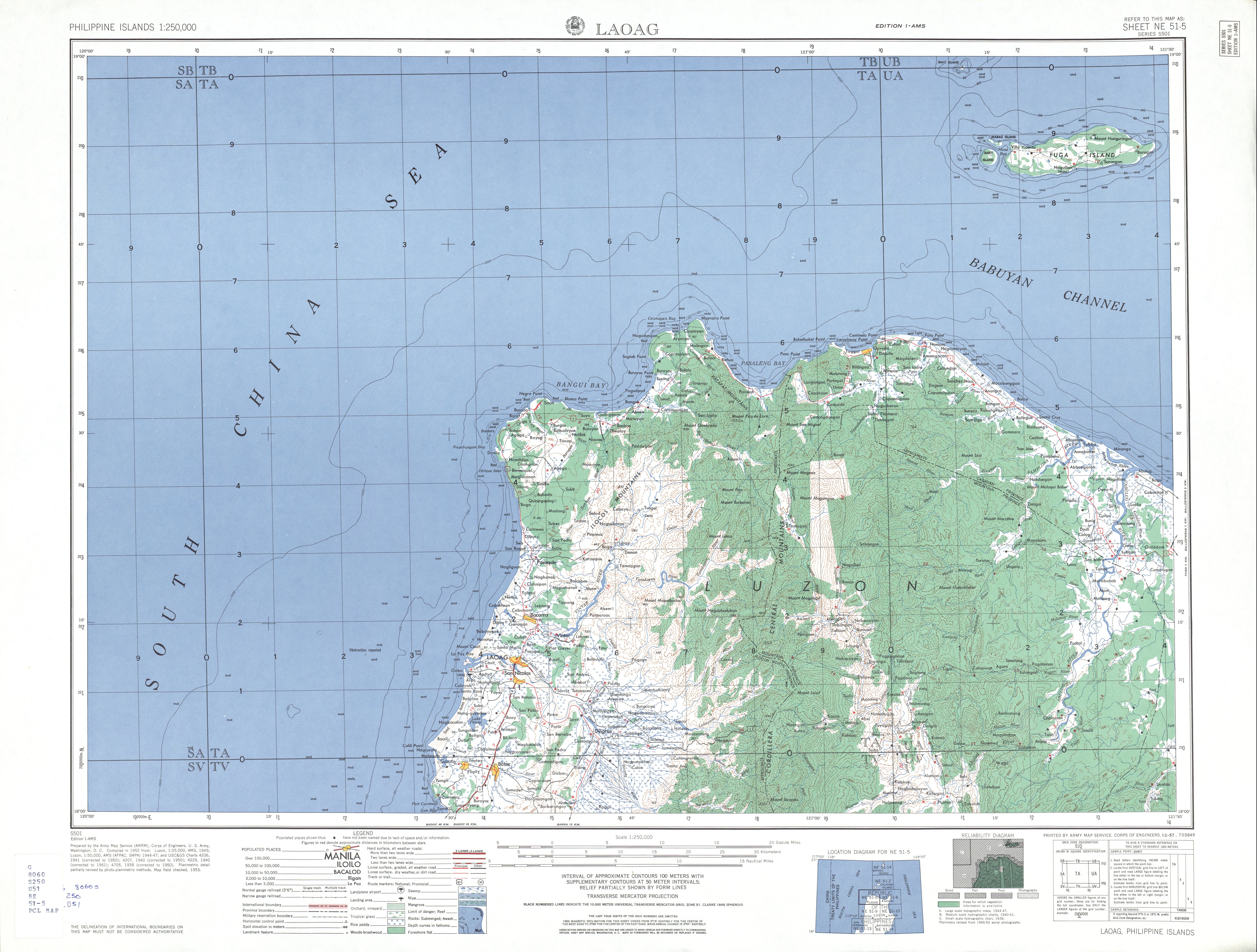
Fuga Island

Last updated
Fuga Island
Fuga Island Tide Gauge 1927.jpg
Fuga Island tide gauge in 1927
Philippines relief location map (square).svg
Red pog.svg
Fuga Island
Location within the Philippines
Geography
Coordinates 18°52′21″N121°22′44″E / 18.87250°N 121.37889°E / 18.87250; 121.37889 Coordinates: 18°52′21″N121°22′44″E / 18.87250°N 121.37889°E / 18.87250; 121.37889
Archipelago Babuyan Islands
Adjacent to Babuyan Channel
Area70 km2 (27 sq mi) [1]
Highest elevation191 m (627 ft) [2]
Highest point Mount Nanguringan
Administration
Region Cagayan Valley
Province Cagayan
Municipality Aparri
Demographics
Population1,939 (2020) [3]
Pop. density27.7/km2 (71.7/sq mi)
Additional information
Fuga Island

Fuga Island is an island and barangay located north of Luzon and is part of the Babuyan Islands, which is the second-northernmost island group of the Philippines. Barangay Fuga Island is one of the 42 barangays under the jurisdiction of the municipality of Aparri in the province of Cagayan.

Contents

Geography

Fuga has an area of 70 square kilometres (27 sq mi) [1] and a population of 2,015 people. [4] The principal settlement is Naguilian (Musa) village on the southern coast. The highest peak is Mount Nanguringan in the northeast, with an elevation of 191 metres (627 ft). [2]

Along with the neighbouring islets of Barit (7 square kilometres (2.7 sq mi)) and Mabaag, [5] it constitutes one of 42 barangays of the municipality of Aparri, Cagayan. It is the only one of the Babuyan Islands under the jurisdiction of a mainland municipality, whereas all other islands form the municipality of Calayan.

History

Presently, Fuga Island is owned by Fuga Island Holdings. It was formerly owned by the Dominican Order under the encomienda system during the Spanish Period eventually returned to the Filipinos after the signing of 1898 Treaty of Paris. The first land title was issued in 1908 under Original Certificate Title number two, and the Insular Government of the Philippine Islands designated the island and surrounding ports an economic zone as part of the Cagayan Special Economic Zone (CEZA) and Freeport under Republic Act No. 7922. [6]

Archaeology

From January 31, 1978 to February 22, 1978, Bryan E. Snow and Richard Shutler, Jr. conducted an archaeological excavation on Fuga Moro Island. Earthenware, pottery, porcelains, and stoneware were found during the excavation. [7]

Military presence

On August 7, 2020, the Northern Luzon Command established a Marine detachment on the island. It also plans to build a defense facilities on the island, which will include a sheltered pier, a naval station, and a littoral monitoring on 20-hectare detachment. [8]

See also

Related Research Articles

<span class="mw-page-title-main">Aparri</span> Municipality in Cagayan, Philippines

Aparri, officially the Municipality of Aparri, is a 1st class municipality in the province of Cagayan, Philippines. According to the 2020 census, it has a population of 68,839 people. 

<span class="mw-page-title-main">Cagayan Valley</span> Administrative region of the Philippines

Cagayan Valley, is an administrative region in the Philippines, located in the northeastern section of Luzon Island. It is composed of five Philippine provinces: Batanes, Cagayan, Isabela, Nueva Vizcaya, and Quirino. The region hosts four chartered cities of Cauayan, Ilagan, Santiago, and Tuguegarao.

<span class="mw-page-title-main">Babuyan Islands</span> Island group in the Philippines

The Babuyan Islands, also known as the Babuyan Group of Islands, is an archipelago in the Philippines, located in the Luzon Strait north of the main island of Luzon and south of Taiwan via Bashi Channel to Luzon Strait. The archipelago consists of five major islands and their surrounding smaller islands. These main islands are, counterclockwise starting from northeast, Babuyan, Calayan, Dalupiri, Fuga, and Camiguin. The Babuyan Islands are separated from Luzon by the Babuyan Channel, and from the province of Batanes to the north by the Balintang Channel.

<span class="mw-page-title-main">Misamis Oriental</span> Province in Northern Mindanao, Philippines

Misamis Oriental, officially the Province of Misamis Oriental, is a province located in the region of Northern Mindanao in the Philippines. Its capital, largest city and provincial center is the city of Cagayan de Oro, which is governed independently from the province.

<span class="mw-page-title-main">Batanes</span> Province in Cagayan Valley, Philippines

Batanes, officially the Province of Batanes, is an archipelagic province in the Philippines, administratively part of the Cagayan Valley region. It is the northernmost province in the Philippines, and the smallest, both in population and land area. The capital is Basco, located on the island of Batan.

<span class="mw-page-title-main">Cagayan</span> Province in Cagayan Valley, Philippines

Cagayan, officially the Province of Cagayan, is a province in the Philippines located in the Cagayan Valley region, covering the northeastern tip of Luzon. Its capital is the city of Tuguegarao. It is about 431 kilometres (268 mi) northwest of Manila, and includes the Babuyan Islands to the north. The province borders Ilocos Norte and Apayao to the west, and Kalinga and Isabela to the south.

<span class="mw-page-title-main">Calayan, Cagayan</span> Municipality in Cagayan, Philippines

Calayan, officially the Municipality of Calayan, is a 3rd class municipality in the province of Cagayan, Philippines. According to the 2020 census, it has a population of 17,410 people. 

<span class="mw-page-title-main">Calayan Island</span> Island in the Philippines

Calayan Island is located about 24 miles west-southwest of Babuyan Island off the north coast of the Philippines and belongs to the Babuyan Islands group in the Luzon Strait. The island is hemmed between Aparri and Batanes islands and it is larger than the Fuga Island, which is 25 miles (40 km) away. Calayan is home to the Calayan rail, a flightless bird identified as a separate species in 2004 and endemic to Calayan Island. The island is part of the Municipality of Calayan.

<span class="mw-page-title-main">Santiago, Ilocos Sur</span> Municipality in Ilocos Sur, Philippines

Santiago, officially the Municipality of Santiago, is a 4th class municipality in the province of Ilocos Sur, Philippines. According to the 2020 census, it has a population of 19,471 people. 

<span class="mw-page-title-main">Allacapan</span> Municipality in Cagayan, Philippines

Allacapan, officially the Municipality of Allacapan, is a 3rd class municipality in the province of Cagayan, Philippines. According to the 2020 census, it has a population of 35,234 people. 

<span class="mw-page-title-main">Gonzaga, Cagayan</span> Municipality in Cagayan, Philippines

Gonzaga is a first-class municipality in Cagayan, Philippines with a population of 41,680 people according to the 2020 census.

<span class="mw-page-title-main">Santa Ana, Cagayan</span> Municipality in Cagayan, Philippines

Santa Ana, officially the Municipality of Santa Ana, is a 2nd class municipality in the province of Cagayan, Philippines. According to the 2020 census, it has a population of 35,688 people. 

<span class="mw-page-title-main">Santa Praxedes, Cagayan</span> Municipality in Cagayan, Philippines

Santa Praxedes, officially the Municipality of Santa Praxedes, is a 5th class municipality in the province of Cagayan, Philippines. According to the 2020 census, it has a population of 4,434 people. 

<span class="mw-page-title-main">Alicia, Isabela</span> Municipality in Isabela, Philippines

Alicia, officially the Municipality of Alicia, is a 1st class municipality in the province of Isabela, Philippines. According to the 2020 census, it has a population of 73,874 people. 

Camiguin de Babuyanes is an active stratovolcano on Camiguin Island, part of the Babuyan Islands group that is located in Luzon Strait, north of the island of Luzon, in the Philippines. The volcano and the island are within the jurisdiction of the municipality of Calayan, in the province of Cagayan. The island has a population of 5,231 people in 2020. 

<span class="mw-page-title-main">Smith Volcano</span> Active volcano in the Philippines

Smith Volcano, also known as Mount Babuyan, is a cinder cone on Babuyan Island, the northernmost of the Babuyan group of islands on Luzon Strait, north of the main island of Luzon in the Philippines. The mountain is one of the active volcanoes in the Philippines, which last erupted in 1924.

<span class="mw-page-title-main">Cagayan Special Economic Zone</span>

The Cagayan Economic Zone Authority(CEZA) is a government-owned and controlled corporation (GOCC) tasked to manage and supervise the development of the Cagayan Special Economic Zone and Freeport (CSEZFP) in the Philippines.

<span class="mw-page-title-main">Babuyan Island</span> Island within the Babuyan Islands, the Philippines

Babuyan Island is the highest and northernmost island in the Babuyan Islands in Luzon Strait north of Luzon Island in the Philippines and also directly south of Taiwan via Bashi Channel to Luzon Strait. The whole island makes up the barangay of Babuyan Claro, that constitute the municipality of Calayan in Cagayan province. The volcanic island has a population of 1,910 as of the 2020 census, up from 1,423 in 2010. 

Barit is a small, wooded, privately owned island in northern Cagayan, Philippines. It is under the jurisdiction of Barangay Fuga Island in the municipality of Aparri.

<span class="mw-page-title-main">Dalupiri Island (Cagayan)</span>

Dalupiri Island is an island in the Babuyan Islands in Luzon Strait north of Luzon Island in the Philippines. The whole island makes up the barangay of Dalupiri, which is part of the municipality of Calayan in Cagayan province, which had 621 inhabitants in 2020, up from 611 in 2010. 

References

  1. 1 2 Genevieve Broad; Carl Oliveros. "Biodiversity and conservation priority setting in the Babuyan Islands, Philippines" (PDF). The Technical Journal of Philippine Ecosystems and Natural Resources. 15 (1–2): 1–30. Retrieved 18 April 2018.
  2. 1 2 "NE 51-5 Laoag". Series S501, U.S. Army Map Service, 1954-. The University of Texas at Austin. Retrieved 18 April 2018.
  3. Census of Population (2020). "Region II (Cagayan Valley)". Total Population by Province, City, Municipality and Barangay. PSA . Retrieved 8 July 2021.
  4. Census of Population (2015). "Region II (Cagayan Valley)". Total Population by Province, City, Municipality and Barangay. PSA . Retrieved 20 June 2016.
  5. Google (1 February 2020). "Fuga Island" (Map). Google Maps . Google. Retrieved 1 February 2020.
  6. "Republic Act No. 7922: An act establishing a special economic zone and free port in the municipality of Santa Ana and the neighboring islands in the municipality of Aparri, province of Cagayan, providing funds therefor, and for other purposes" (PDF). ceza.gov.ph. Congress of the Philippines. February 24, 1995. Retrieved 18 April 2018.
  7. Bryan E. Snow; Richard Shutler Jr (1985). The Archaeology of Fuga Moro Island:New Approaches for the Isolation and Explanation of Diagnostic Ceramic Assemblages in Northern Luzon. University of San Carlos. ISBN   9789711000479.
  8. "Navy safeguards northern islands". Philippine News Agency. 26 August 2020. Retrieved 28 May 2021.