Sywell Aerodrome is the local aerodrome serving the town of Northampton, Wellingborough, Kettering and Rushden, as well as wider Northamptonshire. The aerodrome is located 5 nautical miles northeast of Northampton and was originally opened in 1928 on the edge of Sywell village.

Nottingham Airport, also known as Nottingham City Airport, is located in Tollerton, Nottinghamshire, England. It is situated 3 nautical miles south east of Nottingham City Centre, and signposted on the A52 at Trent Bridge and on the A606—this makes it one of the closest airports to a city centre in the UK. The aerodrome is equipped for private aviation, business aviation and flight instruction.
The Bombay Flying Club is the oldest flying club in India. It is located at the Juhu aerodrome, Bombay (Mumbai).

Hawarden Airport, is an airport near Hawarden in Flintshire, Wales, near the border with England and 3.5 NM west southwest of the English city of Chester.

Peterborough Business Airport is a privately owned airfield in the English county of Cambridgeshire near the villages of Holme and Conington, 7 NM south of Peterborough.

Wolverhampton Halfpenny Green Airport, formerly Halfpenny Green Airport and Wolverhampton Business Airport, locally Bobbington Airport, is a small, 400-acre (1.6 km2) airport situated near the village of Bobbington, South Staffordshire. The airport is situated 8 mi (13 km) south-west of Wolverhampton, the city which it serves.

Derby Airfield is located at the village of Egginton, Derbyshire, 6 nautical miles southwest of Derby in the East Midlands of England.

Denham Aerodrome is an operational general aviation aerodrome located 1.5 NM east of Gerrards Cross, near Denham, Buckinghamshire, England. It lies beneath London's Class D airspace. VFR entry/exit points are at Maple Cross (CHT) and St Giles Church. Entry lanes and circuit height are at 1,000 ft (300 m) MSL. It has one paved runway, aligned 06/24, a grass runway also aligned 06/24 which is referred to as the northside grass and one grass runway aligned 12/30. It also has substantial hangarage.

Panshanger Aerodrome was a former general aviation aerodrome located on the most eastern tip of Welwyn Garden City, Hertfordshire, England, 2.5 NM west of Hertford, East Hertfordshire.

Headcorn Aerodrome is a private airfield in Kent, England. The airfield is located 8 NM south of Maidstone; about 32 miles (51 km) southeast of London.

Newtownards Airport is a local airfield in Newtownards, County Down, Northern Ireland. It is located 8.5 NM east of Belfast. This airport not only offers light aircraft flights but offers Helicopter flights which are operated by HeliPower. This airport also has an onsite restaurant called Cloud Nine.

Perranporth Airfield airfield is located 1.5 NM southwest of Perranporth and 6 NM southwest of Newquay, in the village of Trevellas, Cornwall, England, United Kingdom. It is a former Second World War Royal Air Force fighter station.

Peterborough/Sibson Airport, also known as Sibson Aerodrome, is an unlicensed aerodrome located 6 NM west of Peterborough, Cambridgeshire, England and 1 km (0.62 mi) south of Sibson, Cambridgeshire.

Redhill Aerodrome is an operational general aviation aerodrome located 1.5 NM south-east of Redhill, Surrey, England, in green belt land.

Old Sarum Airfield is located 2 nautical miles north northeast of Salisbury, Wiltshire, England.
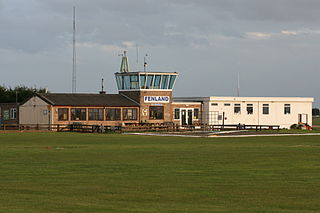
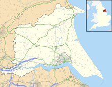
Fenland Airfield or Fenland Aerodrome is located 6 nautical miles southeast of the town Spalding near the small village of Holbeach St Johns in Lincolnshire, England.
Tatenhill Airfield, previously Royal Air Force (RAF) Crossplains and later RAF Tatenhill, is a licensed airfield operated by Tatenhill Aviation Ltd, about 5 nautical miles west of Burton upon Trent, Staffordshire, England. It is part of the Needwood Survey, a 3000 hectare estate held by the Duchy of Lancaster in the area of the former Needwood Forest.

London Elstree Aerodrome is an operational general aviation aerodrome located in Elstree, and is situated 2.6 nautical miles east of Watford, Hertfordshire, England.

Netherthorpe Aerodrome is located 2 NM west by north of Worksop, Nottinghamshire, England. The aerodrome is in the Metropolitan Borough of Rotherham close to the village of Thorpe Salvin.

Wycombe Air Park, also known as Booker Airfield, is an operational general aviation aerodrome located in Booker, Buckinghamshire, 2.4 nautical miles south-west of High Wycombe, England. The airfield celebrated its 50th year of opening on 25 April 2015. It originally opened in 1941 as RAF Booker and was primarily involved in training during World War II, remaining a military establishment until 1965.