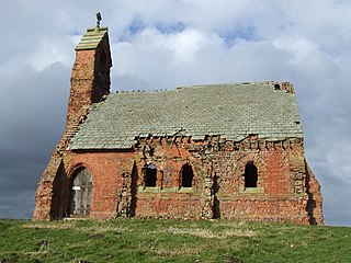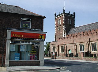
Acaster Malbis is a village and civil parish in the unitary authority of the City of York, England. It is located on the River Ouse, almost 5 miles (8 km) south of York. Nearby are the villages of Copmanthorpe 2 miles (3.2 km) to the north-west, Bishopthorpe 2 miles to the north and Appleton Roebuck 3.5 miles (6 km) to the south-west. The parish covers an area of about 2,000 acres (810 ha).

Elvington is a village and civil parish in the City of York, lying approximately 7 miles (11 km) south-east of York, England, on the B1228 York-Howden road. According to the 2001 census the parish had a population of 1,212, it increased to 1,239 at the 2011 Census. The River Derwent forms part of the parish boundary and the historic Sutton Bridge connects Elvington with Sutton upon Derwent. The village has three separate large industrial estates including a site for Yara International, a Norwegian chemical company.

Bawtry is a market town and civil parish in the City of Doncaster in South Yorkshire, England. It lies 8 miles (13 km) south-east of Doncaster, 10 miles (16 km) west of Gainsborough and 8 miles (13 km) north-west of Retford, on the border with Nottinghamshire and close to Lincolnshire. The town was historically divided between the West Riding of Yorkshire and Nottinghamshire. Its population of 3,204 in the 2001 UK census increased to 3,573 in 2011, and was put at 3,519 in 2019. Nearby settlements include Austerfield, Everton, Scrooby, Blyth, Bircotes and Tickhill.

Thornaby-on-Tees, commonly referred to as Thornaby, is a town and civil parish in North Yorkshire and falls under Stockton-on-Tees Borough Council, England. The parish had a population of 24,741 at the 2011 census, in the Teesside built-up area. It is located on the south bank of the River Tees.

Finningley is a village and civil parish in the City of Doncaster, South Yorkshire, England. Historically in Nottinghamshire, it lies on the A614 road between Bawtry and Thorne, about 6 miles south-east of Doncaster. In the 2011 census, it had a population of 1,497. The Finningley ward of Doncaster Metropolitan Borough Council covers 16.8 square miles, including the villages of Auckley, Branton, Blaxton, Hayfield and Bessacarr Grange, and part of Cantley.

Hatfield is a town and civil parish in the City of Doncaster in South Yorkshire, England. It had a population of 17,236 at the 2011 Census. The town is located on the A18 road between Doncaster and Scunthorpe, and to the west of the M18 motorway. It shares a railway station with Stainforth on the line between Goole and Scunthorpe, and Doncaster. Recorded history in the parish extends as far back as 730, when Bede wrote about the Northumbrian King, Edwin, being killed in battle in the area.

Market Weighton is a town and civil parish in the East Riding of Yorkshire, England. It is one of the main towns in the East Yorkshire Wolds and lies midway between Hull and York, about 20 miles (32 km) from either one. According to the 2021 UK Census Market Weighton parish had a population of 7,459, an increase on the 2001 UK census figure of 5,212.

Holme-on-Spalding-Moor is a large village and civil parish in the East Riding of Yorkshire, England. It is situated approximately 7 miles (11 km) north-east of Howden and 5 miles (8 km) south-west of Market Weighton. It lies on the A163 road where it joins the A614 road.

Hollym is a small village and civil parish in the East Riding of Yorkshire, England, in an area known as Holderness. It is situated approximately 2 miles (3 km) south of Withernsea and is on the A1033 road.

Topcliffe is a village and civil parish in North Yorkshire, England. The village is situated on the River Swale, on the A167 road and close to the A168. It is about 5 miles (8 km) south-west of Thirsk and 11 miles (18 km) south of the county town of Northallerton. It has a population of 1,489. An army barracks, with a Royal Air Force airfield enclosed within, is located to the north of the village.

Cottam is a hamlet and civil parish in the East Riding of Yorkshire, England. The hamlet is west of the B1249 Skipsea to Staxton road, and in the Yorkshire Wolds. It is 16 miles (30 km) north from the county town of Beverley, and approximately 4 miles (6 km) east from the village of Sledmere.

Skirpenbeck is a village and civil parish in the East Riding of Yorkshire, England. It is situated 2 miles (3.2 km) north-west of Stamford Bridge just north of the A166 road.

Seaton Ross is a village and civil parish in the East Riding of Yorkshire, England. It is situated approximately 6 miles (9.7 km) west of the market town of Market Weighton and 3 miles (4.8 km) north-west of the village of Holme-on-Spalding-Moor. It lies to the south of the A1079 road and north of the A163 road.
Pollington is a village and civil parish in the East Riding of Yorkshire, England. It is situated approximately 2 miles (3.2 km) south-west of the town of Snaith and 1 mile (1.6 km) south of the M62 motorway. It lies on the north bank of the Aire and Calder Navigation.

Huggate is a village and civil parish in the East Riding of Yorkshire, England. It is situated approximately 13 miles (21 km) north-west of Beverley town centre and 9 miles (14 km) west of Driffield town centre. The village of North Dalton lies 4 miles (6 km) to the south-east.

Holmpton is a village and civil parish in the East Riding of Yorkshire, England, in an area known as Holderness. It is situated approximately 3 miles (5 km) south of Withernsea town centre and 3 miles (5 km) east of the village of Patrington. It lies just inland from the North Sea coast.
Bellasize is a hamlet and former civil parish, now in the parish of Blacktoft, in the East Riding of Yorkshire, England. It is situated approximately 5 miles (8 km) east of the market town of Howden. In 1931 the parish had a population of 122.
Royal Air Force Full Sutton or RAF Full Sutton is a former Royal Air Force station located 2 miles (3.2 km) south east of Stamford Bridge, East Riding of Yorkshire and 4.7 miles (7.6 km) north west of Pocklington, East Riding of Yorkshire, England. The base did not open until May 1944, and so was the last airfield built for RAF Bomber Command.

Royal Air Force Catfoss, or more simply RAF Catfoss, is a former Royal Air Force station during the Second World War. It was located 4 miles (6.4 km) west of Hornsea, East Riding of Yorkshire, England and 8 miles (13 km) north-east of Leconfield, East Riding of Yorkshire, with the nearest village being Brandesburton.

Sutton-on-Hull is a suburb of the city of Kingston upon Hull, in the ceremonial county of the East Riding of Yorkshire, England. It is located 3 miles (4.8 km) north east of the city centre and has the B1237 road running through it which connects the A165 road with the A1033.


