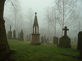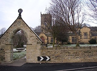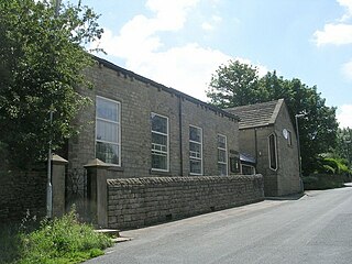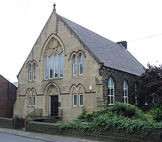
Kirkburton is a village, civil parish and ward in Kirklees in West Yorkshire, England. It is 5 miles (8 km) south-east of Huddersfield. Historically part of the West Riding of Yorkshire, the township comprised the villages of Kirkburton and Highburton and several hamlets, including Thunder Bridge, Thorncliffe, Storthes Hall and Linfit. According to the 2011 census the civil parish had a population of 26,439, while the village had a population of 4,299.

Shelley is a village in the civil parish of Kirkburton, in the Kirklees district, in the county of West Yorkshire, England. The village is 3 miles (5 km) north of Holmfirth and 6 miles (10 km) south-east of Huddersfield.

Hartshead is a village in the Kirklees district of West Yorkshire, England, 3.7 miles (6 km) west of Dewsbury and near to Hartshead Moor.

Carlton is a village in the Metropolitan Borough of Barnsley in South Yorkshire, England. It is situated between the villages of Athersley and Royston. The village is split in two with one half in the Monk Bretton ward and the rest in the Royston ward of the Barnsley MBC. It was built up on coking and coal mining industries and now has one of the largest industrial estates within the surrounding area. In the industrial estate lies a glass recycling plant, called Rexam. To its east stands the Mr Kipling cake factory, owned by Premier Foods. Until 1974 it was in the West Riding of Yorkshire.

Barugh is a village in the metropolitan borough of Barnsley in South Yorkshire, England. The village falls within the Barnsley Metropolitan ward of Darton West. Until 1974 it was in the West Riding of Yorkshire.

Ardsley is a small village approximately 3 miles (5 km) east from Barnsley and forms part of the Metropolitan Borough of Barnsley of South Yorkshire, England. The village is in the Stairfoot ward of Barnsley Metropolitan Council. It is historically part of the West Riding of Yorkshire. The A635 divides the village into two parts.

Clayton West is a village in the parish of Denby Dale, in Kirklees, West Yorkshire, England. It had a population of 4.386 and 2,704 in 2008. It is 9 miles (14 km) south-east of Huddersfield and 7 miles (11 km) north-west of Barnsley.

Lepton is a village near Huddersfield in the parish of Kirkburton, in the Kirklees district of West Yorkshire, England. It is 4.25 miles (7 km) to the east of Huddersfield on the A642 road, 120 metres (390 ft) above the town centre directly north of Lepton Great Wood. In 1931 the parish had a population of 3,323.
Thurstonland and Farnley Tyas was an urban district in the West Riding of Yorkshire from 1925 to 1938.

Kirkheaton is a village in the parish of Kirkburton, in the Kirklees district of West Yorkshire, England, Historically, it is part of the West Riding of Yorkshire. It is 3 miles (5 km) north-east of Huddersfield, in the Dalton ward of Kirklees Council. In 2021 it had a population of 3,496.

Greasbrough is a small suburb in Rotherham, in South Yorkshire, England. The suburb falls in the Greasbrough Ward of Rotherham Metropolitan Borough Council. Greasbrough had its own local council, Greasbrough UDC, until its absorption into the County Borough of Rotherham in 1936. Until 1974 it was in the West Riding of Yorkshire.

Flockton is a village in the civil parish of Kirkburton, in Kirklees, West Yorkshire, England. It is halfway between Huddersfield and Wakefield. In 2020, the population of Flockton and Flockton Green was estimated to be 2,107.

Scholes is a village and former civil parish, now in the parish of Holme Valley, in Kirklees, West Yorkshire, England. It is situated 1 mile (2 km) to the south-east and above Holmfirth, 7 miles (11 km) south-west of Huddersfield, in the Holme Valley. It has a population of 1,990. The name Scholes may have originated from the Scandinavian language meaning 'the temporary huts or sheds'.

Thurlstone is a village and former civil parish, now in the parish of Penistone, in the metropolitan borough of Barnsley, in South Yorkshire, England. Originally it was a small farming community. Some industries developed using water power from the River Don such as corn milling, wire drawing and various wool and cloth processes. Most of these are now gone and only James Durrans and Service Direct owned by 'Don Eddie' remain. The village is now a dormitory for the urban areas of South and West Yorkshire. The village now falls in the Penistone West ward of the Barnsley MBC.

Thurstonland is a village in the civil parish of Kirkburton, in Kirklees, West Yorkshire, England. It has a population of almost 400.

Hepworth is a village and former civil parish, now in the parish of Holme Valley, in the metropolitan borough of Kirklees, in West Yorkshire, England. It is southeast of Holmfirth and southwest of Jackson Bridge. In 1931 the parish had a population of 840.

Farnley Tyas is a village in the parish of Kirkburton, in the Kirklees district, in the county of West Yorkshire, England 3 miles (4.8 km) south east of Huddersfield. It is located on a hilltop between Almondbury, Castle Hill, Thurstonland and Honley. It is mostly rural and farmland with private housing and some local authority social housing. In 1921 the parish had a population of 486.

Minskip is a village in the civil parish of Boroughbridge, in North Yorkshire, England. It is on the A6055 road and 1 mile south-west of Boroughbridge. Minskip appears in the Domesday Book as Minescip, a name derived from the Old English gemaenscipe meaning a community or communal holding.

Soyland is a village in the civil parish of Ripponden, in Calderdale, West Yorkshire, England. It is just north of Ripponden off the A58 road and is 5 miles (8 km) south west of Halifax. The village referred to as Soyland Town, used to be the site of several textile mills, but these have closed down. The walking route Calderdale Way passes through the area.

Midgley is a hill-top village in Calderdale, West Yorkshire, England. It is situated approximately 12 miles (20 km) east from Burnley and 4 miles (6 km) west-north-west of Halifax, and just north of the A646 road. Nearby villages are Mytholmroyd 1 mile (1.6 km) to the west-south-west, and Hebden Bridge 2.5 miles (4.0 km) to the west-north-west.


