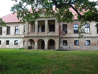
The Leineschloss, situated on the Leine in Hanover, Germany, is the former residence of the Hanoverian kings and the current seat of the Landtag of Lower Saxony.

Ośno Drugie is a village in the administrative district of Gmina Aleksandrów Kujawski, within Aleksandrów County, Kuyavian-Pomeranian Voivodeship, in north-central Poland. It lies 3 kilometres (2 mi) south of Aleksandrów Kujawski and 22 km (14 mi) south of Toruń.

Jesionowo is a village in the administrative district of Gmina Tuchola, within Tuchola County, Kuyavian-Pomeranian Voivodeship, in north-central Poland. It lies approximately 2 kilometres (1 mi) north of Tuchola and 57 km (35 mi) north of Bydgoszcz.

Sławoszewo is a village in the administrative district of Gmina Żnin, within Żnin County, Kuyavian-Pomeranian Voivodeship, in north-central Poland. It lies approximately 7 kilometres (4 mi) west of Żnin and 41 km (25 mi) south-west of Bydgoszcz.

Świerczewo is a village in the administrative district of Gmina Żnin, within Żnin County, Kuyavian-Pomeranian Voivodeship, in north-central Poland. It lies approximately 5 kilometres (3 mi) west of Żnin and 39 km (24 mi) south-west of Bydgoszcz.

Krotoszyn is a village in the administrative district of Gmina Barcin, within Żnin County, Kuyavian-Pomeranian Voivodeship, in north-central Poland. It lies approximately 1 kilometre (1 mi) south-east of Barcin, 18 km (11 mi) east of Żnin, and 31 km (19 mi) south of Bydgoszcz.
Jałówka-Kolonia is a village in the administrative district of Gmina Sidra, within Sokółka County, Podlaskie Voivodeship, in north-eastern Poland.

Rzuchów is a village in the administrative district of Gmina Sadowie, within Opatów County, Świętokrzyskie Voivodeship, in south-central Poland. It lies approximately 3 kilometres (2 mi) north of Sadowie, 9 km (6 mi) north-west of Opatów, and 53 km (33 mi) east of the regional capital Kielce.

Przeździecko-Dworaki is a village in the administrative district of Gmina Andrzejewo, within Ostrów Mazowiecka County, Masovian Voivodeship, in east-central Poland. It lies approximately 4 kilometres (2 mi) north-east of Andrzejewo, 24 km (15 mi) east of Ostrów Mazowiecka, and 110 km (68 mi) north-east of Warsaw.

Zaręby-Choromany is a village in the administrative district of Gmina Andrzejewo, within Ostrów Mazowiecka County, Masovian Voivodeship, in east-central Poland. It lies approximately 7 kilometres (4 mi) east of Andrzejewo, 27 km (17 mi) east of Ostrów Mazowiecka, and 113 km (70 mi) north-east of Warsaw.

Osówka is a village in the administrative district of Gmina Tarnówka, within Złotów County, Greater Poland Voivodeship, in west-central Poland. It lies approximately 4 kilometres (2 mi) north-east of Tarnówka, 12 km (7 mi) west of Złotów, and 108 km (67 mi) north of the regional capital Poznań.

Miroszewo is a village in the administrative district of Gmina Przechlewo, within Człuchów County, Pomeranian Voivodeship, in northern Poland. It lies approximately 7 kilometres (4 mi) north-east of Przechlewo, 23 km (14 mi) north of Człuchów, and 104 km (65 mi) south-west of the regional capital Gdańsk.

Wielka Wieś is a village in the administrative district of Gmina Główczyce, within Słupsk County, Pomeranian Voivodeship, in northern Poland. It lies approximately 28 km (17 mi) north-east of Słupsk and 87 km (54 mi) west of the regional capital Gdańsk.

Polskie Gronowo is a village in the administrative district of Gmina Gniew, within Tczew County, Pomeranian Voivodeship, in northern Poland. It lies approximately 6 kilometres (4 mi) north of Gniew, 26 km (16 mi) south of Tczew, and 56 km (35 mi) south of the regional capital Gdańsk.
Okopa is a settlement in the administrative district of Gmina Bartoszyce, within Bartoszyce County, Warmian-Masurian Voivodeship, in northern Poland, close to the border with the Kaliningrad Oblast of Russia.
Michałowo is a village in the administrative district of Gmina Susz, within Iława County, Warmian-Masurian Voivodeship, in northern Poland.

Lubień is a settlement in the administrative district of Gmina Miłomłyn, within Ostróda County, Warmian-Masurian Voivodeship, in northern Poland. It lies approximately 4 kilometres (2 mi) south of Miłomłyn, 9 km (6 mi) north-west of Ostróda, and 44 km (27 mi) west of the regional capital Olsztyn.

Sentema is a town in Wakiso District, central Uganda. The town is a municipality under Wakiso District Administration. The other municipalities in the district include:

http://forthjunction.ca/blindman-valley-railway.htmFile:Canada+Alberta+location+map+2.svgFile:Red+pog.svgHoadley+Location+of+Hoadley+Alberta

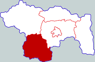
Xiangcheng County is a county in the central part of Henan province, China. It is located in the southwest of the prefecture-level city of Xuchang, and is its southernmost county-level division.


