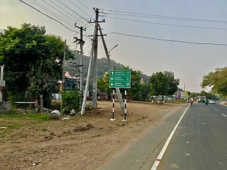
The Godavari is India's second longest river after the Ganga River and drains the third largest basin in India, covering about 10% of India's total geographical area. Its source is in Trimbakeshwar, Nashik, Maharashtra. It flows east for 1,465 kilometres (910 mi), draining the states of Maharashtra (48.6%), Telangana (18.8%), Andhra Pradesh (4.5%), Chhattisgarh (10.9%) and Odisha (5.7%). The river ultimately empties into the Bay of Bengal through an extensive network of distributaries. Measuring up to 312,812 km2 (120,777 sq mi), it forms one of the largest river basins in the Indian subcontinent, with only the Ganga and Indus rivers having a larger drainage basin. In terms of length, catchment area and discharge, the Godavari is the largest in peninsular India, and had been dubbed as the Dakshina Ganga.

East Godavari is a district in the Coastal Andhra region of Andhra Pradesh, India. Its district headquarters is at Rajamahendravaram.

Rajahmundry, officially Rajamahendravaram, is a city in the Indian state of Andhra Pradesh and district headquarters of East Godavari district. It is the seventh most populated city in the state. During British rule, the district of Rajahmundry was created in the Madras Presidency in 1823. It was reorganised in 1859 and bifurcated into the Godavari and Krishna districts. Rajahmundry was the headquarters of Godavari district, which was further bifurcated into East Godavari and West Godavari districts in 1925. It is administered under Rajahmundry revenue division of the East Godavari district. The city is known for its floriculture, history, culture, agriculture, economy, tourism, and its heritage. It is known as the "Cultural Capital of Andhra Pradesh".

The West Godavari district is a coastal district in the Indian state of Andhra Pradesh with an administrative headquarters in Bhimavaram. As of the 2011 Census of India, the district has an area of 2,178 km2 (841 sq mi) and a population of 1,779,935. It is bounded by the Krishna district and Bay of Bengal to the south, East Godavari district to the east, and Eluru district, Kolleru Lake and Upputeru Drain to the northwest.
Malikipuram is a town of Dr. B.R. Ambedkar Konaseema district in Andhra Pradesh, India. It is located in the Amalapuram revenue division.
Rajahmundry Rural mandal, officially known as Rajamahendravaram Rural mandal, is one of the 19 mandals in East Godavari district of the state of Andhra Pradesh, India. The mandal is bounded by Seethanagaram mandal, Korukonda mandal, Rajanagaram mandal, Kadiam mandal and Atreyapuram mandal.

Jayakwadi dam is an earthen dam located on Godavari river at the site of Jayakwadi village in Paithan taluka of Aurangabad district in Maharashtra, India. It is a multipurpose project. The water is mainly used to irrigate agricultural land in the drought-prone Marathwada region of the state. It also provides water for drinking and industrial usage to nearby towns and villages and to the municipalities and industrial areas of Sambhajinagar and Jalna districts. The surrounding area of the dam has a garden and a bird sanctuary.
Divili is a south Indian village in Peddapuram Mandal in East Godavari District of Andhra Pradesh. It covers an area of 213 hectares. As of the year 2011, it had a population of 4,338.
Chandramampalle is a south Indian village in Peddapuram Mandal in East Godavari District of Andhra Pradesh. It covers an area of 121 hectares. As of the year 2011, it had a population of 1,897.
Seethanagaram is one of the 19 mandals in East Godavari district of the state of Andhra Pradesh, India. Its headquarters are located at Seethanagaram. The mandal is bounded by Devipatnam mandal, Korukonda mandal, Rajahmundry (rural) mandal and a part of it lies on the banks of Godavari River. It is sub urban growth of Rajamahendravaram City.
Eelakolanu is a village located 20 kilometers from Rajahmundry in Andhra Pradesh, India. It is knowns for mangoes and cashews, and is in close proximity to National Highway 5, ADB road and Rajahmundry airport, and engineering and medical colleges. Its land can be used for several multiples purpose like farming, housing, and industrial. Due to this, real estate is in booming and land prices are soaring.
Karanjgaon is a village on the bank of river Godavari in Niphad Taluka, Nashik District.

Mukkamala is a village in Ambajipeta mandal of East Godavari district, Andhra Pradesh, India.
Someswaram is a village in Rayavaram Mandal in East Godavari District of Andhra Pradesh, India. Is there Someswara Swamy temple Lord siva is one of the astha(8) Soma lingas in Drakasharama

Bhadradri Kothagudem is a district in the east of the Indian state of Telangana. Kothagudem is the district headquarters. It is the largest district in Telangana, with an area of 7483 km2. It borders the districts Khammam, Mahabubabad, Mulugu, Eluru and East Godavari, and shares a boundary with the bordering states Chhattisgarh and Andhra Pradesh. The district comprises 24 mandals and 2 revenue divisions, Kothagudem and Bhadrachalam.

Biccavolu mandal is one of the 19 mandals in East Godavari district of the Indian state of Andhra Pradesh. It is under the administration of Rajahmundry revenue division and the headquarters are located at Biccavolu village. Biccavolu Mandal is bounded by Rayavaram Mandal towards South, Pedapudi Mandal towards East, Anaparthy Mandal towards west, Ramachandrapuram Mandal towards north. It is located ata distance of 41 kilometres from Rajahhmundry.
Samalkota mandal is one of the 21 mandals in Kakinada district of Andhra Pradesh. As per the 2012 census, the mandal is composed of one town and 17 villages.
Pedapudi mandal is one of the 21 mandals in Kakinada District of Andhra Pradesh. As per census 2011, there are 17 villages.
Rangampeta Mandal is one of the 19 mandals in East Godavari District of Andhra Pradesh. As per census 2011, there are 15 villages.
Thallarevu Mandal is one of the 21 mandals in Kakinada district of Andhra Pradesh. As per census 2011, there are 13 villages.


