
A tram is a urban rail transit in which vehicles, whether individual railcars or multiple-unit trains, run on tramway tracks on urban public streets; some include segments on segregated right-of-way. The tramlines or tram networks operated as public transport are called tramways or simply trams/streetcars. Because of their close similarities, trams are commonly included in the wider term light rail, which also includes systems separated from other traffic.

Transport in the United Kingdom is facilitated by road, rail, air and water networks. Some aspects of transport are a devolved matter, with each of the countries of the United Kingdom having separate systems under separate governments.
Transport in Venezuela revolves around a system of highways and airports. Venezuela is connected to the world primarily via air and sea. In the south and east the Amazon rainforest region has limited cross-border transport; in the west, there is a mountainous border of over 1,375 miles (2,213 km) shared with Colombia. The Orinoco River is navigable by oceangoing vessels up to 400 km inland, and connects the major industrial city of Ciudad Guayana to the Atlantic Ocean.
The Beeching cuts, also colloquially referred to as the Beeching Axe, were a major series of route closures and service changes made as part of the restructuring of the nationalised railway system in Great Britain in the 1960s. They are named for Dr. Richard Beeching, then-chair of the British Railways Board and the author of two reports – The Reshaping of British Railways (1963) and The Development of the Major Railway Trunk Routes (1965) – that outlined the necessity of improving the efficiency of the railways and the plan for achieving this through restructuring.

The ER200 was a Soviet electric train built in Riga by Rīgas Vagonbūves Rūpnīca. It was the first high-speed Direct Current intercity Electric Multiple Unit (EMU) train with rheostatic brake. There were two designs. The first design, begun in 1974, was the ER200-1 EMU, and went into commercial operation in 1984. The second design went into operation between Saint Petersburg and Moscow in 1996.
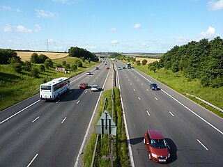
The United Kingdom has a well developed and extensive network of roads totalling about 262,300 miles (422,100 km). Road distances are shown in miles or yards and UK speed limits are indicated in miles per hour (mph) or by the use of the national speed limit (NSL) symbol. Some vehicle categories have various lower maximum limits enforced by speed limiters. A unified numbering system is in place for Great Britain, whilst in Northern Ireland, there is no available explanation for the allocation of road numbers.

Roads in India are an important mode of transport in India. India has a network of over 6,331,791 kilometres (3,934,393 mi) of roads. It is the second-largest road network in the world, after the United States. At of roads per square kilometre of land, the quantitative density of India's road network is equal to that of Hong Kong, and substantially higher than the United States, China, Brazil and Russia. Adjusted for its large population, India has approximately 5.13 kilometres (3.19 mi) of roads per 1,000 people, which is much lower than United States 20.5 kilometres (12.7 mi) but higher than that of China 3.6 kilometres (2.2 mi). India's road network carries over 71% of its freight and about 85% of passenger traffic.
Manikgad / is an ancient fort in Jiwati tehsil,Chandrapur district, Maharashtra. It is a hill fort 507 metres above sea level built by the Naga kings in 9 CE. The fort is in ruins and is frequented by wild animals that live in the vicinity, such as panthers and boars. Several monuments of historical importance are nearby.

Wani is a 3rd largest city in Yavatmal district in the Indian state of Maharashtra.
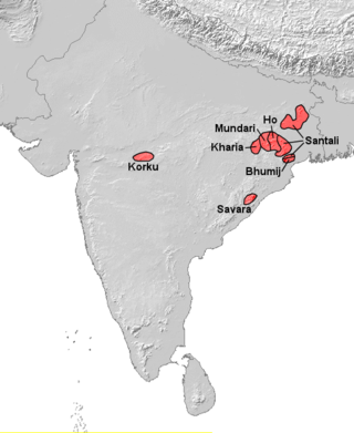
Korku is an Austroasiatic language spoken by the Korku people of central India, in the states of Madhya Pradesh and Maharashtra. It is isolated in the midst of the Gondi people, who are Dravidian, while its closest relatives are in eastern India. It is the westernmost Austroasiatic language.
Korpana is a City and a tehsil in Rajura subdivision of Chandrapur district in Nagpur revenue Division in the Vidarbha region in the state of Maharashtra, India. This is Last Tehsil Place In Chandrapur District. The Telangana border and Yavatmal district .Also this taluka is leading in cement production in Maharashtra. It has 4 big cement factories in the country and 1 coal mine.The taluka covers a total of 113 villages.
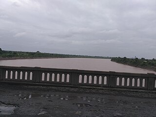
The Painganga River is the chief river of the Buldhana district, Hingoli district, Nanded district, Yavatmal district, Chandrapur district and Washim district in the Maharashtra state in India. It flows along the southeast boundaries of the district in a winding, meandering course. It is deeply entrenched and difficult to navigate. It rises in the Ajantha range and is a major tributary of the Wardha River, the other major river in the district. It is also divided Marathwada and Vidarbha near Umarkhed and Himayatnagar.

Passenger load factor, or load factor, measures the capacity utilization of public transport services like airlines, passenger railways, and intercity bus services. It is generally used to assess how efficiently a transport provider fills seats and generates fare revenue.

Rajura Assembly constituency is one of the six constituencies of the Maharashtra Vidhan Sabha located in Chandrapur district.

Public transport is a system of transport for passengers by group travel systems available for use by the general public unlike private transport, typically managed on a schedule, operated on established routes, and that may charge a posted fee for each trip. There is no rigid definition of which kinds of transport are included, and air travel is often not thought of when discussing public transport—dictionaries use wording like "buses, trains, etc." Examples of public transport include city buses, trolleybuses, trams and passenger trains, rapid transit and ferries. Public transport between cities is dominated by airlines, coaches, and intercity rail. High-speed rail networks are being developed in many parts of the world.
Amalnalla Dam, is an earthfill dam on Amalnalla river near Gadchandur Ta.Korpana Chandrapur district in state of Maharashtra in India.
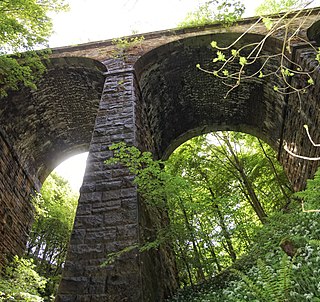
In transport terminology, network length refers to the total length of a transport network, and commonly also refers to the length of any fixed infrastructure associated with the network.
Nanda is a town in Chandrapur district in the state of Maharashtra, India.

National Highway 19 is a national highway in India. It was previously referred to as Delhi–Kolkata Road and is one of the busiest national highways in India. After renumbering of national highways, Delhi to Agra route is now national highway 44 and Agra to Kolkata route is numbered national highway 19. It constitutes a major portion of the historical Grand Trunk Road. It is also part of AH1 of Asian Highway Network, that traverses from Japan to Turkey.
National Highway 353B, or NH-353B is a national highway in India. It is a spur road of National Highway 53. It traverses the states of Maharashtra and Telangana in India.
