
Gadchiroli district is an administrative district in Maharashtra, India. The city of Gadchiroli is the administrative headquarters of the district.

Central Railway is one of the 19 zones of Indian Railways. Its headquarters is in Mumbai at Chhatrapati Shivaji Maharaj Terminus. It has the distinction of operating the first passenger railway line in India, which opened from Mumbai to Thane on 16 April 1853.
Shegaon is a city and municipal council in the Buldhana district in the Indian state of Maharashtra. Shegaon has become a pilgrimage centre due to the influence of Shri Sant Gajanan Maharaj, who is a Hindu saint.
Wardha is a city and a municipal council in Wardha district in the Indian state of Maharashtra. The administrative headquarter of Wardha district is situated here. Wardha gets its name from the Wardha River which flows on the northern, western and southern boundaries of the district. Founded in 1866, the town is now an important centre for cotton trade. Wardha was an important part of the Gandhian era.

Chandrapur district is a district in the Nagpur Division in the Indian state of Maharashtra. Chandrapur was the largest district in India until the Gadchiroli and Sironcha tehsils were separated as Gadchiroli district in 1981. In 2011, the district population was 2,204,307.

Seoni is a city and a municipality in Seoni district in the Indian state of Madhya Pradesh. This tribal household dominated district was formed in the year 1956.

Chandrapur is a city and a municipal corporation in Chandrapur district, Maharashtra state, India. It is the district headquarters of Chandrapur district. Chandrapur is a fort city founded by Khandkya Ballal Shah, a Gond king of the 13th century. The city sits at the confluence of the Erai river and Zarpat river. The area around the city is rich in coal seams.. Hence, Chandrapur is also known as the "Black Gold City".
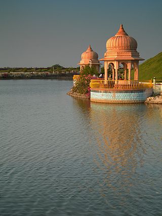
Gadchiroli ( [ɡəɖt͡ʃiɾoliː]) is a city and a municipal council in Gadchiroli district in the state of Maharashtra, central India. It is located in eastern Maharashtra, and is the administrative headquarters of the district. Gadchiroli is called the lung of Maharashtra as almost 70% of this district is covered by forests having 21% of the total forest cover of the state. The main river flowing through city is the Wainganga River. The landscape is lush and green during the monsoon season which is prone to flooding. Gadchiroli is known for its forests. Teak is grown commercially and bamboos are used for various crafts.
Ghugus is a census town in Chandrapur district in the Indian state of Maharashtra.

Sirpur-Kaghaznagar is a town and a municipality in Komaram Bheem Asifabad district in the state of Telangana in India. It is located about 297 kilometres from the state capital, Hyderabad, 140 kilometres from Karimnagar, 90 km from Chandrapur and 250 kilometres from Nagpur.

Wani is a 3rd largest city in Yavatmal district in the Indian state of Maharashtra.

Bhadravati is a city and a municipal council in Chandrapur district in the state of Maharashtra, India. It lies 26 km from Chandrapur city. Bhadravati city has recently bagged the Best City in 'Innovation & Best Practices' award under the population Category - 50K to 1 Lakh from the Government of India under Swach Surverkshan Awards-2021. It has also bagged 8th Rank in being the cleanest city under category population Category - 50K to 1 Lakh under Swach Surverkshan Awards-2021 amongst 132 cities nominated.
Chimur is a city and a municipal council in Chandrapur District, in the state of Maharashtra, India. It is one of the Indian Parliamentary Constituencies and a Vidhan Sabha constituency.

Sirpur (T) is a town and a mandal in Komaram Bheem district of the Indian state of Telangana.
Nagpur CR railway division is one of the five railway divisions under Central Railway zone of Indian Railways. This railway division was formed in 1867 and its headquarter is located at Nagpur in the state of Maharashtra of India.
Balharshah railway station is a railway station serving Ballarpur town, in Chandrapur district of Maharashtra state in India. Established by the Nizam's Guaranteed State Railway, it is now under the Nagpur CR railway division of Central Railway Zone of Indian Railways. It is an important junction on New Delhi–Chennai main line of Indian Railways. It is located at 185 m above sea level and has 5 platforms. The Ballarshah–Wardha–Nagpur section was electrified in 1989.
Chandrapur railway station is a railway station serving Chandrapur city in Chandrapur district of Maharashtra state of India. It is under the Nagpur CR railway division of Central Railway zone of Indian Railways. It is located on the New Delhi–Chennai main line of Indian Railways.
Chanda Fort Railway Station is one of the two main railway stations serving Chandrapur city in Chandrapur district in Maharashtra state in India. It is under Nagpur SEC railway division of South East Central Railway zone of Indian Railways. It is located on Gondia–Nagbhid–Balharshah line of Indian Railways.
Nagbhir Junction railway station is a junction railway station on Gondia–Nagbhir–Balharshah line and Nagpur–Nagbhir line in Nagpur SEC railway division of South East Central Railway Zone of Indian Railways. It serves Nagbhid town in Chandrapur district in Maharashtra state in India. It is located at 246 m above sea level and has two platforms. 12 trains stop at this station.
Ballarpur Fort is an ancient fort in Chandrapur district, Maharashtra, India. It is located in the Ballarpur city, on the east banks of the Wardha River.

