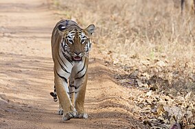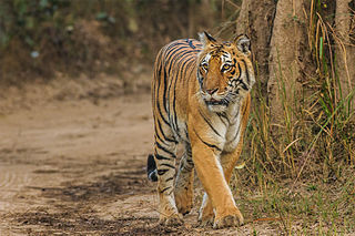
Jim Corbett National Park is a national park in India located in the Nainital district of Uttarakhand state. The first national park in India, it was established in 1936 during the British Raj and named Hailey National Park after William Malcolm Hailey, a governor of the United Provinces in which it was then located. In 1956, nearly a decade after India's independence, it was renamed Corbett National Park after the hunter and naturalist Jim Corbett, who had played a leading role in its establishment and had died the year before. The park was the first to come under the Project Tiger initiative.

The Satpura Range is a range of hills in central India. The range rises in eastern Gujarat running east through the border of Maharashtra and Madhya Pradesh and ends in Chhattisgarh. The range parallels the Vindhya Range to the north, and these two east–west ranges divide Indian Subcontinent into the Indo-Gangetic plain of northern India and the Deccan Plateau of the south. The Narmada River originates from north-eastern end of Satpura in Amarkantak, and runs in the depression between the Satpura and Vindhya ranges, draining the northern slope of the Satpura range, running west towards the Arabian Sea. The Tapti River originates in the eastern-central part of Satpura, crossing the range in the center and running west at the range's southern slopes before meeting the Arabian Sea at Surat, draining the central and southern slopes of the range. Multai, the place of Tapti river origin is located about 465 kilometer far, south-westerly to Amarkantak, separated across by the hill range. The Godavari River and its tributaries drain the Deccan plateau, which lies south of the range, and the Mahanadi River drains the easternmost portion of the range. The Godavari and Mahanadi rivers flow into the Bay of Bengal. At its eastern end, the Satpura range meets the hills of the Chotanagpur Plateau. The Satpura Range is a horst mountain and is flanked by Narmada Graben in the north and much smaller but parallel Tapi Graben in the south.

Bandhavgarh National Park is a national park of India, located in the Umaria district of Madhya Pradesh. Bandhavgarh, with an area of 105 square kilometres (41 sq mi), was declared a national park in 1968 and then became Tiger Reserve in 1993. The current core area is spread over 716 square kilometres (276 sq mi).
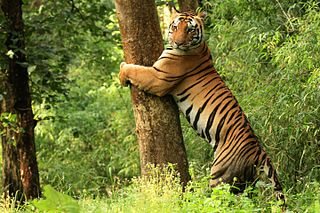
Kanha Tiger Reserve, also known as Kanha–Kisli National Park, is one of the tiger reserves of India and the largest national park of the state of Madhya Pradesh. The present-day Kanha area is divided into two protected areas, Hallon and Banjar, of 250 and 300 km2, respectively. Kanha National Park was created on 1 June 1955 and was designated tiger reserve in 1973. Today, it encompasses an area of 940 km2 (360 sq mi) in the two districts Mandla and Balaghat.
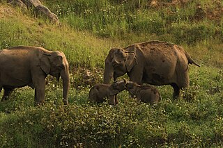
Anaimalai Tiger Reserve, earlier known as Indira Gandhi Wildlife Sanctuary and National Park and as Anaimalai Wildlife Sanctuary, is a protected area in the Anaimalai Hills of Pollachi and Valparai taluks of Coimbatore District and Udumalaipettai taluk in Tiruppur District, Tamil Nadu, India. The Tamil Nadu Environment and Forests Department by a notification dated 27 June 2007, declared an extent of 958.59 km2 that encompassed the erstwhile IGWLS&NP or Anaimalai Wildlife Sanctuary, as Anaimalai Tiger Reserve under the Wildlife Protection Act, 1972. According to the National Tiger Conservation Authority, the Reserve presently includes a core area of 958.59 km2 and buffer/peripheral area of 521.28 km2 forming a total area of 1479.87 km2.

There are four categories of protected areas in India, constituted under the Wildlife Protection Act, 1972. Tiger reserves consist of areas under national parks and wildlife sanctuaries. There are 53 tiger reserves in India. As of January 2023, the protected areas of India cover 173,629.52 square kilometres (67,038.73 sq mi), roughly 5.28% of the total geographical area of the country.

Dibru-Saikhowa National Park is a national park located in Dibrugarh and Tinsukia districts, Assam, India. It was designated a Biosphere Reserve in July 1997 with an area of 765 km2 (295 sq mi), including a core area of 340 km2 (130 sq mi) and a buffer zone of 425 km2 (164 sq mi).

Simlipal National Park is a national park and tiger reserve in the Mayurbhanj district in the Indian state of Odisha covering 2,750 km2 (1,060 sq mi). It is part of the Mayurbhanj Elephant Reserve, which includes three protected areas, Similipal Tiger Reserve, Hadgarh Wildlife Sanctuary with 191.06 km2 (73.77 sq mi) and Kuldiha Wildlife Sanctuary with 272.75 km2 (105.31 sq mi). Simlipal National Park derives its name from the abundance of red silk cotton trees growing in the area.

Chandoli National Park is a national park established in Sangli district in May 2004. Earlier it was a Wildlife Sanctuary declared in 1985. Chandoli Park is notable as the southern portion of the Sahyadri Tiger Reserve, with Koyna Wildlife Sanctuary forming the northern part of the reserve

Manas National Park is a national park, Project Tiger reserve, and an elephant reserve in Assam, India. Located in the Himalayan foothills, it borders the Royal Manas National Park in Bhutan. The park is known for its rare and endangered endemic wildlife such as the Assam roofed turtle, hispid hare, golden langur and pygmy hog. It also hosts the only known population of pygmy hogs in the world. Manas is also famous for its population of the wild water buffalo. Because of its exceptional biodiversity, scenery, and variety of habitats, Manas National Park is a biosphere reserve and a UNESCO World Heritage Site.
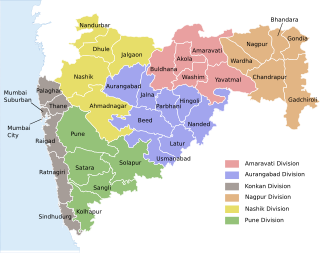
The word Maharashtra, the land of the mainly Marathi-speaking people, appears to be derived from Maharashtri, an old form of Prakrit. Some believe that the word indicates that it was the land of the Mahars and the Rattas, while others consider it to be a corruption of the term 'Maha Kantara', a synonym for 'Dandakaranya'. Maharashtra is the third largest state in India after Rajasthan and Madhya Pradesh. It covers an area of 307,713 km2 and is bordered by the states of Madhya Pradesh to the north, Chhattisgarh to the east, Telangana to the southeast, Karnataka to the south and Goa to the southwest. The state of Gujarat lies to the northwest, with the Union territory of Dadra and Nagar Haveli sandwiched between the borders. Maharashtra has coastline of 720 km.The Arabian Sea makes up Maharashtra's west coast. Maharashtra consists of two major relief divisions. The plateau is a part of the Deccan tableland and the Konkan coastal strip abutting on the Arabian Sea.

Pench Tiger Reserve or Pench National Park is a tiger reserve in India straddling across Madhya Pradesh and Maharashtra. The portion of the reserve that is in Madhya Pradesh is nestled in the southern slopes of the Satpura range of Central India. Pench Tiger Reserve comprises the Indira Priyadarshini Pench National Park, the Pench Mowgli Sanctuary and a buffer. It is the same forest area portrayed in the famous "The Jungle Book" by Rudyard Kipling. It derives its name from its life line - the River Pench. Inside the park, the river flows from North to South before going on to join the Kanhan River, while splitting the Park into two, and forming the boundary of Seoni District and Chhindwara District districts of Madhya Pradesh. The Meghdoot dam built across Pench River at Totladoh has created a large water body of 72 km2 out of which 54 km2 falls in M.P. and the rest in the adjoining state of Maharashtra. The Pench River which emerges from Mahadeo Hills of Satpuda Ranges and the various nallas and streams which drain into it, all flow through the forests of the protected area. The Satpuda ranges which bear the forests of the Protected Area act as an excellent watershed area for the Totladoh as well as lower Pench Reservoirs. On the Madhya Pradesh side, the Pench Tiger Reserve encompasses a core area of 411.33 km2, with a buffer of 768.3 km2., making for a total protected area of 1179.63 km2. The core area includes the Mowgli Pench Wildlife Sanctuary whose area is 118.30 km2. The Buffer Zone is constituted by Reserve Forests, Protected Forests and revenue land.
Sahyadri Tiger Reserve is a reserve in the state of Maharashtra, created by the Indian government in 2008. Located in the Sahyadri Ranges of the Western Ghats of Maharashtra, it is part of the ecoregions of North Western Ghats moist deciduous forests and North Western Ghats montane rain forests. These ranges form a common boundary between Maharashtra, Karnataka and Goa, and constitute rich evergreen, semi-evergreen and moist deciduous forests. The area is spread over the four districts of Satara, Sangli, Kolhapur and Ratnagiri.

The Ratapani Tiger Reserve, located in the Raisen district of Madhya Pradesh, in Vindhya Range in central India, is one of the finest teak forests in the state and is less than 50 kilometres (31 mi) away from the capital Bhopal.
The Palamau Tiger Reserve is one of the nine original tiger reserves in Jharkhand, India and the only one in this state. It forms part of Betla National Park and Palamau Wildlife Sanctuary. As of 2022, the reserve is reported to be largely under Naxal control.
Bor Tiger Reserve is a wildlife sanctuary which was declared as a tiger reserve in July 2014. It is located near Hingani in Wardha District in the Indian state of Maharashtra. It is a home to a variety of wild animals. The reserve covers an area of 138.12 km2 (53.33 sq mi). which includes the drainage basin of the Bor Dam.
Bordharan is a dam in Seloo Tahsil, Wardha District. Formed by the Bor Dam, – and a area of wide spectrum of wildlife, including sambhar, cheetal, barking deer, nilgai, tigers, leopards, and wild dogs. This place has a water reservoir surrounded by hills and beautiful landscape.

The Kamlang Wildlife Sanctuary, established in 1989, is the 50th Tiger reserve in India. In 2024, it was declared as a eco-sensitive zone. The Sanctuary is rich with floral and faunal diversity. It is situated in the Lohit District of the northeastern Indian state of Arunachal Pradesh. The park is named after the Kamlang River which flows through it. The Mishmi, Digaro Mishmi, and Miju Mishmi people tribal people who reside around the periphery of the sanctuary claim their descent from the King Rukmo of the epic Mahabharata. They believe in a myth of an invisible god known as Suto Phenkhenynon jamalu. An important body of water in the sanctuary is the Glow Lake. Located in tropical and sub-tropical climatic zones, the sanctuary is the habitat of the four big cat species of India: tiger, leopard, clouded leopard and snow leopard.
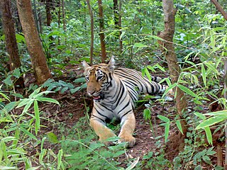
Maharashtra provides legal protection to its tiger population through six dedicated tiger reserves under the precincts of the National Tiger Conservation Authority. under the initiative Project Tiger. These reserves cumulatively cover an estimated area of 9,113 km2 which is about 3% of the total state area.

Ghodazari Wildlife Sanctuary is a wildlife reserve established in 2018 in Nagbhir in the Chandrapur district of the Vidarbha region in Maharashtra, India. It includes 159 km2 (61 sq mi) of southern tropical dry forest and a lake. The forest is considered a key region on the connecting corridor for the tiger migration between the Tadoba Andhari Tiger Project and Umred Karhandala Wildlife Sanctuary. It is named after a village of the same name that is almost in the middle of the forest, about 2 km from the dam and the resort. In Marathi, ghoda means horse and zari means a place with a water spring.
