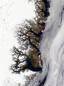
Clavering Island is a large island in eastern Greenland off Gael Hamke Bay, to the south of Wollaston Foreland.
Wollaston Foreland is a peninsula in King Christian X Land, East Greenland. Administratively it belongs to the NE Greenland National Park area.
Sabine Island is an island to the northeast of Wollaston Foreland, previously known as Inner Pendulum Island. It is in the Northeast Greenland National Park area.
Little Pendulum Island is an island in Eastern Greenland, in the Northeast Greenland National Park.

Kuhn Island is a coastal island in Hochstetter Bay, eastern Greenland. There are coal deposits on the island.
Hochstetter Bay is a broad bay in northeastern Greenland. It is part of the Northeast Greenland National Park area.

Zackenberg, or Zackenberg Research Station, is an ecosystem research station and monitoring facility situated in the Northeast Greenland National Park in northeastern Greenland. The station is owned by the Greenland Self-Government and was run by the Danish Arctic Institute until 2008. In 2009 the running of the Station was transferred to the Dept of Arctic Environment at the Danish National Environmental Research Institute
Foster Bay is a large bay of the Greenland Sea in King Christian X Land, Eastern Greenland. Administratively it belongs to the NE Greenland National Park area.

Dove Bay is a bay in King Frederick VIII Land, northeastern Greenland. It is part of the Northeast Greenland National Park area.
Hold with Hope is a peninsula in eastern Greenland. Administratively it is part of the Northeast Greenland National Park zone.
Ardencaple Fjord is a fjord in King Christian X Land, northeastern Greenland. Administratively it is part of the Northeast Greenland National Park.
Newman Bay or Newman Fjord is a fjord in northern Greenland. To the northwest, the fjord opens into the Robeson Channel of the Lincoln Sea. It is a part of the Northeast Greenland National Park.
Skaer Fjord, is a fjord in King Frederick VIII Land, northeastern Greenland.
Igtip Kangertiva, also known as Comanche Bay. is a fjord in Eastern Greenland. It is part of the Sermersooq municipality.

Bliss Bay is a bay in the Wandel Sea, Northern Greenland. The area of the bay is uninhabited. Administratively Bliss Bay and its surroundings belong to the Northeast Greenland National Park.

Constable Bay is a bay in the Wandel Sea, Northern Greenland. Administratively Constable Bay and its surroundings belong to the Northeast Greenland National Park.
Peters Bay is a bay of the Greenland Sea in King Christian X Land, Greenland. Administratively it belongs to the NE Greenland National Park area.
Godthåb Gulf, also known as Clavering Fjord, Clavering Sound and Inner Bay, is a fjord in King Christian X Land, East Greenland. Administratively it is part of the Northeast Greenland National Park zone.

Young Sound is a marine channel with a fjord structure in King Christian X Land, East Greenland. Administratively it is part of the Northeast Greenland National Park zone.
Tyrolerfjord is a fjord in King Christian X Land, East Greenland. Administratively it is part of the Northeast Greenland National Park zone.