The 1991 Nepal census was a widespread national census conducted by the Nepal Central Bureau of Statistics.

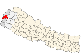
Chaukati is a village in Sindhupalchok District in the Bagmati Zone of central Nepal. At the time of the 1991 Nepal census it had a population of 2346 and had 539 houses in the village. By 2011 the population had become 2497 in 627 households.
Maneshwara is a village in Sindhupalchok District in the Bagmati Zone of central Nepal. At the time of the 1991 Nepal census it had a population of 3065 and had 642 houses in the village. By 2011 the population had become 3393 in 789 households.
Mahadevsthan is a village and former Village Development Committee that is now part of Chandragiri Municipality in Kathmandu District in Province No. 3 of central Nepal. At the time of the 1991 Nepal census it had a population of 4920 and had 867 households in it.
Sangla is a village and former Village Development Committee that is now part of Tarakeshwar Municipality in Kathmandu District in Province No. 3 of central Nepal. At the time of the 1991 Nepal census it had a population of 2625 and had 515 households in it.
Satungal is a village and former Village Development Committee that is now part of Chandragiri Municipality in Kathmandu District in Province No. 3 of central Nepal. Satungal is also known as Satyapur. At the time of the 1991 Nepal census it had a population of 2730 and had 464 households in it. At the time of the 2001 Nepal census Satungal had a population of 5834 and had 1375 households in it. Satungal had 5173 literate people i.e. 88.66%..
Sokhek is a village and former Village Development Committee that is now part of Dakshinkali Municipality in Kathmandu District in Province No. 3 of central Nepal. At the time of the 1991 Nepal census it had a population of 3980 and had 684 households in it.
Naubasta is a town in Banke District in the Bheri Zone of south-western Nepal. At the time of the 1991 Nepal census it had a population of 11,160 and had 1663 houses in the town.
Borlang is a village development committee in northern-central Nepal. As of the 1991 Nepal census it had a population of 4,737 and had 837 houses.
Walting is a village development committee in Kavrepalanchok District in the Bagmati Zone of central Nepal. At the time of the 1991 Nepal census it had a population of 2212 and had 405 houses in it.
Banakhu Chor is a village development committee in Kavrepalanchok District in the Bagmati Zone of central Nepal. At the time of the 1991 Nepal census it had a population of 3549 and had 535 houses in it.
Batase is a village development committee in Kabhrepalanchok District in the Bagmati Zone of central Nepal. At the time of the 1991 Nepal census it had a population of 1985 and had 337 houses in it.
Bhumidanda is a village development committee in Kabhrepalanchok District in the Bagmati Zone of central Nepal. At the time of the 1991 Nepal census it had a population of 3383 and had 630 houses in it.
Bhumlutar is a village development committee in Kavrepalanchok District in the Bagmati Zone of central Nepal. At the time of the 1991 Nepal census it had a population of 2284 and had 414 houses in it.
Bolde Phediche is a village development committee in Kabhrepalanchok District in the Bagmati Zone of central Nepal. At the time of the 1991 Nepal census it had a population of 2324 and had 418 houses in it.
Chyasing Kharka is a village development committee in Kabhrepalanchok District in the Bagmati Zone of central Nepal. At the time of the 1991 Nepal census it had a population of 2628 and had 501 houses in it.
Jyamdi Mandan is a village development committee in Kabhrepalanchok District in the Bagmati Zone of central Nepal. At the time of the 1991 Nepal census it had a population of 4467 and had 848 houses in it.
Situated on the bank of Kaligandaki river, Khadgakot is a town and Village Development Committee, in Gulmi District in the Lumbini Zone of central Nepal. At the time of the 1991 Nepal census it had a population of 4297 persons living in 808 individual households.
Baraipur is a village development committee in Kapilvastu District in the Lumbini Zone of southern Nepal. At the time of the 1991 Nepal census it had a population of 2769.
Pathari Shanishchare (पथरी-शनिश्चरे) is a Municipality in Morang District in the Koshi Zone of south-eastern Nepal. It was formed by merging two existing village development committees i.e. Pathari and Sanischare in May 2014.