
Vemulawada is an ancient historical and a famous pilgrimage census town in Rajanna Sircilla district of the Indian state of Telangana. It is the headquarters of Vemulawada Mandal and Revenue Division. The place is notable for Sri Raja Rajeswara Swamy temple,which is also known as “ Dakshinakashi” constructed between 760 and 973 CE, and a site of pilgrimage for Hindu worshipers. It also has ancient temples of Bheemeswara, Nagareswara and Pochamma nearby the main temple of Sri Raja Rajeswara Swamy. It was the capital of Vemulawada Chalukyas, that ruled present day Telangana, parts of Andhra Pradesh, Karnataka and Maharashtra between 7 and 10 century CE. The town attracts large number of pilgrims from South India as well as Maharashtra, Odisha and Chhattisgarh. Huge number of devotees throng the place during Maha Shivaratri and Sri Rama Navami. The famous floral festival of Telangana, Bathukamma is believed to have originated from this place.

Karimnagar district is one of the 33 districts of the Indian state of Telangana. Karimnagar city is its administrative headquarters. The district shares boundaries with Peddapalli, Jagityal, Sircilla, Siddipet, Jangaon, Hanamkonda district and Jayashankar Bhupalapally districts.

Nizamabad district is a district located in the north-western region of the Indian state of Telangana. The city of Nizamabad is the district headquarters. The district share boundaries with Jagtial, Sircilla, Nirmal, Kamareddy districts and with Nanded district of the state boundary of Maharashtra.

Siricilla is a town and the district headquarters of Rajanna Siricilla district in the Indian state of Telangana. It is located on the banks of Manair river in the Siricilla mandal of Siricilla revenue division. It is popularly known as Textile Town due to the presence of large number of power looms, textile processing and dyeing units. It is the biggest textile hub in the state of Telangana with over 40,000 power looms. Siricilla, along with Warangal is proposed to be developed as a mega textile zone by the Telangana government. The first Visalandhra Mahasabha in Telangana was held at Siricilla during the Visalandhra movement.
Chandurthi is a village and mandal headquarters located in the Rajanna Sircilla district of Telangana, India. It is home to several villages, including Ananthapalli, Bandapalle, Chandurthy, Jogapuram, Lingampeta, Mallial, Kattalingampet, Narsingapur, Marrigadda, Moodepalle, Sangula, Ramaraopally, Thimmapuram, Ashireddypally, and Yangal.
Choppadandi is a town Choppadandi constituency of Karimnagar district in the state of Telangana in India.
Boinpalle or Boinpalli is a mandal in Rajanna Sircilla district in the state of Telangana in India.
Konaraopeta is a mandal in Rajanna Sircilla district in the state of Telangana in India.
Yellareddipet is a village in Rajanna Siricilla district in the state of Telangana, India.
Mustabad is a village and mandal headquarters of Mustabad mandal, located in Rajanna Sircilla district of Telangana, India
Ellanthakunta is a mandal in Rajanna Sircilla district in the state of Telangana in India.
The Maner river or Manair or Maneru (Telugu: మానేరు) is a tributary to the Godavari River in India. It is in turn fed by the Salivagu river. This river provides drinking water to Karimnagar, Telangana and also to the NTPC power plant at Ramagundam.
Thangallapally is the Mandal of Rajanna Sircilla district in Telangana, India. It is located on the banks of Maner River, a tributary of the Godavari river. This Maner River separates it from its District Headquarters of Sircilla. Thangallaplly is situated 133 km north of Hyderabad, the capital city of Telangana.
Vemulawada Assembly constituency is a constituency of Telangana Legislative Assembly, India. It is one of 2 constituencies in Rajanna Sircilla district. It includes the temple town of Vemulawada and part of Karimnagar Lok Sabha constituency.
Siricilla Assembly constituency is a constituency of the Telangana Legislative Assembly, India. Sircilla is a town and the district headquarters of Rajanna Sircilla district in the Indian state of Telangana.
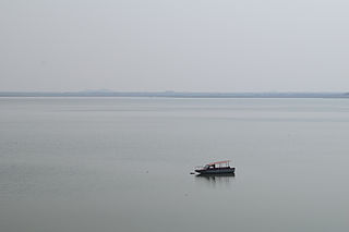
The Upper Manair Dam is a dam on the Manair River, at Narmal Village, Gambhiraopet mandal, Rajanna Sircilla district, Telangana by Nizam.

Kamareddy district is a district located in the northern region of the Indian state of Telangana. The district shares boundaries with Medak, Nizamabad, Sangareddy, Siddipet and Rajanna Sircilla districts and with the state boundary of Maharashtra and Karnataka.

Siddipet district is a district located in the northern region of the Indian state of Telangana. Its headquarters is Siddipet. This district contains a part of the Hyderabad Metropolitan Region(Markook Mulugu Wargal) The district shares boundaries with Jangaon, Sircilla, Karimnagar, Kamareddy, Hanamkonda, Yadadri, Medhchal and Medak districts.
Obulapuram is a village in Ellantakunta Mandal in the Rajanna Sircilla district of Telangana state, India.

Rajanna Sircilla district is a district in the Indian state of Telangana. Sircilla is the district headquarters. The district shares boundaries with Karimnagar, Siddipet, Jagtial, Kamareddy, and Nizamabad districts.

