Southern Nations, Nationalities, and Peoples' Region is a multinational regional state in southwestern Ethiopia. It was formed from the merger of five kililoch, called Regions 7 to 11, following the regional council elections on 21 June 1992. Its government is based in Hawassa.

Gamu-Gofa was a province in the southern part of Ethiopia, named after two of the ethnic groups living within its boundaries, the Gamo and the Gofa. First incorporated into Ethiopia by Emperor Menelik II in the 1880s, its capital was first at Chencha, then around 1965 the capital was moved to Arba Minch. This province was bordered on the west and north by Kaffa, on the north and east by Sidamo, on the southeast by Lake Chew Bahir, and on the south by Kenya and Lake Turkana.

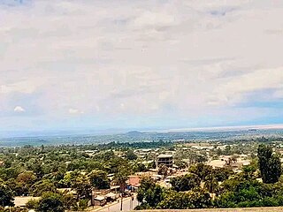
Arba Minch is a city and separate woreda in southern Ethiopia. Located in the Gamo Zone of the Southern Nations, Nationalities, and Peoples Region about 500 kilometers south of Addis Ababa, at an elevation of 1285 meters above sea level. It is the largest town in Gamo Gofa Zone and the second town in SNNPR next to Awassa. It is surrounded by Arba Minch Zuria woreda.

Chencha is a town in southern Ethiopia. Located in the Gamo Gofa Zone of the Southern Nations, Nationalities, and Peoples Region, 37 kilometers north of Arba Minch, Chencha has a longitude and latitude of 6°15′N37°34′E and an elevation of 2732 meters above sea level.

North Omo Zone was a zone in the Southern Nations, Nationalities, and Peoples' Region of Ethiopia. It was named after the Omo River, which flows in the western area of the former zone. In 2000 it was split into three zones: Dawro, Gamo Gofa, and Wolayita; and Basketo and Konta became special woredas.
![Konta special woreda District in the Southern Nations, Nationalities, and Peoples Region]], Ethiopia](https://upload.wikimedia.org/wikipedia/commons/thumb/8/80/Map_of_zones_of_Ethiopia.svg/320px-Map_of_zones_of_Ethiopia.svg.png)
Konta, previously called Ela, is a woreda in the Southern Nations, Nationalities, and Peoples' Region of Ethiopia. It is named after Konta people who speak the dialects called Kontatsuwa, Omotic languages. Because Konta is not part of any zone in the SNNPR, it is considered a special woreda, an administrative subdivision which is similar to an autonomous area. This special woreda is bordered on the south by the Omo River which separates it from the Gamo Gofa Zone and Selamgto woreda, Debub Omo Zone, on the west by the Keffa Zone, on the north by the Gojeb River which separates it from the Oromia Region, and on the east by the Dawro Zone; the Denchya River defines the southern part of the boundary with the Keficho Shekicho Zone. The administrative center is Ameya; other towns include Chida.
Gofa Zone was one of the 17 Zones in the Southern Nations, Nationalities, and Peoples' Region of Ethiopia. Part of the Southern Nations, Nationalities, and Peoples' Region, Gofa Zone was bordered on the south by Kamba and Daramalo woredas, on the southwest by the Debub (South) Omo Zone, on the west by the Basketo special woreda, on the northwest by Dawro Zone, on the north by the Dawro Zone, and on the east by Kucha. The administrative center of Gofa Zone is Sawla; other towns included Bulki. Gofa Zone was separated for Demba Gofa Woreda, Geze Gofa Woreda, Zala Woreda, Malo Koza Woreda, Gada Woreda, Uba Debretsehay Woreda, Oyda Woreda and the two town Administrations Sawla town and Bulki town.
Humbo is one of the woredas in the Southern Nations, Nationalities, and Peoples' Region of Ethiopia. Part of the Wolayita Zone located in the Great Rift Valley, Humbo is bordered on the southeast by Lake Abaya which separates it from the Oromia Region, on the south by the Gamo Gofa Zone, on the west by Offa, on the northwest by Sodo Zuria, on the northeast by Damot Weyde, and on the east by the Bilate River which separates it from the Sidama Zone. The administrative center of Humbo is Tebela.
Boreda Abaya was one of the 77 woredas in the Southern Nations, Nationalities, and Peoples' Region of Ethiopia. Part of the Semien Omo Zone, Boreda Abaya was bordered on the south by Arba Minch Zuria, on the southwest by Chencha, on the west by Kucha, on the north by Humbo, and on the east by Lake Abaya which separates it from the Oromia Region. Aruro Island, the largest island in Lake Abaya, was administratively part of this woreda. Towns in Boreda Abaya included Birbir and Zefene. Boreda Abaya was separated for Boreda and Mirab Abaya woredas.
Chencha is a woreda in Southern Nations, Nationalities, and Peoples' Region, Ethiopia. Part of the Gamo Zone, Chencha is bordered on the south by Arba Minch Zuria, on the west by Dita,&Gofa on the north by Kucha and Boreda, and on the east by Mirab Abaya. Towns in Chencha include Chencha, Dorze, Dokko and Ezo.
Zala Ubamale was one of the 77 woredas in the Southern Nations, Nationalities, and Peoples' Region of Ethiopia. Part of the Gamo Gofa Zone, Zala Ubamale was bordered on the south and west by the Debub Omo Zone, on the northwest by Gofa Zuria, on the northeast by Kucha, on the east by Dita Dermalo and on the southeast by Kemba. Towns in Zala Ubamale included Beto and Meleante. Zala Ubamale was divided for Uba Debretsehay and Zala woredas.
Bonke is one of the woredas in the Southern Nations, Nationalities, and Peoples' Region of Ethiopia. Part of the Gamo Gofa Zone, Bonke is bordered on the south by the Dirashe special woreda, on the west by the Weito River which separates it from Kemba, on the northwest by Deramalo, on the north by Dita, and on the east by Arba Minch Zuria. The major town in Bonke is Gerese.
Arba Minch Zuria is a woreda in Southern Nations, Nationalities, and Peoples' Region, Ethiopia. A part of the Gamo Gofa Zone located in the Great Rift Valley, Arba Minch Zuria is bordered on the south by the Dirashe special woreda, on the west by Bonke, on the north by Dita and Chencha, on the northeast by Mirab Abaya, on the east by the Oromia Region, and on the southeast by the Amaro special woreda. This woreda also includes portions of two lakes and their islands, Abaya and Chamo. Nechisar National Park is located between these lakes. City of Arba Minch is surrounded by Arba Minch Zuria.
Melokoza is one of the woredas in the Southern Nations, Nationalities, and Peoples' Region of Ethiopia. Part of the Gamo Gofa Zone, Melokoza is bordered on the south by Basketo special woreda, on the southwest by the Debub (South) Omo Zone, on the northwest by the Konta special woreda, on the north by the Dawro Zone, and on the east by Demba Gofa and Geze Gofa; the Omo River defines its northwestern boundary separating the woreda from Konta and the Dawro Zone. The major town in Melokoza is Leha.
Dawro is a zone in the Ethiopian Southern Nations, Nationalities, and Peoples' Region (SNNPR). It is located at about 500km southwest of Addis Ababa, the capital of Ethiopia and 319 km of Hawassa, the capital of the SNNPR. Dawuro is bordered on the south by Gamo Gofa Zone, on the west by the Konta special woreda, on the north by the Gojeb River which defines its boundary with the Oromia Region,Jimma zone, on the northeast by Hadiya and Kembata Tembaro Zones, and on the east by Wolayita Zone; the Omo River defines its eastern and southern boundaries. The administrative center of Dawuro was Waka before it was transferred to Tarcha.

Wolayita or Wolaita is an administrative zone in the Southern Nations, Nationalities, and Peoples' Region (SNNPR) of Ethiopia. It is named for the Welayta people, whose homeland is in the zone. Wolayita is bordered on the south by Gamo Gofa, on the west by the Omo River which separates it from Dawro, on the northwest by Kembata Tembaro, on the north by Hadiya, on the northeast by the Oromia Region, on the east by the Bilate River which separates it from Sidama Region, and on the south east by the Lake Abaya which separates it from Oromia Region. The administrative centre of Wolayita is Sodo. Other major towns are Bedessa, Areka, Dimtu, Bele, Gununo, Tebela, Gesuba and Boditi.
Mirab Abaya is one of the woredas in the Southern Nations, Nationalities, and Peoples' Region of Ethiopia. Part of the Gamo Gofa Zone, Mirab Abaya is bordered on the east and south by Lake Abaya which separates it from the Oromia Region on the east and Arba Minch Zuria on the south, on the west by Chencha, on the northwest by Borena, and on the north by the Wolayita Zone. Towns in Mirab Abaya include Birbir. Mirab Abaya was part of former Boreda Abaya woreda.
Dita is one of the woredas in the Southern Nations, Nationalities, and Peoples' Region of Ethiopia. Part of the Gamo Gofa Zone, Dita is bordered on the south by Arba Minch Zuria and Bonke, on the west by Deramalo, on the north by Kucha, and on the east by Chencha. Towns in Dita include Zeda. Dita was part of former Dita Dermalo woreda.
Oyda is one of the woredas in the Southern Nations, Nationalities, and Peoples' Region of Ethiopia. It is named after Oyda people living in this woreda. Part of the Gamo Gofa Zone, Oyda is bordered on the south by Uba Debretsehay, on the west by the Debub Omo Zone, on the north by Geze Gofa, and on the northeast by Demba Gofa. Oyda was part of former Gofa Zuria woreda.