
The Southern Nations, Nationalities, and Peoples' Region (often abbreviated as SNNPR; is a regional state in southwestern Ethiopia. It was formed from the merger of five kililoch, called Regions 7 to 11, following the regional council elections on 21 June 1992. Its government is based in Hawassa.

Sidamo was a province in the southern part of Ethiopia, with its capital city at Irgalem, and after 1978 at Awasa. It was named after an ethnic group native to Ethiopia, called the Sidama, who are located in the south-central part of the country. Their major political state was the ancient Kingdom of Sidama.

The Omo River in southern Ethiopia is the largest Ethiopian river outside the Nile Basin. Its course is entirely contained within the boundaries of Ethiopia, and it empties into Lake Turkana on the border with Kenya. The river is the principal stream of an endorheic drainage basin, the Turkana Basin.
Historically, Ethiopia was divided into provinces, further subdivided into awrajjas or districts, until they were replaced by ethnically-based regions (kililoch) and chartered cities in 1992.

Kaffa was a province on the southwestern side of Ethiopia; its capital city was Bonga. It was named after the former Kingdom of Kaffa or "Kefa".

' woreda in the southern part of Ethiopia. "Arba Minch" means "40 Springs", originated from the presence of more than 40 springs. It is located in the Gamo Zone of the Southern Nations, Nationalities, and Peoples Region about 500 kilometers south of Addis Ababa, at an elevation of 1285 meters above sea level. It is the largest town in Gamo Zone and the second town in SNNPR next to Hawassa, which is now the capital city of the newly formed Sidama Region. It is surrounded by Arba Minch Zuria woreda. This Town has plenty of natural gifts including the bridge of God, Crocodile ranch, crocodile market, different fruits and vegetables, different fishes farmed from Chamo and Abaya Lakes, more than 40 springs, different cereals, and crops, surprisingly having the two big Lakes in the country, lake Abaya and Chamo, respectively, next to Lake Tana, etc. This makes the town an attraction for domestic and international tourism.
The Kingdom of Kaffa was a kingdom located in what is now Ethiopia from 1390 to 1897, with its first capital at Bonga. The Gojeb River formed its northern border, beyond which lay the Gibe kingdoms; to the east the territory of the Konta and Kullo peoples lay between Kaffa and the Omo River; to the south numerous subgroups of the Gimira people, and to the west lay the Majangir people. The native language, also known as Kaffa, is one of the Omotic group of languages.

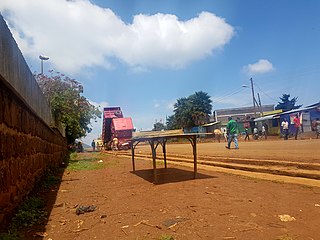
Chencha is a town in southern Ethiopia. Located in the Gamo Gofa Zone of the Southern Nations, Nationalities, and Peoples Region, 37 kilometers north of Arba Minch, Chencha has a longitude and latitude of 6°15′N37°34′E and an elevation of 2732 meters above sea level.

South Omo Zone is a zone in the Ethiopian Southern Nations, Nationalities and Peoples' Region (SNNPR). Debub Omo is bordered on the south by Kenya, on the southwest by the South Sudan, on the west by Bench Maji, on the northwest by Keffa, on the north by Konta, Gamo Gofa and Basketo, on the northeast by Dirashe and Konso, and on the east by the Oromia Region. The administrative center of Debub Omo is Jinka.

North Omo Zone was a zone in the Southern Nations, Nationalities, and Peoples' Region of Ethiopia. It was named after the Omo River, which flows in the western area of the former zone. In 2000 it was split into three zones: Dawro, Gamo Gofa, and Wolayita; and Basketo and Konta became special woredas.
Konta, previously called Ela, is a special woreda in the South West Region of Ethiopia. It is named after Konta people who speak the dialects called Kontatsuwa, Omotic languages. Because Konta is not part of any zone in the South West Region, it is considered a special woreda, an administrative subdivision which is similar to an autonomous area. This special woreda is bordered on the south by the Omo River which separates it from the Gamo Gofa Zone and Selamgto woreda, Debub Omo Zone, on the west by the Keffa Zone, on the north by the Gojeb River which separates it from the Oromia Region, and on the east by the Dawro Zone; the Denchya River defines the southern part of the boundary with the Keficho Shekicho Zone. The administrative center is Ameya; other towns include Chida.
Basketo is a woreda in the Southern Nations, Nationalities, and Peoples' Region of Ethiopia, named after its inhabitants, the Basketo people. Because Basketo is not part of any administrative Zone in the SNNPR, it is considered a special woreda—an administrative subdivision which is similar to an autonomous area.
Uba debretsehay was one of the 77 woredas in the Southern Nations, Nationalities, and Peoples' Region of Ethiopia. Part of the Gofa Zone, Uba debretsehay was bordered on the south and west by the Debub Omo Zone, on the northwest by Oyda, on the northeast by sawla, on the east by Zala and on the southeast by Kemba. Towns in Uba debretsehay included Beto and Zaba. Uba debretsehay was divided for Uba Debretsehay and Zala woredas in 2001.
Kemba is one of the woredas in the Southern Nations, Nationalities, and Peoples' Region of Ethiopia. Part of the Gamo Gofa Zone, Kemba is bordered on the southwest by the Debub Omo Zone, on the west by Uba Debretsehay, on the northwest by Zala, on the northeast by Deramalo, on the east by Bonke, and on the southeast by the Dirashe special woreda; the Weito River defines the boundary with Bonke and Dirashe. The major town in this woreda is Kemba.
Bako Gazer is one of the woredas in the Southern Nations, Nationalities, and Peoples' Region of Ethiopia. It is also called Southern Aari as it is part of the homeland of Aari people. Part of the Debub Omo Zone, Bako Gazer is bordered on the south by Bena Tsemay, on the west by the Mago River which separates it from Selamago, on the north by the Basketo special woreda and Gelila, on the northeast by the Gamo Gofa Zone, and on the east by Male. The administrative center of this woreda is Jinka; other towns in Bako Gazer include Tolta and Wub Hamer. Gelila and Male woredas were separated from Bako Gazer.
Melokoza is one of the woredas in the Southern Nations, Nationalities, and Peoples' Region of Ethiopia. Part of the Gamo Gofa Zone, Melokoza is bordered on the south by Basketo special woreda, on the southwest by the Debub (South) Omo Zone, on the northwest by the Konta special woreda, on the north by the Dawro Zone, and on the east by Demba Gofa and Geze Gofa; the Omo River defines its northwestern boundary separating the woreda from Konta and the Dawro Zone. The major town in Melokoza is Leha.
Gidole is a town in southern Ethiopia, and is the administrative center of the Dirashe special woreda. Located in the Southern Nations, Nationalities, and Peoples Region, it sits at a latitude and longitude of 05°39′N37°22′E with an elevation ranging from 2045 to 2650 meters above sea level. The town is named after the Gidole or Gardulla people, an ethnic group inhabiting southern Ethiopia better known as the Dirashe.
Gaamo Zone is a zone in the Southern Nations, Nationalities, and Peoples' Region of Ethiopia. Gaamo is bordered on the south by the Dirashe special woreda, on the southwest by Debub (South) Omo and the Basketo special woreda, on the northwest by Konta special woreda, on the north by Dawro and Wolayita, on the northeast by the Lake Abaya which separates it from the Oromia Region, and on the southeast by the Amaro special woreda. The administrative center of Gaamo is Arba Minch.
Dawro is a zone in the South West Region of Ethiopia. It is located at about 500km southwest of Addis Ababa, the capital of Ethiopia and 319 km of Hawassa, the capital of the SNNPR. Dawuro is bordered on the south by Gamo Gofa Zone, on the west by the Konta special woreda, on the north by the Gojeb River which defines its boundary with the Oromia Region,Jimma zone, on the northeast by Hadiya and Kembata Tembaro Zones, and on the east by Wolayita Zone; the Omo River defines its eastern and southern boundaries. The administrative center of Dawuro was Waka before it was transferred to Tarcha.

Wolayita or Wolaita is an administrative zone in Ethiopia. It is named for the Welayta people, whose homeland is in the zone. Wolayita is bordered on the south by Gamo Gofa, on the west by the Omo River which separates it from Dawro, on the northwest by Kembata Tembaro, on the north by Hadiya, on the northeast by the Oromia Region, on the east by the Bilate River which separates it from Sidama Region, and on the south east by the Lake Abaya which separates it from Oromia Region. The administrative centre of Wolayita is Sodo. Other major towns are Areka, Boditi, Tebela, Bele, Gesuba, Gununo, Bedessa and Dimtu.
