Khunti is the headquarter of Khunti district in the Indian state of Jharkhand. It is in South Chotanagpur division and one of the 24 districts in the Indian state of Jharkhand. The district of Khunti was carved out of Ranchi district on 12 September 2007. It is historically known as the centre of activity of the Birsa movement. As of 2011, it is the second least populous district of Jharkhand, after Lohardaga. The district is a part of the Red Corridor.
Karra block is a CD block that forms an administrative division in the Khunti Sadar subdivision of Khunti district, in the Indian state of Jharkhand.
Murhu block is a CD block that forms an administrative division in the Khunti Sadar subdivision of Khunti district, in the Indian state of Jharkhand.
Torpa block is a CD block that forms an administrative division in the Khunti Sadar subdivision of Khunti district, in the Indian state of Jharkhand.
Kitahatu is a village in Murhu block, Khunti district, in the Indian state of Jharkhand.

Khunti district is one of the twenty-four districts in South Chotanagpur division of the Indian state of Jharkhand. The district of Khunti was carved out of Ranchi district on 12 September 2007. As of 2011, it is the second least populous district of Jharkhand, after Lohardaga. Khunti town is the headquarters of the district. It is historically known as the birthplace of Birsa Munda, and being the centre of activity of the Birsa movement. It is the part of State Capital Region (SCR).
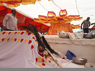
Kalas is a village in the southern state of Karnataka, India. It is located in the Kundgol taluk of Dharwad district in Karnataka. This is the native place of Guru Govindabhatta, who is the guru of Santha Shishunal Sharif. Today we can find Samadhi of Guru Govindabhatta here. His aradhana takes place every year during summer.
Gobindpur is a village located in southern part of Karra block, Khunti district. It is 50 kilometres from Ranchi, the capital of Jharkhand state.

Panchghagh Falls is a waterfall located in Khunti district in the Indian state of Jharkhand.

Badachi is a village in Belgaum district in the southern state of Karnataka, India. It is located in Athani Taluka of Belgaum District, near Bijapur -Athani Highway.
Khijri is a small village in Kamdara block in Gumla District of Jharkhand, India. It is a part of the Khijri constituency in the Legislative Assembly of Jharkhand. It is located south of the District headquarters at Gumla and 35 km from the state capital at Ranchi.

Torpa is a census town in the Torpa CD block in the Khunti Sadar subdivision of the Khunti district in the Indian state of Jharkhand.
Dorma is a small village or hamlet in Torpa Block, Khunti District, Jharkhand, India. It comes under Domra Panchayath. It is 29 km (18 mi) west from the district headquarters and 59 km (37 mi) from the state capital at Ranchi.
Lalkhatanga is a small Village/hamlet in Namkum Block in Ranchi district of Jharkhand State, India. It comes under anchal of Namkum. It is located 16 km from District headquarters and State capital Ranchi.
Siladon is a small Village/hamlet in Khunti Block in Khunti District of Jharkhand State, India. It comes under Ganeor Panchayath. It is located south of District headquarters Khunti and 30 km from State capital Ranchi.
Barudih is a small Village/hamlet in Khunti Block in Khunti District of Jharkhand State, India. It comes under Ganeor Panchayath. It is located south of District headquarters Khunti and 29 km from State capital Ranchi.
Sodag is a small Village/hamlet in Khunti Block in Khunti District of Jharkhand State, India. It comes under Ganeor Panchayath. It is located south of District headquarters Khunti and 32 km from State capital Ranchi.
Murhu is a village in the Murhu CD block in the Khunti Sadar subdivision of the Khunti district in the Indian state of Jharkhand.
Perwaghagh Falls is a waterfall with clear water flow on Chata River in the Fatka panchayat of Torpa block in Khunti district in the Indian state of Jharkhand.
Ulihatu is a village in the Arki CD block in the Khunti Sadar subdivision of the Khunti district in the Indian state of Jharkhand.


