The M4, originally the London-South Wales Motorway, is a motorway in the United Kingdom running from west London to southwest Wales. The English section to the Severn Bridge was constructed between 1961 and 1971; the Welsh element was largely complete by 1980, though a non-motorway section around Briton Ferry bridge remained until 1993. On the opening of the Second Severn Crossing in 1996, the M4 was rerouted over it.
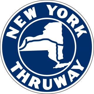
The New York State Thruway is a system of controlled-access toll roads spanning 569.83 miles (917.05 km) within the U.S. state of New York. It is operated by the New York State Thruway Authority (NYSTA), a New York State public-benefit corporation. The 496.00-mile (798.23 km) mainline is a freeway that extends from the New York City line at Yonkers to the Pennsylvania state line at Ripley by way of I-87 and I-90 through Albany, Syracuse, and Buffalo. According to the International Bridge, Tunnel and Turnpike Association, the Thruway is the fifth-busiest toll road in the United States. The toll road is also a major route for long distance travelers linking the cities of Toronto, Buffalo, and Montreal with Boston and New York City.

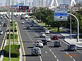
A dual carriageway (BrE) or a divided highway (AmE) is a class of highway with carriageways for traffic travelling in opposite directions separated by a central reservation (BrE) or median (AmE). Roads with two or more carriageways which are designed to higher standards with controlled access are generally classed as motorways, freeways, etc., rather than dual carriageways.

A median strip, central reservation, roadway median, or traffic median is the reserved area that separates opposing lanes of traffic on divided roadways such as divided highways, dual carriageways, freeways, and motorways. The term also applies to divided roadways other than highways, including some major streets in urban or suburban areas. The reserved area may simply be paved, but commonly it is adapted to other functions; for example, it may accommodate decorative landscaping, trees, a median barrier, or railway, rapid transit, light rail, or streetcar lines.

The Burlington Bay James N. Allan Skyway, originally called the Burlington Bay Skyway and simply known as the Burlington Skyway or The Skyway, is a pair of high-level freeway bridges spanning the Burlington Bay Canal. The Skyway, as it is locally known, is located in Hamilton and Burlington, Ontario, Canada, and is part of the Queen Elizabeth Way (QEW) highway linking Fort Erie with Toronto. The 1958 steel bridge is a suspended deck through-arch truss bridge. The approach to the main span has elements of a through-truss bridge, but the arch shape takes the truss higher than the roadway deck, so hangers are used to suspend the deck from the arch truss. The truss bridge is 2,560 m (8,400 ft) long overall. The main span of 151 m (495 ft) is flanked by two back spans each 83.7 m (275 ft) long; there are 72 total approach spans, and the bridge has 36.7 m (120 ft) of vertical clearance below the bottom of the deck. The girder bridge, completed in 1985, is 335 m (1,099 ft) shorter. The roadway deck for each bridge is 30 m (97 ft) wide.

A reversible lane is a managed lane in which traffic may travel in either direction, depending on certain conditions. Typically, it is meant to improve traffic flow during rush hours, by having overhead traffic lights and lighted street signs notifying drivers which lanes are open or closed to driving or turning.

The road hierarchy categorizes roads according to their functions and capacities. While sources differ on the exact nomenclature, the basic hierarchy comprises freeways, arterials, collectors, and local roads. Generally, the functional hierarchy can more or less correspond to the hierarchy of roads by their owner or administrator.

Road signs in the Republic of Ireland do not differ greatly from those used elsewhere in Europe – with the notable exception that hazard or warning signs follow the "MUTCD" style of a yellow diamond shape. The symbols used on these warning signs do, nevertheless, resemble much more closely those used in the rest of Europe than many of those seen in the United States.
State Road 589 (SR 589), also known as the Veterans Expressway and Suncoast Parkway, is a controlled-access toll road near the Florida Gulf Coast. Maintained and operated by Florida's Turnpike Enterprise, this 68-mile (109 km) transportation corridor extends from State Road 60 in Tampa, north to State Road 44 near Lecanto. The Veterans Expressway was built to accommodate the increasing commuter traffic in the Tampa-St. Petersburg metropolitan area, with the Suncoast Parkway opening in 2001, extending from near the northern terminus of the Veterans Expressway to U.S. Route 98, with a possible northern extension to U.S. Route 19/U.S. Route 98 in Crystal River in Citrus County in the planning and development stages. As of February 28, 2022, Phase I of the extension is now open between US 98 and Florida State Road 44. Phase II, which would further extend the highway to County Road 486, is undergoing the design phase.

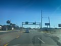
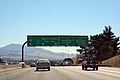
A controlled-access highway is a type of highway that has been designed for high-speed vehicular traffic, with all traffic flow—ingress and egress—regulated. Common English terms are freeway, motorway, and expressway. Other similar terms include throughway or thruway and parkway. Some of these may be limited-access highways, although this term can also refer to a class of highways with somewhat less isolation from other traffic.

Road signs in Malaysia are standardised road signs similar to those used in Europe but with certain distinctions. Until the early 1980s, Malaysia closely practice in road sign design, with diamond-shaped warning signs and circular restrictive signs to regulate traffic. Signs usually use the Transport Heavy font on non-tolled roads and highways. Tolled expressways signs use a font specially designed for the Malaysian Highway Authority (LLM) which is LLM Lettering. It has two type of typefaces, LLM Narrow and LLM Normal. Older road signs used the FHWA Series fonts typeface also used in the United States, Canada, and Australia.

Interstate 95 (I-95) is an Interstate Highway running along the East Coast of the United States from Miami, Florida, north to the Canadian border at Houlton, Maine. In Maryland, the route is a major highway that runs 110.01 miles (177.04 km) diagonally from southwest to northeast, entering from the District of Columbia and Virginia at the Woodrow Wilson Bridge over the Potomac River, northeast to the Delaware state line near Elkton. It is the longest Interstate Highway within Maryland and is one of the most traveled Interstate Highways in the state, especially between Baltimore and Washington, D.C., despite alternate routes along the corridor, such as the Baltimore–Washington Parkway, U.S. Route 1 (US 1), and US 29. I-95 also has eight auxiliary routes in the state, the most of any state along the I-95 corridor. Portions of the highway, including the Fort McHenry Tunnel and the Millard E. Tydings Memorial Bridge, are tolled.
Interstate 95 (I-95) is a major north–south Interstate Highway that runs along the East Coast of the United States from Miami, Florida, north to the Canada–United States border at Houlton, Maine. In the state of Pennsylvania, it runs 51.00 miles (82.08 km) from the Delaware state line near Marcus Hook in Delaware County in the southeastern part of the state northeast to the Delaware River–Turnpike Toll Bridge at the New Jersey state line near Bristol in Bucks County, closely paralleling the New Jersey state line for its entire length through Pennsylvania.

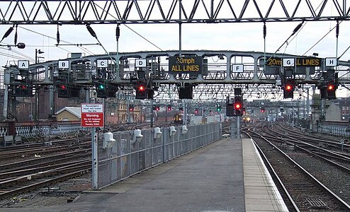
Active traffic management is a method of increasing peak capacity and smoothing traffic flows on busy major highways. Techniques include variable speed limits, hard-shoulder running and ramp-metering controlled by overhead variable message signs. It has been implemented in several countries, including Germany, the United Kingdom, Canada and the United States.

Road signs in Thailand are standardized road signs similar to those used in other nations but much of it resembles road signage systems used in South American countries with certain differences, such as using a blue circle instead of a red-bordered white circle to indicate mandatory actions. Until the early 1980s, Thailand closely followed American, European, Australian, and Japanese practices in road sign design, with diamond-shaped warning signs and circular restrictive signs to regulate traffic. The Department of Railway maintains a standard on the typeface used in the sign, with custom made type for Thai text, unofficially named "Thang Luang" (อักษรทางหลวง) and a small derivation of FHWA Series fonts typeface, which is used on American road signage, for Latin text. In most Bangkok Metropolitan Area's routes, TS Lopburi is still used.

Road signs in India can vary in design, depending on the location. For the most part, they tend to closely follow European practices, usually identical to the United Kingdom or the Vienna Convention on Road Signs and Signals. However, yellow rectangular signs that do carry such messages like "Be gentle on my curves" and "Danger creeps when safety sleeps" are present nationwide. Road signs in India are metric.
Road signs in New Zealand are similar to those set by the Vienna Convention on Road Signs and Signals. While New Zealand is not a signatory to the convention, its road signs are generally close in shape and function. New Zealand uses yellow diamond-shaped signs for warnings in common with Australia, the Americas, Ireland, Japan and Thailand. Speed limit signs are a red circle with a white background and the limitation in black, and are in kilometres per hour. There are also some signs unique to New Zealand. Road signs in New Zealand are controlled by NZ Transport Agency Waka Kotahi and are prescribed in the Land Transport Rule: Traffic Control Devices 2004 and set out in the Traffic Control Devices (TCD) Manual.
Road signs in Indonesia are standardized road signs similar to those used in other nations but with certain distinctions. As a former Dutch colony, until the 1970s road signs in Indonesia closely followed The Netherlands rules on road signs. Nowadays, Indonesian road sign design are a mix of European, US MUTCD, Australia, New Zealand and Japanese road sign features. According to the 2014 Minister of Transport's Regulation No. 13 concerning Traffic Signs, the official typeface for road signs in Indonesia is Clearview. Indonesia formerly used FHWA Series fonts as the designated typeface though the rules are not being implemented properly.

Terminology related to road transport—the transport of passengers or goods on paved routes between places—is diverse, with variation between dialects of English. There may also be regional differences within a single country, and some terms differ based on the side of the road traffic drives on. This glossary is an alphabetical listing of road transport terms.
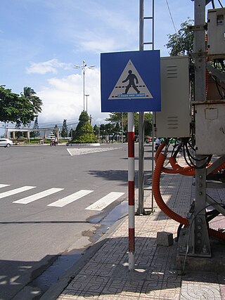
Road signs in Vietnam follow Chinese and French road signs. Some signs are written in both Vietnamese and English. The signs are prescribed by the Vietnam Ministry of Transport with the 2019 standardization being the up-to-date regulations.