Traffic camera

Last updated

A traffic camera is a video camera which observes vehicular traffic on a road. Typically, traffic cameras are put along major roads such as highways, freeways, expressways and arterial roads, and are connected by optical fibers buried alongside or under the road, with electricity provided either by mains power in urban areas, or by solar panels or other alternative power sources which provide consistent imagery without the threat of power outages.

A monitoring center receives the live video in real time, and serves as a dispatcher if there is a traffic collision, some other disruptive incident or road safety issue.

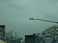
Traffic cameras form a part of most intelligent transportation systems. They are especially valuable in tunnels, where safety equipment can be activated remotely based on information provided by the cameras and other sensors. On surface roads, they are typically mounted on high poles or masts, sometimes with street lights. On arterial roads, they are often mounted on traffic light poles at intersections, where problems are most likely. In remote areas beyond the electrical grid, they are usually powered by a renewable source such as solar power, which also provides a backup source to urban camera infrastructure.

Traffic cameras are distinct from road safety cameras, which are put in specific places to enforce rules of the road by taking still photos in a much higher image resolution upon a trigger. Traffic cameras are only for observation and continuously take lower-resolution video, often in full motion, though they may be remotely controlled to focus on an incident in the distance, or at an orientation normally outside its field of view; such as a frontage road. Many transmit in analog television formats, though many are being converted to high definition or 4K resolution video as equipment is replaced. Some have a compass built in which displays the cardinal direction at which the camera is aimed, though many installers also provide a reference image with the cardinal direction.

A non-public use for traffic cameras is video tolling, where motorists drive through open road tolling gantries, have an image of their license plate taken, then are billed after automatic number-plate recognition has read the license plate and cross-referenced it with motor vehicle databases.

Many transportation departments have linked their camera networks to the internet so that travelers can view traffic conditions. They may show either streaming video or still imagery which refreshes at a set interval, helping travelers determine whether an alternate route should be taken. In the United States and Canada, these often are displayed on state or municipally-run 5-1-1 websites (511 being a telephone service relaying traffic information). These image may be combined with in-road sensors that measure traffic timing and mapping providers such as Google Maps/Waze that allow user-generated traffic information.

Many states and provinces consider this information public domain, thus many television stations air live traffic camera imagery during traffic reports on their local news broadcasts, or simply as a moving background during newscasts. Some cable TV systems provide these pictures full-time on a governmental access channel, and some broadcast stations set aside a full digital subchannel solely for traffic information and camera imagery, such as WMVT-DT3 in Milwaukee and WFMZ-DT2 in Allentown, Pennsylvania. However, in some cases for toll roads and other private road authorities, such as the Illinois State Toll Highway Authority, these images are the property of the toll agency (or private company which runs a toll road), and are released exclusively to one station (e.g. ISTHA feeds only to WMAQ-TV).

Related Research Articles

<span class="mw-page-title-main">Toll road</span> Roadway for which a fee (or toll) is assessed for passage

A toll road, also known as a turnpike or tollway, is a public or private road for which a fee is assessed for passage. It is a form of road pricing typically implemented to help recoup the costs of road construction and maintenance.

<span class="mw-page-title-main">Intelligent transportation system</span> Advanced application

An intelligent transportation system (ITS) is an advanced application which aims to provide innovative services relating to different modes of transport and traffic management and enable users to be better informed and make safer, more coordinated, and 'smarter' use of transport networks.

<span class="mw-page-title-main">Ramp meter</span> Traffic management system

A ramp meter, ramp signal, or metering light is a device, usually a basic traffic light or a two-section signal light together with a signal controller, that regulates the flow of traffic entering freeways according to current traffic conditions. Ramp meters are used at freeway on-ramps to manage the rate of automobiles entering the freeway. Ramp metering systems have proved to be successful in decreasing traffic congestion and improving driver safety.

<span class="mw-page-title-main">Traffic enforcement camera</span> Camera for detecting motoring offenses

A traffic enforcement camera is a camera which may be mounted beside or over a road or installed in an enforcement vehicle to detect motoring offenses, including speeding, vehicles going through a red traffic light, vehicles going through a toll booth without paying, unauthorized use of a bus lane, or for recording vehicles inside a congestion charge area. It may be linked to an automated ticketing system.

<span class="mw-page-title-main">Electronic toll collection</span> Wireless system to automatically collect the usage fee or toll charged to vehicles

Electronic toll collection (ETC) is a wireless system to automatically collect the usage fee or toll charged to vehicles using toll roads, HOV lanes, toll bridges, and toll tunnels. It is a faster alternative which is replacing toll booths, where vehicles must stop and the driver manually pays the toll with cash or a card. In most systems, vehicles using the system are equipped with an automated radio transponder device. When the vehicle passes a roadside toll reader device, a radio signal from the reader triggers the transponder, which transmits back an identifying number which registers the vehicle's use of the road, and an electronic payment system charges the user the toll.

<span class="mw-page-title-main">5-1-1</span> Traffic information telephone hotline in North America

5-1-1 is a transportation and traffic information telephone hotline in some regions of the United States and Canada. Travelers can dial 511, a three-digit telephone number, on landlines and most mobile phones. The number has also extended to be the default name of many state and provincial transportation department road conditions Web sites, such as Wisconsin's site. It is an example of an N11 code, part of the North American Numbering Plan.

<span class="mw-page-title-main">Aerial survey</span> Method of collecting geophysical data from high altitude aircraft

Aerial survey is a method of collecting geomatics or other imagery by using airplanes, helicopters, UAVs, balloons or other aerial methods. Typical types of data collected include aerial photography, Lidar, remote sensing and also geophysical data (such as aeromagnetic surveys and gravity. It can also refer to the chart or map made by analysing a region from the air. Aerial survey should be distinguished from satellite imagery technologies because of its better resolution, quality and atmospheric conditions. Today, aerial survey is sometimes recognized as a synonym for aerophotogrammetry, part of photogrammetry where the camera is placed in the air. Measurements on aerial images are provided by photogrammetric technologies and methods.

<span class="mw-page-title-main">Partial cloverleaf interchange</span> Modification of a cloverleaf interchange

A partial cloverleaf interchange or parclo is a modification of a cloverleaf interchange.

<span class="mw-page-title-main">Automatic number-plate recognition</span> Optical character recognition technology

Automatic number-plate recognition is a technology that uses optical character recognition on images to read vehicle registration plates to create vehicle location data. It can use existing closed-circuit television, road-rule enforcement cameras, or cameras specifically designed for the task. ANPR is used by police forces around the world for law enforcement purposes, including checking if a vehicle is registered or licensed. It is also used for electronic toll collection on pay-per-use roads and as a method of cataloguing the movements of traffic, for example by highways agencies.

<span class="mw-page-title-main">National Highway System (United States)</span> Network of strategic highways

The National Highway System (NHS) is a network of strategic highways within the United States, including the Interstate Highway System and other roads serving major airports, ports, military bases, rail or truck terminals, railway stations, pipeline terminals and other strategic transport facilities. Altogether, it constitutes the largest highway system in the world.

<span class="mw-page-title-main">Open road tolling</span> Boothless toll collecting

Open road tolling (ORT), also called all-electronic tolling, cashless tolling, or free-flow tolling, is the collection of tolls on toll roads without the use of toll booths. An electronic toll collection system is usually used instead. The major advantage to ORT is that users are able to drive through the toll plaza at highway speeds without having to slow down to pay the toll. In some installations, ORT may also reduce congestion at the plazas by allowing more vehicles per hour/per lane.

<span class="mw-page-title-main">Highway 6 (Israel)</span> Highway in Israel

Highway 6, also known as the Trans-Israel Highway or Cross-Israel Highway, is a major electronic toll highway in Israel. Highway 6 is the first Israeli Build-Operate-Transfer road constructed, carried out mainly by the private sector in return for a concession to collect tolls on the highway for a given number of years. It is also one of the largest infrastructure projects undertaken in Israel.

<span class="mw-page-title-main">Bing Maps</span> Web mapping service from Microsoft

Bing Maps is a web mapping service provided as a part of Microsoft's Bing suite of search engines and powered by the Bing Maps Platform framework which also support Bing Maps for Enterprise APIs and Azure Maps APIs. Since 2020, the map data is provided by TomTom, OpenStreetMap and others.

<span class="mw-page-title-main">Backup camera</span>

A backup camera is a special type of video camera that is produced specifically for the purpose of being attached to the rear of a vehicle to aid in backing up and to alleviate the rear blind spot. It is designed to avoid a backup collision. The area directly behind vehicles has been described as a "killing zone" due to associated accidents. Backup cameras are usually connected to the vehicle head unit display. A common variant is a Surround View system, which assembles a synthetic but positionally accurate top-down view of the vehicle and its adjacencies.

DriveBC is a website and toll-free phone service which provides traffic, road, and weather conditions for British Columbia, Canada’s provincial highways. The service, delivered by the provincial government’s Ministry of Transportation, helps motorists decide when to travel and which route to take.

The City of Vaughan in Ontario, Canada offers a complex transportation infrastructure, which includes highways, public transit, regional roads, municipality-funded roads, and train services.

Elevated photography is the process of taking aerial photos using a telescoping pole or mast, or other aerial or elevated support systems, to emulate aerial photographs, or video, taken from a commercially licensed aircraft.

<span class="mw-page-title-main">Glossary of road transport terms</span>

Terminology related to road transport—the transport of passengers or goods on paved routes between places—is diverse, with variation between dialects of English. There may also be regional differences within a single country, and some terms differ based on the side of the road traffic drives on. This glossary is an alphabetical listing of road transport terms.

<span class="mw-page-title-main">Managed lane</span>

A managed lane is a type of highway lane that is operated with a management scheme, such as lane use restrictions or variable tolling, to optimize traffic flow, vehicle throughput, or both. Definitions and goals vary among transport agencies, but managed lanes are generally implemented to achieve an improved operational condition on a highway, such as improving traffic speed and throughput, reducing air pollution, and improving safety. Types of managed lanes include high-occupancy vehicle (HOV) lanes, high-occupancy toll lanes, express toll lanes, reversible lanes, and bus lanes. Most managed lane facilities are located in the United States and Canada, although HOV and bus lanes can be found in many other countries; outside of the US and Canada, many countries use active traffic management that manage all lanes of a highway.

A video management system, also known as video management software plus a video management server, is a component of a security camera system that in general: