Related Research Articles

Dodge City Regional Airport is three miles east of Dodge City, in Ford County, Kansas. It is used for general aviation and is subsidized by the Essential Air Service program.
Garden City Regional Airport is nine miles southeast of Garden City, in Finney County, Kansas, United States. It sees one scheduled airline, subsidized by the federal government's Essential Air Service program at a cost of $2,919,026.

Liberal Mid-America Regional Airport is two miles west of Liberal, in Seward County, Kansas. It is used for general aviation and is subsidized by the Essential Air Service program. Formerly Liberal Municipal Airport, it hosts the Mid-America Air Museum.
Taunton Municipal Airport, also known as King Field, is a public use airport located three nautical miles (6 km) east of the central business district of Taunton, a city in Bristol County, Massachusetts. It is located in the East Taunton neighborhood of the city. The city-owned airport is maintained and operated by the Taunton Airport Commission. According to the FAA's National Plan of Integrated Airport Systems for 2009–2013, it is categorized as a general aviation airport.
Emporia Municipal Airport is a city-owned public-use airport, located five miles south of Emporia, in Lyon County, Kansas.
Hill City Municipal Airport is a mile northeast of Hill City, in Graham County, Kansas.
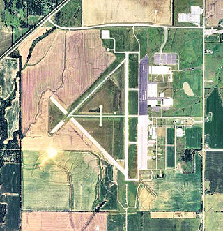
Hugoton Municipal Airport is a county-owned public-use airport located two nautical miles (3.7 km) southwest of the central business district of Hugoton, a city in Stevens County, Kansas, United States.

Hutchinson Municipal Airport is a city-owned public airport three miles east of Hutchinson, in Reno County, Kansas, United States.

On July 1, 1965 Continental Airlines Flight 12 overran the runway while attempting to land at Kansas City Municipal Airport. No one was killed or seriously injured, but the accident forced discussions about runway safety in Kansas City and resulted in construction of a new airport, Kansas City International Airport, which opened in 1972. The accident also led to widespread implementation of runway grooving, which improves braking in wet landing conditions.
Fernandina Beach Municipal Airport is a city-owned public-use airport located on Amelia Island three nautical miles (6 km) south of the central business district of Fernandina Beach, a city in Nassau County, Florida, United States. It is designated as a reliever airport for Jacksonville International Airport.
Independence Municipal Airport is six miles southwest of Independence, in Montgomery County, Kansas. The National Plan of Integrated Airport Systems for 2011–2015 categorized it a general aviation facility.

Wetumpka Municipal Airport is a city-owned, public-use airport located six nautical miles west of the central business district of Wetumpka, a city in Elmore County, Alabama, United States. It is included in the FAA's National Plan of Integrated Airport Systems for 2011–2015, which categorized it as a general aviation facility. During World War II the airport, known then as Elmore Auxiliary Field, served as an auxiliary field for Gunter Army Airfield training operations. In 2013 the airport was listed in the Alabama Register of Landmarks and Heritage.

Headland Municipal Airport is a city-owned, public-use airport located two nautical miles northeast of the central business district of Headland, a city in Henry County, Alabama, United States.

Scottsboro Municipal Airport, also known as Word Field, is a city-owned public-use airport located two nautical miles (3.7 km) northeast of the central business district of Scottsboro, a city in Jackson County, Alabama, United States. According to the FAA's National Plan of Integrated Airport Systems for 2009–2013, it is categorized as a general aviation facility.
Dyersburg Regional Airport is two miles south of Dyersburg, in Dyer County, Tennessee, United States. It was formerly Dyersburg Municipal Airport.
Eureka Municipal Airport, also known as Lt. William M. Milliken Airport, is a city-owned, public-use airport located two nautical miles (4 km) north of the central business district of Eureka, a city in Greenwood County, Kansas, United States. It is included in the National Plan of Integrated Airport Systems for 2011–2015, which categorized it as a general aviation facility.
Stanton County Municipal Airport is a county-owned, public-use airport in Stanton County, Kansas, United States. It is located two nautical miles (4 km) northeast of the central business district of Johnson, Kansas, which is also known as Johnson City. This airport was included in the National Plan of Integrated Airport Systems for 2011–2015, which categorized it as a general aviation facility.
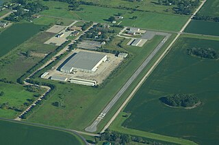
Marion Municipal Airport is a city-owned, public-use airport located two nautical miles (4 km) southeast of the central business district of Marion, a city in Marion County, Kansas, United States.
Lincoln Municipal Airport is a public use airport in Lincoln County, Kansas, United States. It is owned by the City of Lincoln, also known as Lincoln Center, and located two nautical miles (4 km) northwest of the central business district.
Osage City Municipal Airport is a city-owned public-use airport located one nautical mile east of the central business district of Osage City, a city in Osage County, Kansas, United States.