
The economy of Rwanda has undergone rapid industrialisation due to a successful governmental policy. It has a mixed economy. Since the early-2000s, Rwanda has witnessed an economic boom, which improved the living standards of many Rwandans. The Government's progressive visions have been the catalyst for the fast transforming economy. The President of Rwanda, Paul Kagame, has noted his ambition to make Rwanda the "Singapore of Africa".

Kigali is the capital and largest city of Rwanda. It is near the nation's geographic centre in a region of rolling hills, with a series of valleys and ridges joined by steep slopes. As a primate city, Kigali has been Rwanda's economic, cultural, and transport hub since it became the capital following independence from Belgian rule in 1962.

Mission is a city in the Lower Mainland of the province of British Columbia, Canada. It was originally incorporated as a district municipality in 1892, growing to include additional villages and rural areas over the years, adding the original Town of Mission City, long an independent core of the region, in 1969. It is bordered by the city of Abbotsford to the south and the city of Maple Ridge to the west. To the east are the unincorporated areas of Hatzic and Dewdney.

The South Region is located in the southwestern and south-central portion of the Republic of Cameroon. It is bordered to the east by the East Region, to the north by the Centre Region, to the northwest by the Littoral Region, to the west by the Gulf of Guinea, and to the south by the countries of Equatorial Guinea, Gabon, and Congo. The South occupies 47,720 km2 of territory, making it the fourth largest region in the nation. The major ethnic groups are the various Beti-Pahuin peoples, such as the Ewondo, Fang, and Bulu.
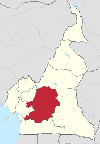
The Centre Region occupies 69,000 km2 of the central plains of the Republic of Cameroon. It is bordered to the north by the Adamawa Region, to the south by the South Region, to the east by the East Region, and to the West by the Littoral and West Regions. It is the second largest of Cameroon's regions in land area. Major ethnic groups include the Bassa, Ewondo, and Vute.

The Mulanje Massif, also known as Mount Mulanje, is a large inselberg in southern Malawi. Sapitwa Peak, the highest point on the massif at 3,002 m, is the highest point in Malawi. It lies 65 km east of Blantyre, rising sharply from the surrounding plains of Phalombe and the Mulanje district.
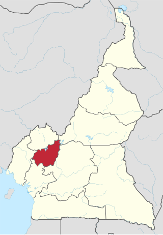
The West Region is 14,000 km2 of territory located in the central-western portion of the Republic of Cameroon. It borders the Northwest Region to the northwest, the Adamawa Region to the northeast, the Centre Region to the southeast, the Littoral Region to the southwest, and the Southwest Region to the west. The West Region is the smallest of Cameroon's ten regions in area, yet it has the highest population density.

Western Province was one of Kenya's seven administrative provinces outside Nairobi. It is inhabited mainly by the Luhya people. Quakerism is widely practised here. Kenya's second highest mountain, Mount Elgon is located in Bungoma District. The Kakamega Forest rainforest is part of the area. The province capital was Kakamega. After the 2013 general election, and the coming into effect of the new constitution, provinces became defunct and the country was now divided into 47 counties. Each county has its own government and therefore there is no central regional capital. Western Province became the Western region, comprising four counties: Kakamega, Bungoma, Vihiga, and Busia.

Gisenyi, historically rendered as Kisenyi, is the second largest city in Rwanda, located in the Rubavu district in Rwanda's Western Province. Gisenyi is contiguous with Goma, the city across the border in the Democratic Republic of the Congo.

The Anamala or Anaimalai, also known as the Elephant Mountains, are a range of mountains in the southern Western Ghats of central Kerala and span the border of western Tamil Nadu in Southern India. The name anamala is derived from the Malayalam word aana and the Tamil word yaanai, meaning elephant, or from tribal languages. Mala or Malai means 'mountain', and thus literally translatable as 'Elephant mountain'.

Akim Oda, a town in Ghana's Eastern Region, serves as the administrative and traditional center of the Birim Central Municipal District and Akyem Kotoku, respectively. The town had 60,604 residents as of 2013.
Southern Province is one of Rwanda's five provinces. It was created in early January 2006 as part of a government decentralization program that re-organized the country's local government structures.
Ntchisi is a town located in the Central Region of Malawi. It is the administrative capital of Ntchisi District.
Uraga is one of the Aanaas in the Oromia of Ethiopia. Part of the Guji Zone, Uraga is bordered on the south by Odo Shakiso, on the west by the Borena Zone, on the north by the Southern Nations, Nationalities, and Peoples Region, and on the east by Bore. The largest town in Uraga is Haro Wachu. Dama and Hambela Wamena woredas were separated from Uraga.
Liben is one of the woredas in the Oromia Region of Ethiopia. Part of the East Borana Zone, Liben is bordered on the south by the Dawa River which separates it from the Borena Zone, on the west by Odo Shakiso, on the northwest by Adolana Wadera, on the north by the Ganale Dorya River which separates it from the Bale Zone, and on the east by the Somali Region. The map of the Oromia Region published by Disaster Prevention and Disaster Agency shows that this woreda is part of the Guji Zone, and that the eastern part has been transferred to the Somali Region to create the Liben woreda of that region. The town of Negele Boran was separated from Liben woreda and is separate woreda now.

Nyamagabe is a district (akarere) in Southern Province, Rwanda. Its capital is Gasaka.

Nyabihu is a district (akarere) in Western Province, Rwanda. Its capital is Mukamira. Nyabihu district is divided into 12 sectors (imirenge): Bigogwe, Jenda, Jomba, Kabatwa, Karago, Kintobo, Mukamira, Muringa, Rambura, Rugera, Rurembo and Shyira.These sectors are themselves separated in 73 cells and 474 villages also called “imidugudu".

Gikongoro Province was one of the former twelve provinces (intara) of Rwanda and is situated in the southwest of the country. The former province had an area of some 2,146 square kilometers. Its population was estimated at 466,451 (1990) and 511,776 (2002) prior to its dissolution in January 2006, with an annual growth rate of .810% between the years of 1990 and 2002. It included 13 "communes" and 125 sectors.
Muvumba is a river in northeastern of Rwanda and southwestern Uganda. It is part of the upper headwaters of the Nile. At 170 km long, it is one of the major rivers of Rwanda both in size and economic importance. Its upper course provides water for tea plantations in the high altitudes of north Rwanda and southwestern Uganda. Its lower course provides water for the dry areas of Nyagatare, facilitating irrigation of rice fields and other crops as well as providing water for cattle in this area for cattle farming.
The 2020 East Africa floods were a natural disaster in Rwanda, Kenya, Somalia, Burundi, Ethiopia, Uganda, Democratic Republic of Congo, Djibouti and Tanzania, affecting at least 700,000 people. They began when excessive rains began falling in March, leading to massive flooding and landslides. They caused more than 430 deaths, notably in Kenya and Rwanda. In the fall another round of floods hit the African Sahel.
