| Gatuncillo Formation | |
|---|---|
| Stratigraphic range: Middle-Late Eocene | |
| Type | Formation |
| Underlies | Caimito, Bohío & Panama Formations |
| Overlies | Cretaceous basement |
| Thickness | 150–800 m (490–2,620 ft) |
| Lithology | |
| Primary | Mudstone, siltstone |
| Other | Limestone, sandstone, conglomerate |
| Location | |
| Coordinates | 9°18′N79°42′W / 9.3°N 79.7°W |
| Approximate paleocoordinates | 6°48′N77°18′W / 6.8°N 77.3°W |
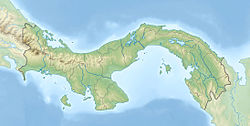
| Region | Panamá Province |
| Country | Panama |
| Extent | Panama Basin |
| Type section | |
| Named for | Gatuncillo River |
| Named by | Thompson |
| Year defined | 1944 |
 Gatuncillo Formation (Panama) | |
The Gatuncillo Formation (Tgo) [1] is a geologic formation in central Panama. The formation is exposed in the Panama Canal Zone and surrounding areas. It preserves fossils dating back to the Middle to Late Eocene period. [2]