Gbarnga

Last updated
Gbarnga
Gbanga, Gbanka
Monrovia to Gbarnga highway.jpg
Highway from Monrovia to Gbarnga
Liberia location map.svg
Red pog.svg
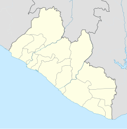
Gbarnga
Location in Liberia
Coordinates: 6°59′53″N9°28′23″W / 6.99806°N 9.47306°W / 6.99806; -9.47306
Country Flag of Liberia.svg Liberia
County Bong County
Elevation
250 m (820 ft)
Population
 (2008)
  Total34,046
Climate Am

Gbarnga is the capital city of Bong County, Liberia, lying north east of Monrovia. During the First Liberian Civil War, it was the base for Charles Taylor's National Patriotic Front of Liberia. [1] Cuttington College, a private, Episcopal-affiliated institution, is located near the town. Its campus was once home to the Africana Museum, which was destroyed during the civil war.

Contents

As of the 2008 census, Gbarnga has a population of 34,046. Of this, 16,080 were male and 17,966 female; it is the fourth-most populous urban area in Liberia. [2]

Gbarnga is the hometown of Tamba Hali, a former professional football player of the Kansas City Chiefs of the National Football League in the United States.

The town is twinned with Baltimore, Maryland, in the United States. [3]

Climate

Köppen-Geiger climate classification system classifies its climate as tropical monsoon (Am). [4] Its climate is similar to the capital Monrovia, but less rainy and with cooler night temperatures.

Climate data for Gbarnga
MonthJanFebMarAprMayJunJulAugSepOctNovDecYear
Mean daily maximum °C (°F)32.1
(89.8)
33.1
(91.6)
32.5
(90.5)
32.3
(90.1)
31.3
(88.3)
30.4
(86.7)
29.1
(84.4)
28.1
(82.6)
29.8
(85.6)
31.1
(88.0)
31.3
(88.3)
31.5
(88.7)
31.1
(87.9)
Daily mean °C (°F)25.1
(77.2)
25.2
(77.4)
25.3
(77.5)
25.7
(78.3)
25.3
(77.5)
24.8
(76.6)
24.1
(75.4)
23.2
(73.8)
24.5
(76.1)
25.5
(77.9)
25.8
(78.4)
25.1
(77.2)
25.0
(76.9)
Mean daily minimum °C (°F)18.1
(64.6)
17.4
(63.3)
18.1
(64.6)
19.1
(66.4)
19.3
(66.7)
19.2
(66.6)
19.2
(66.6)
18.3
(64.9)
19.2
(66.6)
20
(68)
20.3
(68.5)
18.7
(65.7)
18.9
(66.0)
Average precipitation mm (inches)20
(0.8)
61
(2.4)
150
(5.9)
179
(7.0)
194
(7.6)
216
(8.5)
221
(8.7)
204
(8.0)
384
(15.1)
236
(9.3)
110
(4.3)
38
(1.5)
2,013
(79.1)
Source: Climate-Data.org, altitude: 250m [4]

Places of worship

Education

Related Research Articles

<span class="mw-page-title-main">Liberia</span> Country in West Africa

Liberia, officially the Republic of Liberia, is a country on the West African coast. It is bordered by Sierra Leone to its northwest, Guinea to its north, Ivory Coast to its east, and the Atlantic Ocean to its south and southwest. It has a population of around 5 million and covers an area of 43,000 square miles (111,369 km2). The country's official language is English; however, over 20 indigenous languages are spoken, reflecting the country's ethnic and cultural diversity. The capital and largest city is Monrovia.

<span class="mw-page-title-main">Armed Forces of Liberia</span> Combined military forces of Liberia

The Armed Forces of Liberia (AFL) are the armed forces of the Republic of Liberia. Tracing its origins to a militia that was formed by the first black colonists in what is now Liberia, it was founded as the Liberian Frontier Force in 1908, and retitled in 1956. For almost all of its history, the AFL has received considerable materiel and training assistance from the United States. For most of the 1941–89 period, training was largely provided by U.S. advisers, though this assistance has not prevented the same generally low levels of effectiveness common to most of the armed forces in the developing world.

<span class="mw-page-title-main">Monrovia</span> Capital, chief port, and the largest city of Liberia

Monrovia is the capital city of the West African country of Liberia. Founded in 1822, it is located on Cape Mesurado on the Atlantic coast and as of the 2008 census had 1,010,970 residents, home to 29% of Liberia’s total population. As the nation's primate city, Monrovia is the country's economic, financial and cultural center; its economy is primarily centered on its harbor and its role as the seat of Liberian government.

<span class="mw-page-title-main">Montserrado County</span> County in Liberia

Montserrado County is a county in the northwestern portion of the West African nation of Liberia containing its national capital, Monrovia. One of 15 counties that comprise the first-level of administrative division in the nation, it has 17 sub political districts. As of the 2022 Census, it had a population of 1,920,914, making it the most populous county in Liberia. The area of the county measures 1,912.7 square kilometres (738.5 sq mi), the smallest in the country. Bensonville serves as the capital.

<span class="mw-page-title-main">Lofa County</span> County of Liberia

Lofa is a county in the northernmost portion of Liberia. One of 15 counties that constitute the first-level of administrative division in the nation, it has nine districts. Voinjama serves as the capital with the area of the county measuring 9,982 square kilometres (3,854 sq mi). As of the 2022 Census, it had a population of 367,376, making it Liberia's fourth most populous county.

Greenville is the capital of Sinoe County in southeastern Liberia and lies on a lagoon near the Sinoe River and the Atlantic Ocean. It is located about 150 miles southeast of Monrovia. As of the 2008 national census, the population stood at 16,434.

<span class="mw-page-title-main">Tubmanburg</span> Place in Bomi County, Liberia

Tubmanburg, also known as Bomi and formerly known as Vaitown, is the capital of Bomi County in Liberia. It lies in the Bomi Hills northwest of Monrovia and was an iron ore and diamond mining centre until it was largely destroyed in the First Liberian Civil War. During the Second Liberian Civil War, it was the headquarters of the Liberians United for Reconciliation and Democracy rebel group. Most residents are members of the Vai tribe.

<span class="mw-page-title-main">First Liberian Civil War</span> 1989–1997 civil war in Liberia

The First Liberian Civil War was the first in a series of two civil wars within the West African nation of Liberia. It lasted from 1989 to 1997. President Samuel Doe established a regime in 1980 but totalitarianism and corruption led to unpopularity and the withdrawal of support from the United States by the late 1980s. The National Patriotic Front of Liberia (NPFL) led by Charles Taylor invaded Liberia from the Ivory Coast to overthrow Doe in December 1989 and gained control over most of the country within a year. Doe was captured and executed by the Independent National Patriotic Front of Liberia (INPFL), a splinter faction of the NPFL led by Prince Johnson, in September 1990. The NPFL and INPFL fought each other for control of the capital city, Monrovia and against the Armed Forces of Liberia and pro-Doe United Liberation Movement of Liberia for Democracy. Peace negotiations and foreign involvement led to a ceasefire in 1995 but fighting continued until a peace agreement between the main factions occurred in August 1996. Taylor was elected President of Liberia following the 1997 Liberian general election and entered office in August of the same year.

<span class="mw-page-title-main">Voinjama</span> Place in Lofa County, Liberia

Voinjama is a small city that serves as the capital of Lofa County, Liberia and is located in the hilly, far northern part of the country near the Guinean border. As of the 2008 national census, the population stood at 26,594.

<span class="mw-page-title-main">Bomi County</span> County of Liberia

Bomi is a county in the northwestern portion of the West African nation of Liberia. The county was established in 1984. The county's area is 746 square miles (1,900 km2).

<span class="mw-page-title-main">Bong County</span> County of Liberia

Bong is a county in the north-central portion of the West African nation of Liberia. One of 15 counties that comprise the first-level of administrative division in the nation, it has twelve districts. Gbarnga serves as the capital. The area of the county measures 8,772 square kilometres (3,387 sq mi). As of the 2022 Census, it had a population of 467,502, making it the third-most populous county in Liberia. The county was organized in 1964 and is important for its mining industry.

<span class="mw-page-title-main">Margibi County</span> County of Liberia

Margibi is a county on the north to central coast of Liberia. One of 15 counties that constitute the first-level of administrative division in the nation, it has five districts. Kakata serves as the capital with the area of the county measuring 2,616 square kilometres (1,010 sq mi). As of the 2022 Census, it had a population of 304,946, making it the fith most populous county in Liberia.

<span class="mw-page-title-main">Sinoe County</span> County in Liberia

Sinoe is one of Liberia's 15 counties and it has 17 districts. Greenville is the county's capital. As of the 2022 Census, it had a population of 150,358, making it one of the least populous counties in Liberia. Sinoe has the third-largest area of all Liberia's counties; it has the second least-dense population after Gbarpolu County. The County was originally a colony in the name Mississippi-in-Africa, under auspices of a chapter of the American Colonization Society as it was created with slaves from Mississippi to Liberia.

<span class="mw-page-title-main">River Gee County</span> County of Liberia

River Gee is a county in the southern portion of Liberia. One of 15 counties that constitute the first-level of administrative division in the nation, it has six districts. Fish Town serves as the capital with the area of the county measuring 5,113 square kilometres (1,974 sq mi). As of the 2022 Census, it had a population of 124,653, making it one of the least populous counties in Liberia. It was created in 2000.

<span class="mw-page-title-main">Independent National Patriotic Front of Liberia</span>

The Independent National Patriotic Front of Liberia (INPFL) was a rebel group that participated in the First Liberian Civil War under the leadership of Prince Johnson. It was a breakaway faction of the National Patriotic Front of Liberia (NPFL).

<span class="mw-page-title-main">Zwedru</span> Place in Grand Gedeh County, Liberia

Zwedru is the capital of Grand Gedeh County, one of the 15 counties in Liberia. Zwedru is located in Tchien District of Grand Gedeh County, near the Cavalla River in the country's south-eastern region and near the border with Côte d'Ivoire. It is located 350 miles southeast from the capital city of Monrovia. The town is a stronghold of the Krahn tribe.

<span class="mw-page-title-main">Kakata</span> Place in Margibi County, Liberia

Kakata is the capital city of Liberia's Margibi County. Located in Kakata District, its proximity to the Du River bridge also comprises its border with Todee District. It is a transit town at the heart of the historical natural rubber cultivation belt in Liberia. The city is colloquially known as "Kak City".

Greater Monrovia is one of four districts located in Montserrado County, Liberia. It contains the country's capital Monrovia. It recorded a population of 970,824 in the 2008 census.

<span class="mw-page-title-main">Catholic Church in Liberia</span>

The Catholic Church in Liberia is part of the worldwide Catholic Church, under the spiritual leadership of the Pope in Rome.

The following is a timeline of the history of the city of Monrovia, Liberia.

References

  1. Stephen Ellis, The Mask of Anarchy
  2. "2008 National Population and Housing Census: Preliminary Results" (PDF). Liberia Institute of Statistics and Geo-Information Services. Government of the Republic of Liberia. June 2008. Retrieved 2008-11-14.
  3. "Baltimore City Mayor's Office of International and Immigrant Affairs - Sister Cities Program". Archived from the original on August 7, 2008. Retrieved 2009-07-18.
  4. 1 2 "Climate: Gbarnga - Climate graph, Temperature graph, Climate table". Climate-Data.org. Retrieved 4 October 2013.

6°59′53″N9°28′23″W / 6.998°N 9.473°W / 6.998; -9.473